Fort Totten in Northeast Washington in Washington, District of Columbia — The American Northeast (Mid-Atlantic)
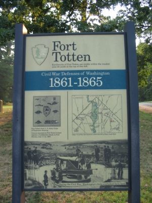
Fort Totten
Civil War Defenses of Washington
— 1861-1865 —
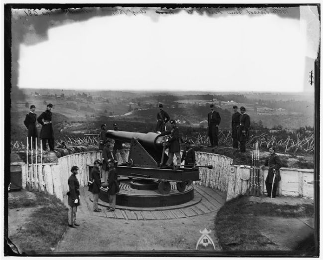
Cannon mounted at Fort Totten helped repulse a Confederate attack on Fort Stevens, July 11-12, 1864.
Erected by National Park Service, U.S. Department of the Interior.
Topics and series. This historical marker is listed in these topic lists: Forts and Castles • War, US Civil. In addition, it is included in the Defenses of Washington series list. A significant historical date for this entry is July 11, 1767.
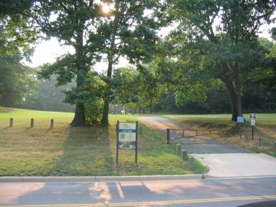
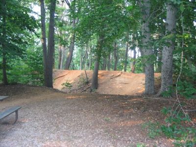
Location. 38° 56.92′ N, 77° 0.373′ W. Marker is in Northeast Washington in Washington, District of Columbia. It is in Fort Totten. Marker is on Fort Totten Drive Northeast north of Crittenden Street Northeast, on the right when traveling north. At the exit (north end of the loop through the park) to the Fort Totten Park. The park is a short walk from the Fort Totten Metro (Red, Green and Yellow) Line station. Touch for map. Marker is at or near this postal address: 4810 Fort Totten Drive Northeast, Washington DC 20011, United States of America. Touch for directions.
Other nearby markers. At least 8 other markers are within walking distance of this marker. A different marker also named Fort Totten (within shouting distance of this marker); a different marker also named Fort Totten (about 500 feet away, measured in a direct line); St. Paul's Episcopal Church and Rock Creek Cemetery (approx. 0.2 miles away); In Memory of Those Who Lost Their Lives on June 22, 2009 (approx. 0.3 miles away); St. Paul's Episcopal (approx. 0.3 miles away); St. Paul's Episcopal Church (approx. 0.4 miles away); Opha May Jacob Johnson Monument (approx. 0.4 miles away); Memorial Day Order (approx. 0.4 miles away). Touch for a list and map of all markers in Northeast Washington.
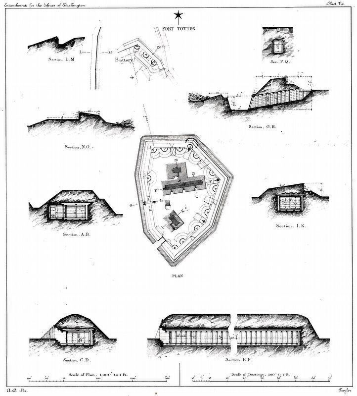
More about this marker. The marker displays a diagram of "Fort Totten from U.S. Army Corps of Engineers drawing," on the left. On the right is a map showing "Other Civil War fort locations administered by Rock Creek Park," with Fort Totten indicated with a red dot. The lower portion of the marker is a photograph from the war of a cannon mounted at one of Washington, DC's forts, "During the Civil War, Washington's forts overlooked farm land." The photograph is of a 100-pdr Parrott Rifled Cannon in place at Fort Totten during the war.
Additional commentary.
1. Fort Totten(s)
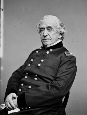
There are at least three Fort Tottens, all named after Brigadier General
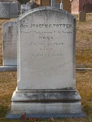
Joseph Totten (1788-1864), Chief of the US Army Corps of Engineers. The one here in Washington, DC was probably the first. Later a second Fort Totten was erected in Bismark, North Dakota. Finally in 1898 the "Fort at Willet's Point" defending New York City was renamed Fort Totten after the long serving General.
— Submitted October 15, 2007, by Craig Swain of Leesburg, Virginia.
2. Fort Totten Particulars
From "Mr. Lincoln's Forts: A Guide to the Civil War Defenses of Washington," by Benjamin Franklin Cooling III and Walton H. Owen II:
The fort had a perimeter of 272 yards. Armament included two 8-inch siege howitzers, eight 32-pdr seacoast guns, one 100-pdr Parrot Rifle, three 30-pdr Parrott Rifles, four 6pdr James Rifles, one 10-inch mortar, and one 24-pdr Coehorn mortar. The fort was manned by a garrison of 350 officers and men.
Troops stationed at the fort at different times included the 76th New York, 2nd Pennsylvania Heavy Artillery, the 136 and 137th Pennsylvania Infantry, 4th US Artillery, 150th Ohio National Guard, 1st New Hampshire Heavy Artillery, and the 1st Vermont Heavy Artillery.
— Submitted October 15, 2007, by Craig Swain of Leesburg, Virginia.
3. Joseph G. Totten
Joseph G. Totten served an incredible twenty-five years as the Chief of Engineers. His military service started in 1805 with a commission after graduation from West Point. He served in the War of 1813 with conspicuous gallantry, and later in the Mexican War. He supervised construction of the ring of forts around Washington during the Civil War. He died of pneumonia in 1864.
— Submitted March 8, 2016.
Civil War Photographs, Library of Congress
5. Civil War Photograph of the 100-pdr Parrott
This photograph was used on the marker's lower section. Notice the rolling farmland in the background. The terrain here has changed dramatically in the last 140 years. (Civil War photographs, 1861-1865 / compiled by Hirst D. Milhollen and Donald H. Mugridge, Washington, D.C. : Library of Congress, 1977. No. 0775)
Credits. This page was last revised on March 11, 2024. It was originally submitted on October 15, 2007, by Craig Swain of Leesburg, Virginia. This page has been viewed 4,383 times since then and 72 times this year. Photos: 1, 2. submitted on October 15, 2007, by Craig Swain of Leesburg, Virginia. 3. submitted on March 11, 2024, by Allen C. Browne of Silver Spring, Maryland. 4, 5. submitted on October 15, 2007, by Craig Swain of Leesburg, Virginia. 6. submitted on March 23, 2011, by Richard E. Miller of Oxon Hill, Maryland. 7. submitted on February 15, 2015, by Allen C. Browne of Silver Spring, Maryland.
