Guilford Center in South Central Region, Connecticut — The American Northeast (New England)
Outhouse Exhibit
Photographed by Conrad Ward, April 29, 2025
1. Outhouse Exhibit Marker
(left)
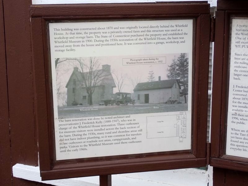
This building was constructed about 1870 and was originally located directly behind the Whitfield House. At that time, the property was a privately-owned farm and this structure was used as a workshop and storage barn. The State of Connecticut purchased the property and established the Whitfield Museum in 1900. During the 1930s restoration of the Whitfield House, the barn was moved away from the house and positioned here. It was converted into a garage, workshop, and storage facility.
The barn renovation was done by noted architect and preservationist J. Frederick Kelly (1888-1947), who was in charge of the Whitfield House restoration. Three outhouses for museum visitors were installed across the back section of the barn. During the 1930s, many rural and shoreline areas still did not have indoor plumbing, so it was common for travelers to use outhouses at roadside rest areas, campgrounds, and parks. Visitors to the Whitfield Museum used these outhouses until the early 1960s.
(caption)
Photograph taken during the Whitfield House restoration, c. 1932
(right)
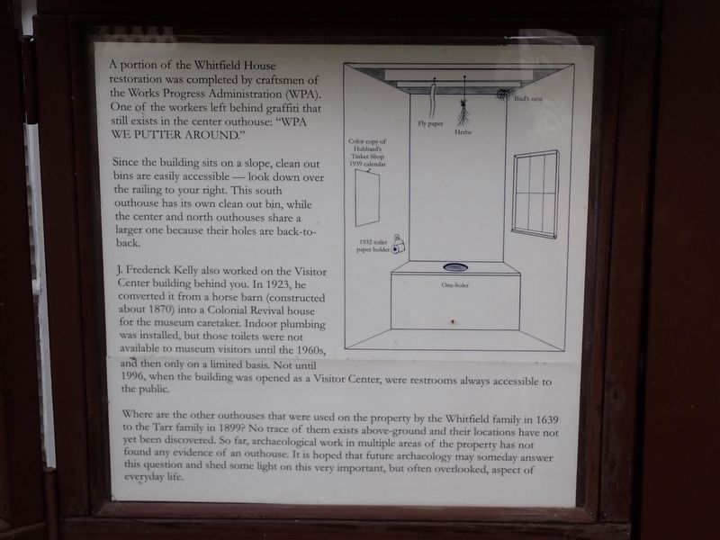
A portion of the Whitfield House restoration
this page online
Since the building sits on a slope, clean out bins are easily accessible — look down over the railing to your right. This south outhouse has its own clean out bin, while the center and north outhouses share a larger one because their holes are back-to-back.
J. Frederick Kelly also worked on the Visitor Center building behind you. In 1923, he converted it from a horse barn (constructed about 1870) into a Colonial Revival house for the museum caretaker. Indoor plumbing was installed, but those toilets were not available to museum visitors until the 1960s, and then only on a limited basis. Not until 1996, when the building was opened as a Visitor Center, were restrooms always accessible to the public.
Where are the other outhouses that were used on the property by the Whitfield family in 1639 to the Tarr family in 1899? No trace of them exists above-ground and their locations have not yet been discovered. So far, archaeological work in multiple areas of
Photographed by Conrad Ward, April 29, 2025
2. Outhouse Exhibit Marker
Erected by Henry Whitfield State Museum.
Topics and series. This historical marker is listed in these topic lists: Anthropology & Archaeology • Architecture. In addition, it is included in the Works Progress Administration (WPA) projects series list.
Location. 41° 16.697′ N, 72° 40.526′ W. Marker is in Guilford in South Central Region, Connecticut. It is in Guilford Center. It can be reached from Stone House Lane north of Old Whitfield Street, on the left when traveling north. Located at the Henry Whitfield State Museum. Touch for map. Marker is in this post office area: Guilford CT 06437, United States of America. Touch for directions.

Regionally, this marker is in the Connecticut River Valley, on the Connecticut Shoreline, and in Greater New Haven. It is also in the American Northeast, in New England, and on the Eastern Seaboard. Globally, it is in the
Photographed by Conrad Ward, April 29, 2025
3. Outhouse Exhibit
Other nearby markers. At least 8 other markers are within walking distance of this marker: Barn (here, next to this marker); War of 1812 Cannon (a few steps from this marker); Visitor Center (a few steps from this marker); Reverend Henry Whitfield (a few steps from this marker); Whitfield House (within shouting distance of this marker); Home of Rev. Henry Whitfield (within shouting distance of this marker); Covenant Stone (about 500 feet away, measured in a direct line); Made In Guilford (approx. 0.2 miles away). Touch for a list and map of all markers in Guilford.
Also see . . .
1. J. Frederick Kelly (Wikipedia). (Submitted on May 8, 2026.)
2. Henry Whitfield State Museum, Guilford. (Submitted on May 8, 2026.)
Credits. This page was last revised on May 19, 2026. It was originally submitted on May 8, 2026, by Conrad Ward of Guilford, Connecticut. This page has been viewed 14 times since then. Photos: 1, 2, 3. submitted on May 8, 2026, by Conrad Ward of Guilford, Connecticut. • Michael Herrick was the editor who published this page.
