
Bent Creek in Appomattox County, Virginia — The American South (Mid-Atlantic)
Diuguidsville
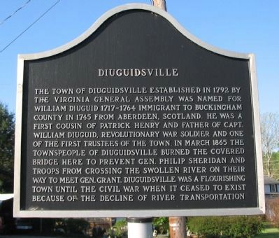
Photographed by Craig Swain, April 18, 2010
1. Diuguidsville Marker
Topics. This historical marker is listed in these topic lists: Settlements & Settlers • War, US Civil. A significant historical month for this entry is March 1865.
Location. 37° 32.097′ N, 78° 49.65′ W. Marker is in Bent Creek, Virginia, in Appomattox County. It is at the intersection of Richmond Highway (U.S. 60) and State Highway 26, on the right when traveling south on Richmond Highway. Touch for map. Marker is in this post office area: Gladstone VA 24553, United States of America. Touch for directions.

Regionally,
this page online
Other nearby markers. At least 8 other markers are within 11 miles of this marker, measured as the crow flies: Nelson County / Amherst County (approx. 5.2 miles away); Boyhood Home of Rev. Dr. W.A.R. Goodwin (1869-1939) (approx. 7.6 miles away); Lee’s Rear Guard (approx. 9 miles away); William Cabell (approx. 9.2 miles away); Buckingham County / Nelson County (approx. 9.2 miles away); Thomas S. Bocock (approx. 9.2 miles away); Conner House Site (approx. 10.2 miles away); Confederates Trapped (approx. 10.2 miles away).
Another marker is no longer nearby. Lee's Rear Guard (was approx. 9 miles away but has been permanently removed).
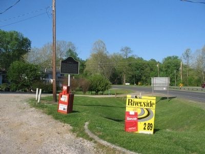
Photographed by Craig Swain, April 18, 2010
2. Diuguidsville Marker
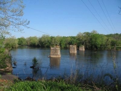
Photographed by Craig Swain, April 18, 2010
3. Bridge Ruins at Diuguidsville
Next to the modern highway bridge are these piers standing in the James River. Although nothing indicates these are the ruins of the Civil War era bridge, the location matches descriptions from the time period.
Credits. This page was last revised on June 16, 2016. It was originally submitted on April 20, 2010, by Craig Swain of Leesburg, Virginia. This page has been viewed 2,733 times since then and 88 times this year. Photos: 1, 2, 3. submitted on April 20, 2010, by Craig Swain of Leesburg, Virginia.
