Chatham in Pittsylvania County, Virginia — The American South (Mid-Atlantic)
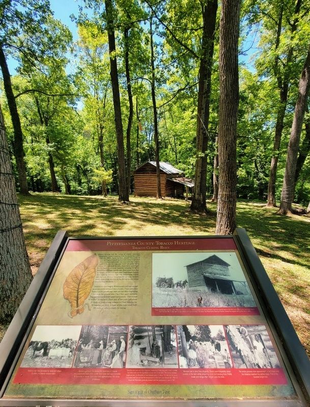
Pittsylvania County Tobacco Heritage
Tobacco Curing Barn
Photographed by C. Ryan Dodson, May 8, 2026
1. Pittsylvania County Tobacco Heritage Marker
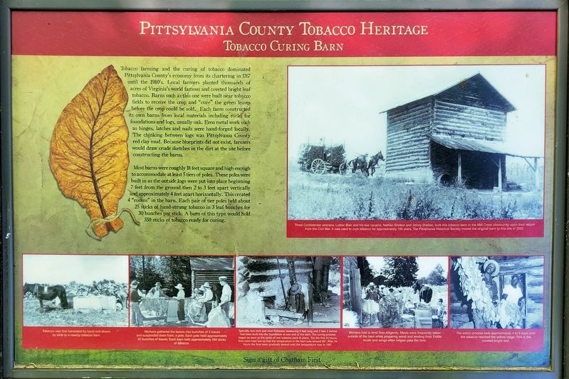
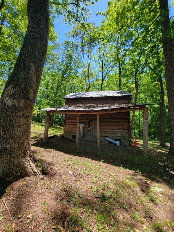
Most barns were roughly 18 feet square and high enough to accommodate at least 5 tiers of poles. These poles were built in as the outside logs were put into place beginning 7 feet from the ground then 2 to 3 feet apart vertically and approximately 4 feet apart horizontally. This created 4 "rooms" in the barn. Each pair of tier poles held about 25 sticks of hand-strung tobacco in 3 leaf bunches
this page online
(Captions)
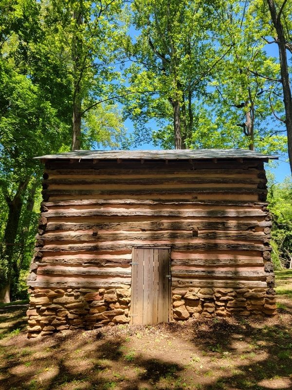
Three Confederate veterans, Luther Blair and his two cousins, Nathan Shelton and Jimmy Shelton, built this tobacco barn in the Mill Creek community upon their return from the Civil War. It was used to cure tobacco for approximately 100 years. The Pittsylvania Historical Society moved the original barn to this site in 2002.
Tobacco was first harvested by hand and drawn by slide to a nearby tobacco barn.
Workers gathered the leaves into bunches of 3 leaves and suspended them from a pole. Each pole held approximately 30 bunches of leaves Each barn held approximately 50 sticks of tobacco.
Typical two rock and mud fireboxes measuring 5 feet long and 2 feet 2 inches had been built into the foundation at one end of the barn. The curing process began as soon as the poles of raw tobacco were in place. For the first 24 hours fires were kept low so that the the temperature in the barn was around 90°. After 24 hours the fires were gradually stoked until the temperature rose to 190°.
Workers had to tend fires diligently. Meals were frequenty taken outside of the barn while preparing wood and tending fires. Fiddle music and songs often helped pass the time.
The entire process took approximataly 4 to 5 days until the tobacco reached the yellow stage. This is the coveted bright leaf.
Erected by Chatham
Photographed by C. Ryan Dodson, May 8, 2026
2. Pittsylvania County Tobacco Heritage Marker
Topics. This historical marker is listed in these topic lists: Agriculture • Architecture.
Location. 36° 49.566′ N, 79° 24.044′ W. Marker is in Chatham, Virginia, in Pittsylvania County. It can be reached from the intersection of Court Place and Whittle Street, on the right when traveling south. The Marker is located in Frances H. Hurt Park. Touch for map. Marker is at or near this postal address: 16 Court Place, Chatham VA 24531, United States of America. Touch for directions.

Regionally, this marker is in Southern Virginia, specifically in the Piedmont, and in Southside Virginia. It is also in the American South and specifically in the Upper South. Globally, it is in North America, the Western Hemisphere, the Western World, and the Anglosphere. Historically, it finds itself in what was once the territory of the Mississippian Culture, one of the original Thirteen Colonies, one of the Confederate States of America, and the Antebellum South.
Other nearby markers. At least 8 other markers are within walking distance of this marker:
Photographed by C. Ryan Dodson, May 8, 2026
3. Pittsylvania County Tobacco Heritage Marker
Photographed by C. Ryan Dodson, May 8, 2026
4. Historic Tobacco Barn
Near the Marker in Frances Hurt Park.
Photographed by C. Ryan Dodson, May 8, 2026
5. Historic Tobacco Barn
Near the Marker in Frances Hurt Park.

Photographed by C. Ryan Dodson, May 12, 2026
6. Frances Hurt Park
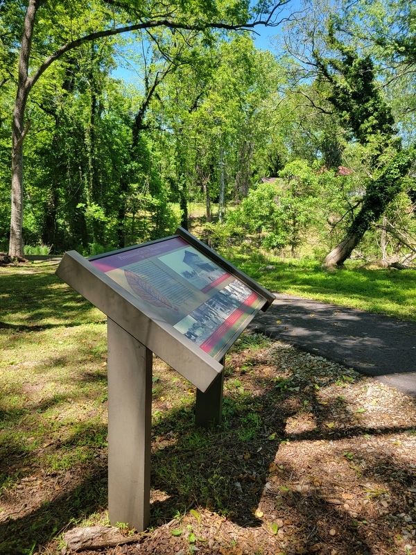
The Marker is located in Frances H. Hurt Park, along the walking trail.
Photographed by C. Ryan Dodson, June 8, 2026
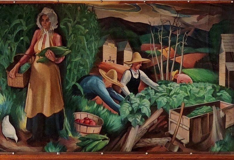
7. Harvest Season in Southern Virginia
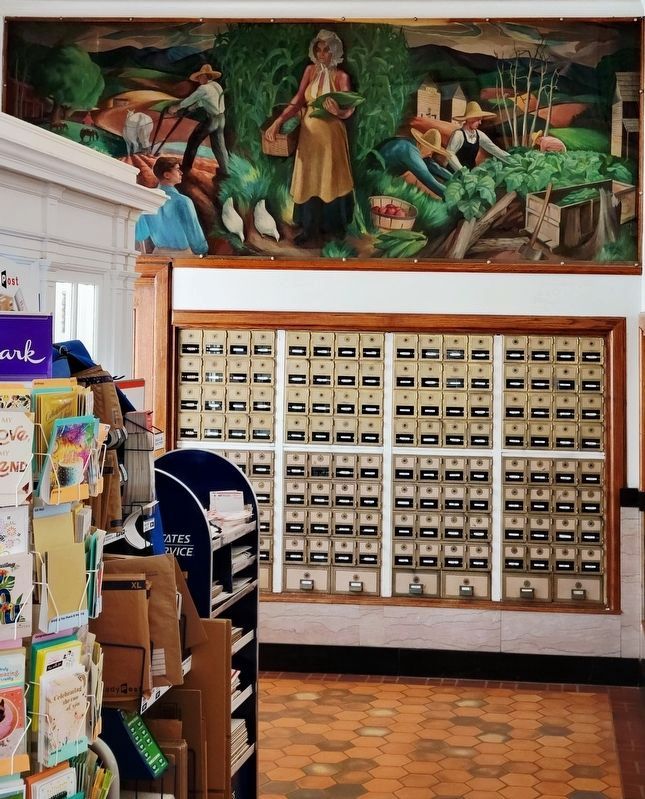
Pittsylvania County's tobacco heritage is prominently featured in Harvest Season in Southern Virginia, a 1938, New Deal-funded mural located in the Chatham Post Office, a few blocks from the Marker.
Photographed by C. Ryan Dodson, June 8, 2026
8. Harvest Season in Southern Virginia
The 1938 mural was one of several New Deal era murals painted by Carson Davenport, a future WPA Art School director and future professor at Averett University in Danville.
Photographed by C. Ryan Dodson, May 8, 2026
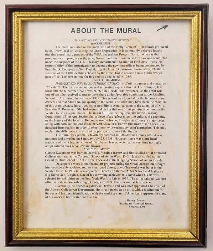
9. Harvest Season in Southern Virginia
Information about the mural located inside the Post Office.
Credits. This page was last revised on July 9, 2026. It was originally submitted on May 13, 2026, by C. Ryan Dodson of Danville, Virginia. This page has been viewed 33 times since then. Photos: 1, 2, 3, 4, 5. submitted on May 13, 2026, by C. Ryan Dodson of Danville, Virginia. 6. submitted on May 22, 2026, by C. Ryan Dodson of Danville, Virginia. 7, 8, 9. submitted on June 9, 2026, by C. Ryan Dodson of Danville, Virginia. • Bernard Fisher was the editor who published this page.
