Fort Hill in East Providence in Providence County, Rhode Island — The American Northeast (New England)
Veterans Memorial Parkway
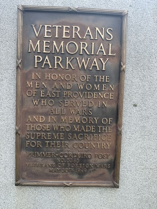
Photographed by G.W.Bartlett, May 15, 2026
1. Veterans Memorial Parkway Marker
Men and Women
of East Providence
Who Served in
All Wars
and in Memory of
Those Who Made the
Supreme Sacrifice
for Their Country
Primmer-Cordeiro Post
No. 5385
Veterans of Foreign Wars
May 30th 1949
Erected 1949 by Veterans of Foreign Wars - Primmer-Cordeiro Post No. 5385.
Topics. This memorial is listed in these topic lists: Military • Roads & Vehicles.
Location. 41° 48.824′ N, 71° 23.255′ W. Memorial is in East Providence, Rhode Island, in Providence County. It is in Fort Hill. It is at the intersection of Veterans Memorial Parkway and Mercer Street, on the left when traveling south on Veterans Memorial Parkway. Touch for map. Memorial is at or near this postal address: 1 Veterans Memorial Pkwy, East Providence RI 02914, United States of America. Touch for directions.

Regionally, this memorial is in Greater Providence and on Narragansett Bay. It is also in the American Northeast, in New England, and on the Eastern Seaboard. Globally, it is in the North Atlantic Region, North America, the Western Hemisphere, the
this page online
Other nearby markers. At least 8 other markers are within walking distance of this marker: Four Cannon Fort (within shouting distance of this marker); Bridging the Seekonk (approx. ¼ mile away); Green Jacket Shoal (approx. ¼ mile away); History of John L. Lewis Waterfront Park (approx. ¼ mile away); Roger Williams Landing 1636 (approx. 0.3 miles away); Tockwotton and the Indiamen / Sails to Rails 1835: Providence's First Train Station (approx. 0.3 miles away); West Bank / East Bank / Washington Bridges (approx. 0.4 miles away); Head of Narragansett Bay / Crossing the Seekonk River (approx. 0.4 miles away). Touch for a list and map of all markers in East Providence.

Photographed by G.W.Bartlett, May 15, 2026
2. Veterans Memorial Parkway Marker
Credits. This page was last revised on May 25, 2026. It was originally submitted on May 16, 2026, by G.W.Bartlett of Hingham, Massachusetts. This page has been viewed 15 times since then. Photos: 1, 2. submitted on May 16, 2026, by G.W.Bartlett of Hingham, Massachusetts. • Michael Herrick was the editor who published this page.
