Downtown in Columbus in Franklin County, Ohio — The American Midwest (Great Lakes)
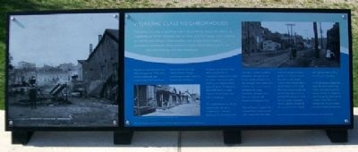
Working Class Neighborhoods
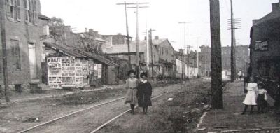
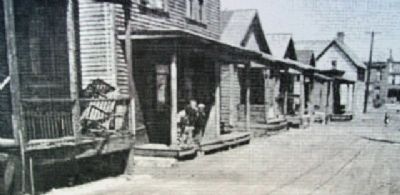
The history of a city is found not only in its grand old houses, but also in its neighborhoods. While Columbus has its share of grand houses, most residents did not live that lifestyle. Many working class people lived in hotels, apartments, tenements, cabins, and even hovels. Home ownership for the poor and working class was uncommon.
Workers in Columbus from the 1800s through mid-1950s were typically immigrants and predominantly German. Waves of new arrivals from Italy, Ireland, Greece, Hungary, Slovenia, and Croatia joined the Appalachian and African-American communities. Many ethnic groups lived in segregated communities, except in Flytown. There were other working class neighborhoods such as Tintown, The Badlands, and Greek Town, etc.; but, Flytown was the largest and best remembered.
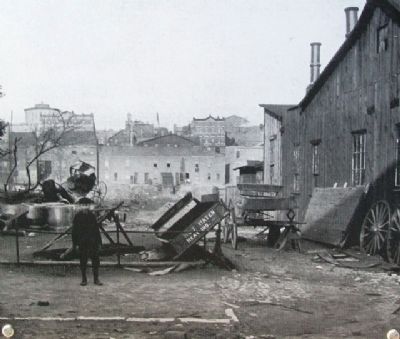
The neighborhood was the first point of entry for many immigrants to Columbus because of its proximity to the railroads. It earned the title of Columbus' “Melting Pot.” It's cheap housing seemed to “fly-up” overnight. Men, women and children from the community worked in the buggy companies, tanneries, shoe factories, railroads, and breweries all along the river.
Former Flytown residents tell of a mixed ethnic neighborhood with a close-knit society that truly crossed age, economic, gender, and race barriers. It's boundaries were roughly Collins Avenue on the North, Spruce Street on the South, Dennison Avenue on the east and the Olentangy River on the west. The Godman Guild, the city's oldest settlement house, provided services for the new arrivals and helped them get adjusted to life in America and Columbus.
As things changed through the years, the area declined into slums. Government and civic leaders decided to change the area through an urban renewal project in the 1950s, and Flytown was virtually leveled to allow for new development.
Erected by City of Columbus.
Topics. This historical marker is listed in these topic lists: African Americans • Charity & Public Work • Government & Politics • Industry & Commerce • Man-Made Features • Notable Places • Political Subdivisions • Railroads & Streetcars • Settlements & Settlers.
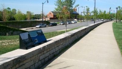
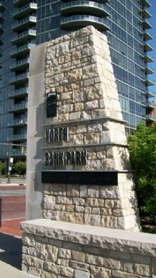
Location. 39° 57.931′ N, 83° 0.522′ W. Marker is in Columbus, Ohio, in Franklin County. It is in Downtown. Marker is on Long Street (U.S. 33), on the left when traveling east. Marker is about 300 feet east of Neil Avenue, in North Bank Park. Touch for map. Marker is in this post office area: Columbus OH 43215, United States of America. Touch for directions.
Other nearby markers. At least 8 other markers are within walking distance of this marker
. The Urban Face of the Scioto River (a few steps from this marker); William and Hannah Neil (within shouting distance of this marker); The Irish in Columbus (about 400 feet away, measured in a direct line); Transportation, Growth, and Development (about 400 feet away); General John Hunt Morgan, CSA / Morgan's Escape (about 500 feet away); Native Americans (about 500 feet away); The Railroads (about 700 feet away); John Brickell (approx. 0.2 miles away). Touch for a list and map of all markers in Columbus.
Also see . . . Flytown. Wikipedia entry (Submitted on June 30, 2022, by Larry Gertner of New York, New York.)
Credits. This page was last revised on February 3, 2023. It was originally submitted on April 22, 2010, by William Fischer, Jr. of Scranton, Pennsylvania. This page has been viewed 1,132 times since then and 19 times this year. Photos: 1, 2, 3, 4, 5. submitted on April 22, 2010, by William Fischer, Jr. of Scranton, Pennsylvania. 6. submitted on April 20, 2010, by William Fischer, Jr. of Scranton, Pennsylvania.
