
New Braunfels in Comal County, Texas — The American South (West South Central)
York Creek Cemetery
Photographed by Jeff Leichsenring, March 18, 2026
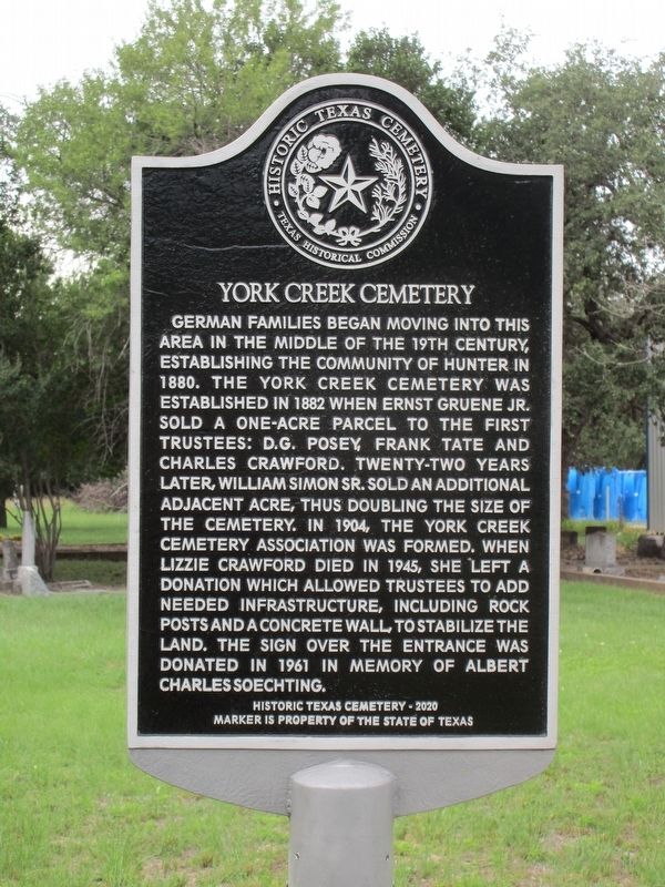
1. York Creek Cemetery Marker
German families began moving into this area in the middle of the 19th century, establishing the community of Hunter in 1880. The York Creek Cemetery was established in 1882 when Ernst Gruene Jr. sold a one-acre parcel to the first trustees: D.G. Posey, Frank Tate and Charles Crawford. Twenty-two years later, William Simon Sr. sold an additional adjacent acre, thus doubling the size of the cemetery. In 1904, the York Creek Cemetery Association was formed. When Lizzie Crawford died in 1945, she left a donation which allowed trustees to add needed infrastructure, including rock posts and a concrete wall, to stabilize the land. The sign over the entrance was donated in 1961 in memory of Albert Charles Soechting.
Erected 2020 by Texas Historical Commission. (Marker Number 23308.)
Topics. This historical marker is listed in this topic list: Cemeteries & Burial Sites. A significant historical year for this entry is 1880.
Location. 29° 47.222′ N, 98° 1.506′ W. Marker is in New Braunfels, Texas, in Comal County. It is on Old Bastrop Road 0.2 miles south of York Creek Road, on the right when traveling
this page online

Regionally, this marker is in the Hill Country and in the San Antonio Metropolitan Area. It is also in the American South. Globally, it is in North America, a Gulf of Mexico state, the Western Hemisphere, the Western World, and the Anglosphere. Historically, it finds itself in what was once New Spain, the Republic of Texas, and one of the Confederate States of America.
Other nearby markers. At least 8 other markers are within 6 miles of this marker, measured as the crow flies: Kings Highway Camino Real — Old San Antonio Road (approx. 0.8 miles away); Riley's Tavern (approx. 1.3 miles away); a different marker also named Kings Highway Camino Real — Old San Antonio Road (approx. 2.4 miles away); Kings Highway (approx. 3.9 miles away); Pitts Cemetery (approx. 4.1 miles away); First Baptist Church (approx. 4.9 miles away); The Cattle Drives (approx. 5.2 miles away); Gruene (approx. 5.8 miles away).

Photographed by Jeff Leichsenring, March 18, 2026
2. York Creek Cemetery and marker
Credits. This page was last revised on May 21, 2026. It was originally submitted on May 19, 2026, by Jeff Leichsenring of Garland, Texas. This page has been viewed 15 times since then. Photos: 1, 2. submitted on May 19, 2026, by Jeff Leichsenring of Garland, Texas. • James Hulse was the editor who published this page.
