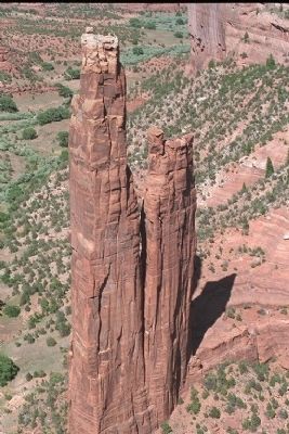
Shiprock in San Juan County, New Mexico — The American Mountains (Southwest)
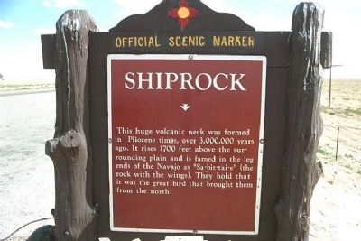
Shiprock
This huge volcanic neck was formed in Pliocene times, over 3,000,000 years ago. It rises 1700 feet above the surrounding plain and is famed in legends of the Navajo as "Sa-bit-tai-e" (the rock with the wings). They hold that it was the great bird that brought them from the north.
Erected by State of New Mexico.
Topics. This historical marker is listed in these topic lists: Environment • Native Americans. A significant historical year for this entry is 1700.
Location. Marker has been reported missing. It was located near 36° 46.324′ N, 108° 44.006′ W. Marker was in Shiprock, New Mexico, in San Juan County. Marker was on U.S. 64, on the left when traveling west. West of the town of Shiprock, several un-named Reservation roads in the area. Touch for map. Marker was in this post office area: Shiprock NM 87420, United States of America. Touch for directions.
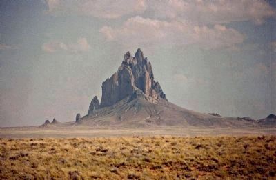
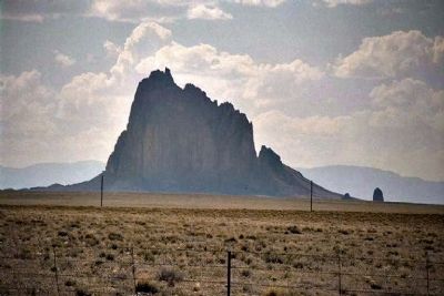
Regarding Shiprock. Shiprock, located in northwestern New Mexico, is a most impressive example of a volcanic neck, or a central feeder pipe. The remnant of an eruption around 30 million years ago during the Oligocene, it is the basalt core of an extinct volcano. Near the main peak, one can see small pinnacles, the remains of smaller auxiliary volcanic vents. When the magma solidifies before ever reaching the surface, it is referred to as a "diatreme". The local Navajos consider it sacred, being a main character in their folklore. They call it Tse Bitai, meaning "the winged rock". The central part of Shiprock, visible from many kilometers away, is roughly 500 meters in diameter. Stretching 600 meters into the sky above the surrounding terrain, Shiprock is part of both the Navajo and Chuska volcanic fields in northeastern Arizona and northwestern New Mexico, extending north into Utah and Colorado. It is also within the boundaries of the vast Colorado Plateau. Known as the Four-Corners area, this region of extinct volcanic features covers approximately 20,000 square km. ( Navajo Nation Organization)
The name "Shiprock" apparently came into use in the 1870s as indicated by U.S.Geological Survey Maps.
Also see . . .
1. Shiprock. Wikipedia entry:
The peak and surrounding land are of great religious and historical significance to the Navajo people. (Submitted on April 23, 2010, by Mike Stroud of Bluffton, South Carolina.)
2. Shiprock Peak. Navaho Tourism Department website entry (Submitted on March 27, 2021, by Larry Gertner of New York, New York.)
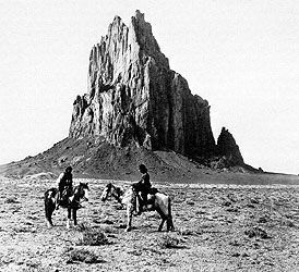
Photographed By Www.lapahie.com, circa 1914
4. Shiprock
or Shiprock Peak or Ship Rock (Navajo: Tsé Bit'a'í, "winged rock" is a rock formation rising 1,583 feet above the high-desert plain on the Navajo reservation, about 12 miles southwest of the northern New Mexico town of Shiprock, which is named for the peak.
Credits. This page was last revised on April 18, 2022. It was originally submitted on April 23, 2010, by Mike Stroud of Bluffton, South Carolina. This page has been viewed 2,242 times since then and 41 times this year. Photos: 1, 2, 3, 4, 5, 6. submitted on April 23, 2010, by Mike Stroud of Bluffton, South Carolina.
