
Near Negley in Red River County, Texas — The American South (West South Central)
Tuggle Springs Cemetery

Photographed by Duane and Tracy Marsteller, May 1, 2026
1. Tuggle Springs Cemetery Marker
Erected 2008 by Texas Historical Commission. (Marker Number 14230.)
Topics. This historical marker is listed in these topic lists: Cemeteries & Burial Sites • Settlements & Settlers. A significant historical year for this entry is 1850.
Location. 33° 47.81′ N, 95° 6.023′ W. Marker is near Negley, Texas, in Red River County. It can be reached from Farm to Market 2118 0.3 miles north of Farm to Market 2226, on the right when traveling north. Touch for map.
this page online

Regionally, this marker is in the American South and in the Piney Woods. Globally, it is in North America, a Gulf of Mexico state, the Western Hemisphere, the Western World, and the Anglosphere. Historically, it finds itself in what was once New Spain, the Republic of Texas, one of the Confederate States of America, and the Antebellum South.
Other nearby markers. At least 8 other markers are within 12 miles of this marker, measured as the crow flies: New Haven Cemetery (approx. 5.8 miles away); Arnold E. A. Roitsch Archeological Site (approx. 7.4 miles away); Near Here at the Old Jonesboro Crossing Sam Houston (approx. 8.9 miles away); Jonesboro (approx. 8.9 miles away); Jane Chandler Gill (approx. 9 miles away); Jesse B. Bowman (approx. 9 miles away); Stone's Chapel Cemetery (approx. 9½ miles away); Shiloh Cumberland Presbyterian Church (approx. 11.3 miles away).
Also see . . . Tuggle Springs Cemetery. Find a Grave page for the burial ground. (Submitted on May 20, 2026, by Duane and Tracy Marsteller of Murfreesboro, Tennessee.)
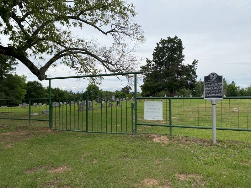
Photographed by Duane and Tracy Marsteller, May 1, 2026
2. Tuggle Springs Cemetery Marker
Credits. This page was last revised on May 20, 2026. It was originally submitted on May 20, 2026, by Duane and Tracy Marsteller of Murfreesboro, Tennessee. This page has been viewed 23 times since then. Photos: 1, 2. submitted on May 20, 2026, by Duane and Tracy Marsteller of Murfreesboro, Tennessee.
