
Sandwich in Windsor in Essex County, Ontario — Central Canada (North America)
Sandwich First Baptist Church
⎯⎯⎯
Première Église Baptiste de Sandwich
1851
Photographed by Tim Boyd, May 15, 2026
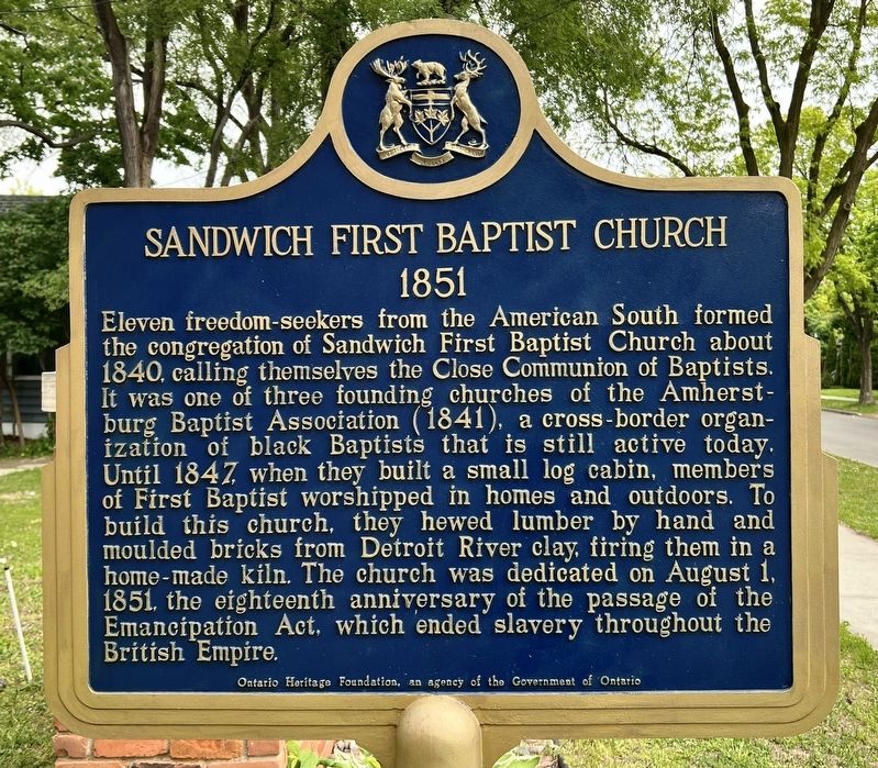
1. Sandwich First Baptist Church side of marker

Eleven freedom-seekers from the American South formed the congregation of Sandwich First Baptist Church about 1840, calling themselves the Close Communion of Baptists. It was one of three founding churches of the Amherstburg Baptist Association (1841), a cross-border organization of black Baptists that is still active today. Until 1847 when they built a small log cabin, members of First Baptist worshipped in homes and outdoors. To build this church, they hewed lumber by hand and moulded bricks from Detroit River clay, firing them in a home-made kiln. The church was dedicated on August 1, 1851, the eighteenth anniversary of the passage of the Emancipation Act, which ended slavery throughout the British Empire.
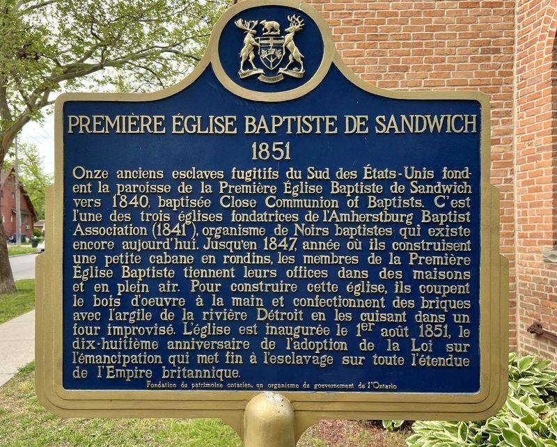
Onze anciens esclaves fugitifs du Sud des États-Unis fondent la paroisse de la Première Église Baptiste de Sandwich vers 1840, baptisée Close Communion of Baptists. C'est l'une des trois églises fondatrices de l'Amherstburg Baptist Association (1841), organisme de Noirs baptistes qui existe encore aujourd'hui. Jusqu'en
this page online
Erected by Ontario Heritage Foundation.
Topics and series. This historical marker is listed in these topic lists: Abolition & Underground RR • African Americans • Religion & Religious Structures. In addition, it is included in the Canada, Ontario Heritage Trust series list. A significant historical year for this entry is 1851.
Location. 42° 17.509′ N, 83° 4.805′ W. Marker is in Windsor, Ontario, in Essex County. It is in Sandwich. It is on Peter Street south of Watkins Street, on the right when traveling south. Touch for map. Marker is at or near this postal address: 3652 Peter Street, Windsor ON N9C 1J8,
Photographed by Tim Boyd, May 15, 2026
2. Première Église Baptiste de Sandwich side of marker

Regionally, this marker is in the Southwest Ontario Area and in Southwestern Ontario. It is also in Central Canada. Globally, it is in North America, on the Great Lakes, in the Western Hemisphere, in the Western World, and in the Anglosphere. Historically, it finds itself in what was once a British colony, the Viceroyalty of New France, the Haudenosaunee (Iroquois) Confederacy, and Rupert’s Land.
Other nearby markers. At least 8 other markers are within walking distance of this marker: The Sandwich First Baptist Church / L’Église de la First Baptist Church de Sandwich (here, next to this marker); The Hon. Alexander Grant 1734-1813 (approx. 0.9 kilometers away); Gregory Robert McGregor Esq. (approx. 0.9 kilometers away); St. John’s Church (approx. 0.9 kilometers away); 1872 (approx. 0.9 kilometers away); The Stone College (approx. 0.9 kilometers away); District Court House and Gaol (approx. one kilometer away); William Dummer Powell (approx. one kilometer away). Touch for a list and map of all markers in Windsor.
Photographed by Tim Boyd, May 15, 2026
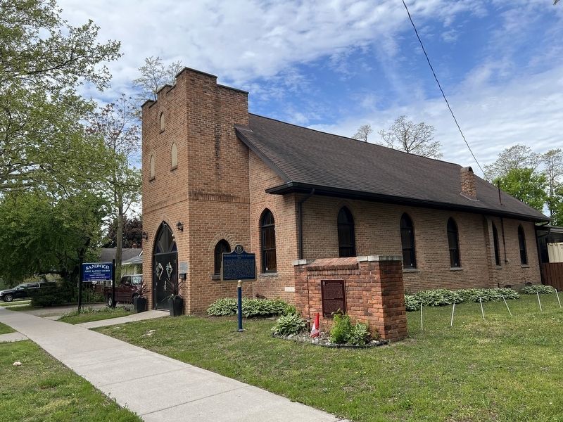
3. Sandwich First Baptist Church / Première Église Baptiste de Sandwich Marker
Photographed by Tim Boyd, May 15, 2026
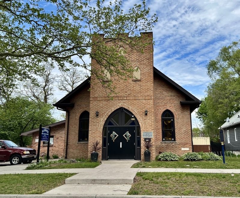
4. Sandwich First Baptist Church in 2026
Credits. This page was last revised on May 20, 2026. It was originally submitted on May 20, 2026, by Tim Boyd of Hamilton, Ontario. This page has been viewed 16 times since then. Photos: 1, 2, 3, 4. submitted on May 20, 2026, by Tim Boyd of Hamilton, Ontario. • Andrew Ruppenstein was the editor who published this page.
