East Melbourne in Melbourne, Victoria, Australia — Oceania
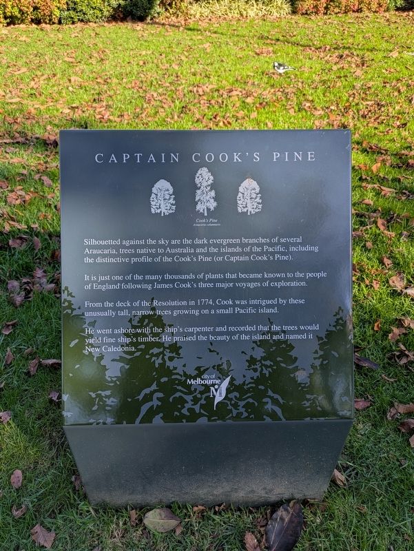
Captain Cook's Pine
| — | Araucaria columnaris | — |
Photographed by Dean Barton-Ancliffe, May 11, 2026
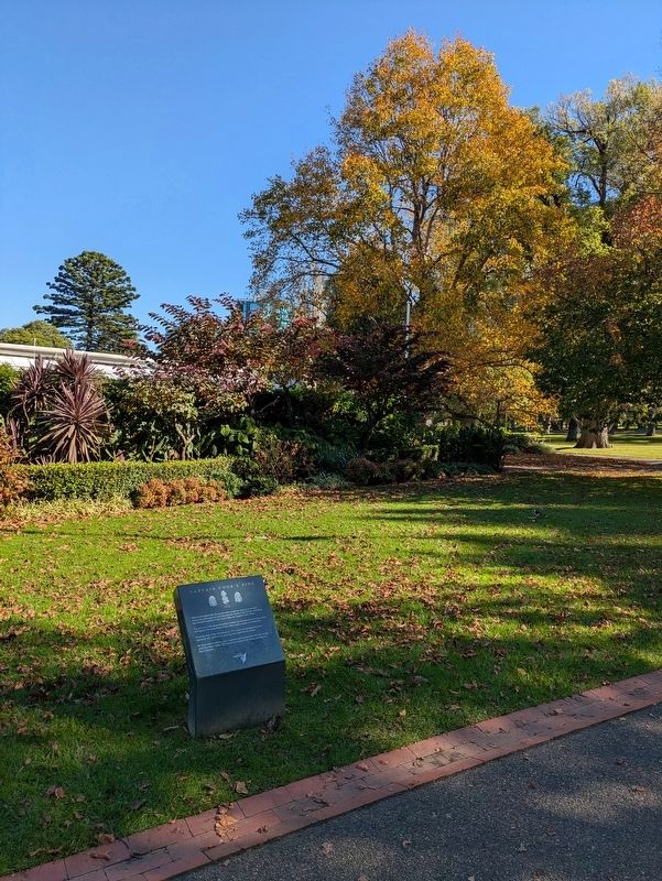
1. Captain Cook's Pine Marker
It is just one of the many thousands of plants that became known to the people of England following James Cook's three major voyages of exploration.
From the deck of the Resolution in 1774, Cook was intrigued by these unusually tall, narrow trees growing on a small Pacific island.
He went ashore with the ship's carpenter and recorded that the trees would yield fine ship's timber. He praised the beauty of the island and named it New Caledonia.
Erected by City of Melbourne.
Topics. This historical marker is listed in these topic lists: Exploration • Horticulture & Forestry • Parks & Recreational Areas. A significant historical year for this entry is 1774.
Location. 37° 48.877′ S, 144° 58.748′ E. Marker is in East Melbourne, Victoria, in Melbourne. It can be reached from Wellington Parade (Victoria Route 30) 0.1 kilometers Jolimont Road. Touch for map. Marker is at or near this postal
this page online

Regionally, it is in Oceania, in Australasia, in the Pacific Ocean, in South Pacific, on the Pacific Rim, in the Western World, and in the Anglosphere. Historically, it finds itself in what was once a British colony.
Other nearby markers. At least 8 other markers are within walking distance of this marker: A Great Australian Tree (a few steps from this marker); Fitzroy Gardens Welcome (about 90 meters away, measured in a direct line); Sinclair's Cottage (about 90 meters away); Scarred Tree (about 120 meters away); Fitzroy Gardens (about 150 meters away); The Fairies Tree (about 210 meters away); Model Tudor Village (about 210 meters away); John F. Kennedy Memorial (approx. 0.2 kilometers away). Touch for a list and map of all markers in East Melbourne.
Also see . . .
1. Araucaria columnaris. Wikipedia
Araucaria columnaris is a distinctive narrowly conical tree growing up to 60 m (200 ft) tall in its native habit. The trees have a slender, spire-like crown. The shape of young trees strongly resembles A. heterophylla. The bark peels(Submitted on May 20, 2026, by Dean Barton-Ancliffe of Rowville, Victoria.)off in thin paper-like sheets or strips and is rough, grey, and resinous. The relatively short, mostly horizontal branches are in whorls around the slender, upright to slightly leaning trunk. The branches are lined with cord-like, horizontal branchlets. The branchlets are covered with small, green, incurved, point-tipped, spirally arranged, overlapping leaves. The young leaves are needle-like, while the broader adult leaves are triangular and scale-like.Photographed by Dean Barton-Ancliffe, May 11, 20262. Captain Cook's Pine Marker
The female seed cones are scaly, egg-shaped, and 10–15 cm (4–6 in) long by 7–11 cm (3–4 in) wide. The smaller, more numerous male pollen cones are at the tips of the branchlets and are scaly, foxtail-shaped, and 5 cm (2 inches) long.
A 2017 study found that trees tend to have a tilt dependent on the hemisphere of their location, growing upright on the Equator but leaning south in the northern hemisphere and north in the southern hemisphere.
2. Cook's chart of New Caledonia. The National Archives
Catalogue context: 1 item (illustrating the log of HMS Resolution, Captain James Cook, 1772-1775) extracted from ADM 55/108 . New Caledonia. Map showing the north-east coast.(Submitted on May 20, 2026, by Dean Barton-Ancliffe of Rowville, Victoria.)
Credits. This page was last revised on May 21, 2026. It was originally submitted on May 20, 2026, by Dean Barton-Ancliffe of Rowville, Victoria. This page has been viewed 15 times since then. Photos: 1, 2. submitted on May 20, 2026, by Dean Barton-Ancliffe of Rowville, Victoria. • Andrew Ruppenstein was the editor who published this page.
