Marion in Smyth County, Virginia — The American South (Mid-Atlantic)
Battle of Marion
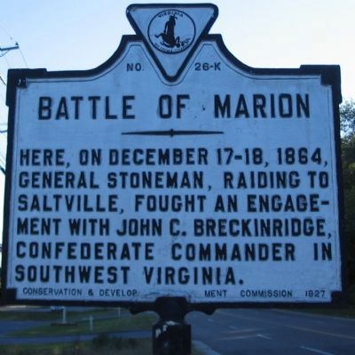
Photographed by Craig Swain, September 5, 2010
1. Battle of Marion Marker
Erected 1927 by Conservation & Development Commission. (Marker Number K-26.)
Topics and series. This historical marker is listed in this topic list: War, US Civil. In addition, it is included in the Virginia Department of Historic Resources (DHR) series list. A significant historical date for this entry is December 17, 1864.
Location. This marker has been replaced by another marker nearby. It was located near 36° 50.906′ N, 81° 29.379′ W. Marker was in Marion, Virginia, in Smyth County. It was at the intersection of North Main Street (U.S. 11) and Medical Park Drive, on the right when traveling north on North Main Street. Touch for map. Marker was at or near this postal address: 1616 N Main St, Marion VA 24354, United States of America. Touch for directions.

Regionally, this marker was in Southwest Virginia and in the Blue Ridge Highlands. It was also in the American South, specifically in the Upper South, in Appalachia, and specifically in Southern Appalachia.
this page online
Other nearby markers. At least 8 other markers are within 2 miles of this location, measured as the crow flies: A different marker also named Battle of Marion (here, next to this marker); Sherwood Anderson (approx. 0.2 miles away); Royal Oak Presbyterian Church (approx. half a mile away); Site of Colonial Home (approx. ¾ mile away); Col. Arthur Campbell (approx. ¾ mile away); Birthplace of Modern Mountain Dew (approx. 1.6 miles away); Governor David Campbell (approx. 1.8 miles away); Annabel Morris Buchanan (approx. 1.8 miles away). Touch for a list and map of all markers in Marion.
Other markers no longer nearby. Engagement at Marion (was about 300 feet away, measured in a direct line but has been permanently removed); Col. William Elisha Peters (was approx. 1.6 miles away but has been permanently removed).
Also see . . . Battle of Marion.
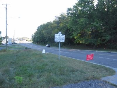
Photographed by Craig Swain, September 5, 2010
2. Battle of Marion Marker
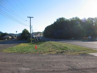
Photographed by Craig Swain, September 5, 2010
3. Confederate Withdrawal
Much of the fighting in the battle occurred close to the Interstate-81 by-pass. Short on ammunition, on the night of December 18, 1864, Breckinridge fell back to Mount Airy, Virginia, initially following the course presently used by Main Street and US Highway 11.
Credits. This page was last revised on May 28, 2026. It was originally submitted on September 22, 2010, by Craig Swain of Leesburg, Virginia. This page has been viewed 2,038 times since then and 79 times this year. Last updated on May 21, 2026, by Mike McKeown of Baltimore, Maryland. Photos: 1, 2, 3. submitted on September 22, 2010, by Craig Swain of Leesburg, Virginia. • Bernard Fisher was the editor who published this page.
