McGregor in Essex in Essex County, Ontario — Central Canada (North America)
Historic McGregor
Photographed by Tim Boyd, May 15, 2026
1. Historic McGregor Marker
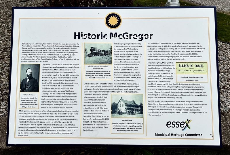
McGregor's story is one of a small town in Upper Canada, having railroads as the primary influence for its creation. Most settlers aimed to own water front properties, but these desired lots were in short supply in the late 19th century. On November 26, 1875, nearly 2700 acres of land known as the "Indian Reserve and Ordnance Lands", which surrounded the community, were sold off as individual lots to accommodate primarily French settlers. At first this new settlement would be known as "Colchester Crossing." But the name would change in 1876 when a post office named in honour of William McGregor, the Liberal member of parliament
this page online
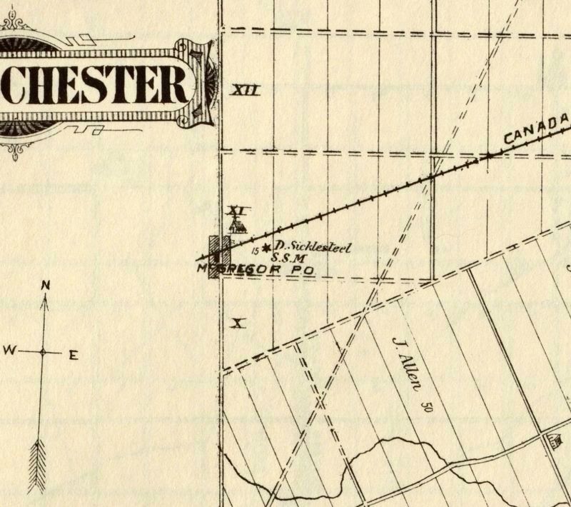
McGregor was home to some of the tallest trees in Southern Ontario including white oak, balsam, hickory, ash and elm trees. The abundant trees were some of the community's first catalysts for economic development and marked McGregor as a lumber settlement. An example of this increased development was the Sicklesteel sawmill located on lot 1 in 1876. The owner, David Sicklesteel, was able to expand his business and construct some of the first residences in McGregor for his employees. It is believed that the accumulation of sawdust from sawmill activity in McGregor was so significant that it dried up the marshy terrain allowing for favourable conditions for residential construction.
With the prospering lumber industry of McGregor came the need to export the resource. The "Amherstburg Branch" was an expansion of the Canada Southern Railway and was the section that allowed for McGregor to have accessible means to export lumber. This railway expansion was due to the efforts of Thomas Adair, the Reeve of Southampton, who made an agreement with Canada Southern Railway to erect a station. The railway was used to ship lumber to prominent business
Photographed by Tim Boyd, May 15, 2026
2. Historic McGregor Marker
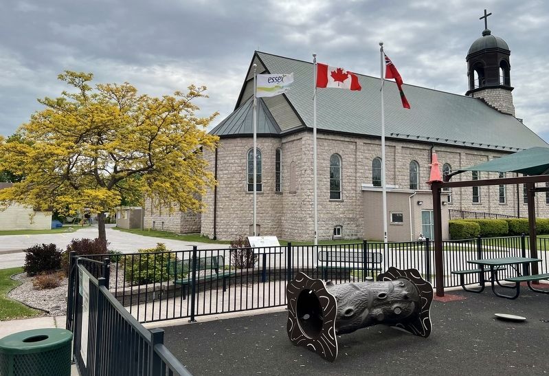
Below the Essex flag
With the train, came a need for a hotel. Known as "The Hotelman of Essex County," John Thrasher helped support the growth of McGregor during its early years. Thrasher became the proprietor of many hotels across Windsor-Essex, including the Thrasher Hotel in McGregor. The sustainability of the community was further ensured when water was struck 87 feet beneath the settlement. For education, a schoolhouse was constructed in 1878, after the establishment of S.S. #8, a union school section between Anderdon Township and Colchester Township. This building would be lost to a fire and replaced in 1884. In 1914, S.S. #8 switched from a public school to a separate school and would later be named École Sainte-Ursule.
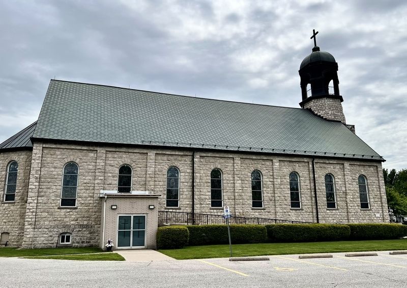
The first Roman Catholic church at McGregor, called St. Clement, was dedicated on June 6, 1880. This wooden frame church was located at the north corner of the present parking lot, and could accommodate 200 people. Father Grand, of Amherstburg, oversaw the construction and remained as pastor for the first six months. The Church was replaced in 1903 to accommodate an expanding congregation but included elements of the original building, such as the bell within the belfry.
Since its inception, McGregor has been a thriving
Photographed by Tim Boyd, May 15, 2026
3. St. Clement’s Church, McGregor, 2026
In 1999, the former towns of Essex and Harrow, along with the former townships of Colchester North and Colchester South, were brought together through a provincially mandated amalgamation process. Through this amalgamation, the community of McGregor was split between the municipalities of Amherstburg and Essex. The name McGregor remained for the community.
Erected by Essex Municipal Heritage Committee.
Topics. This historical marker is listed in these topic lists: Disasters • Indigenous Peoples and Communities • Industry & Commerce • Settlements & Settlers. A significant historical year for this entry is 1875.
Location. 42° 8.772′ N, 82° 58.132′ W.
4. McGregor and area in 1882, showing the Sicklesteel Sawmill
Source: University of Windsor (public domain)

Regionally, this marker is in the Southwest Ontario Area and in Southwestern Ontario. It is also in Central Canada. Globally, it is in North America, on the Great Lakes, in the Western Hemisphere, in the Western World, and in the Anglosphere. Historically, it finds itself in what was once a British colony, the Viceroyalty of New France, the Haudenosaunee (Iroquois) Confederacy, and Rupert’s Land.
Other nearby markers. At least 8 other markers are within 13 kilometers of this marker, measured as the crow flies: River Canard Bridge / Pont de la Rivière aux Canards (approx. 9.5 kilometers away); a different marker also named River Canard Bridge / Pont de la Rivière aux Canards (approx. 9.6 kilometers away); Skirmishes at the Canard River / Escarmouches près de la Rivière Canard (approx. 11 kilometers away); The Wyandot (approx. 12 kilometers away); Amherstburg First Baptist Church / L’Église de la First Baptist Church D’Amherstburg (approx. 12.3 kilometers away); The Nazrey African Methodist Episcopal (AME) Church (approx. 12.4 kilometers away); Fort Amherstburg (Fort Malden) (approx. 12.6 kilometers away); Essex Railway Station (approx. 12.6 kilometers away).
Credits. This page was last revised on May 28, 2026. It was originally submitted on May 23, 2026, by Tim Boyd of Hamilton, Ontario. This page has been viewed 34 times since then. Photos: 1, 2, 3, 4. submitted on May 23, 2026, by Tim Boyd of Hamilton, Ontario. • Andrew Ruppenstein was the editor who published this page.
