
Buxton in Dare County, North Carolina — The American South (South Atlantic)
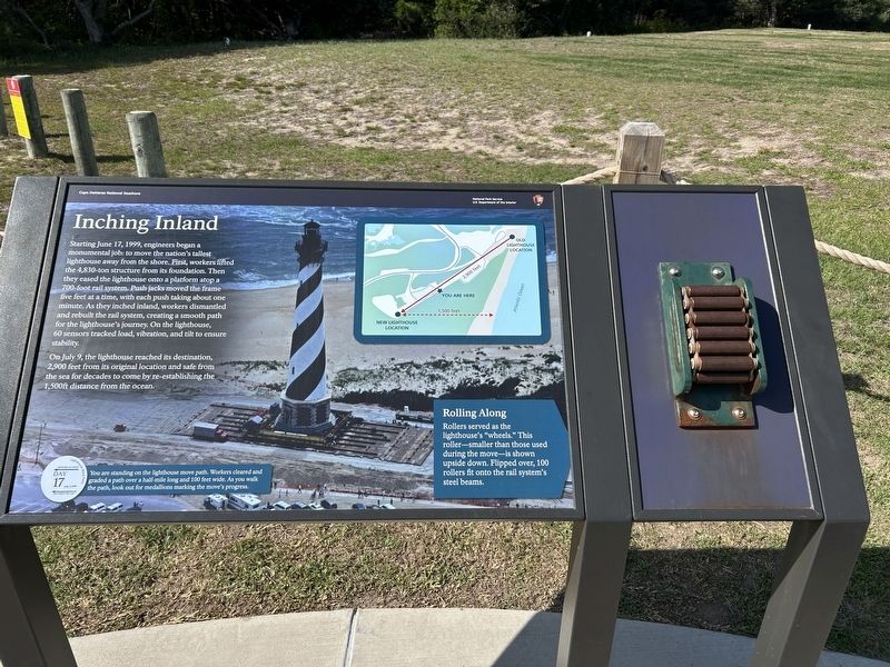
Inching Inland
Cape Hatteras National Seashore
Photographed by Steve Stoessel, May 13, 2026
1. Inching Inland Marker
On July 9, the lighthouse reached its destination, 2,900 feet from its original location and safe from the sea for decades to come by re-establishing the 1,500ft distance from the ocean.
Rolling Along
Rollers served as the lighthouse's "wheels." This roller-smaller than those used during the move-is shown upside down. Flipped over, 100 rollers fit onto the rail system's steel beams.
You are standing on the lighthouse move path. Workers cleared and graded a path over a half-mile long and 100 feet wide. As you walk the path, look out for medallions marking the move's
this page online
Erected by National Park Service.
Topics. This historical marker is listed in this topic list: Waterways & Vessels. A significant historical date for this entry is June 17, 1999.
Location. 35° 15.113′ N, 75° 31.565′ W. Marker is in Buxton, North Carolina, in Dare County. It can be reached from Lighthouse Road. Marker is on the bicycle path. Touch for map. Marker is in this post office area: Buxton NC 27920, United States of America. Touch for directions.

Regionally, this marker is in North Carolina’s Coastal Plain and on the Outer Banks. It is also in the American South, specifically in the Upper South, in the Tidewater, and on the Eastern Seaboard. Globally, it is in the North Atlantic Region, North America, the Western Hemisphere, the Western World, and the Anglosphere. Historically, it finds itself in what was once the territory of the Mississippian Culture, one of the original Thirteen Colonies, one of the Confederate States of America, and the Antebellum South.
Other nearby markers. At least 8 other markers are within walking distance of this marker: Lighthouse Move Path (about 300 feet away, measured

Photographed by Steve Stoessel, May 13, 2026
2. Inching Inland Marker
Related marker. Click here for another marker that is related to this marker.
Credits. This page was last revised on May 24, 2026. It was originally submitted on May 24, 2026, by Steve Stoessel of Niskayuna, New York. This page has been viewed 13 times since then. Photos: 1, 2. submitted on May 24, 2026, by Steve Stoessel of Niskayuna, New York.
