Englishtown in Limerick in County Limerick, Munster, Ireland — Irish South-West ((Éire) North Atlantic Ocean)
Athlunkard Street

Photographed by Ian Lefkowitz, May 13, 2026
1. Athlunkard Street Marker
This plaque was erected in 2024 to commemorate the 200th anniversary of the laying out of Athlunkard Street, April 26th, 1824.
Erected 2024.
Topics. This historical marker is listed in this topic list: Roads & Vehicles. A significant historical year for this entry is 1824.
Location. 52° 40.102′ N, 8° 37.32′ W. Marker is in Limerick, Munster, in County Limerick. It is in Englishtown. It is on Athlunkard Street east of Nicholas Street, on the left when traveling east. Touch for map. Marker is at or near this postal address: 1 Athlunkard Street, Limerick, Munster V94 HFN5, Ireland. Touch for directions.

Regionally, this marker is in the Ancient East. Globally, it is on the Atlantic Ocean, in the North Atlantic Region, in Europe, on the Island of Ireland, on the Celtic Fringe, in the European Union, in Atlantic Europe, on one of the British Isles, in the Western World, and in the Anglosphere.
Other nearby markers. At least 8 other markers are within walking distance of this marker: Bourke House (a few steps from this marker); St. Mary’s Cathedral (within shouting distance of this marker); The Graveyard
this page online
Also see . . . Bourke House is Limerick’s oldest mediaeval house (Patrick Comerford).
The name Athlunkard comes from the Irish Ath an Longphuirt, ‘the town of the naval fortress.’ After the demolition of the Walls of Limerick in 1760, the new bridge became an economic and social necessity with demands to expand the city into the surrounding countryside. The new street and new bridge were improvements that were much needed in Limerick in the first decades of the 19th century.(Submitted on May 24, 2026, by Ian Lefkowitz of New York, New York.)

Photographed by Ian Lefkowitz, May 13, 2026
2. Athlunkard Street Marker
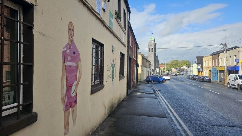
Photographed by Ian Lefkowitz, May 13, 2026
3. Athlunkard Street
The marker faces Athlunkard Street, in celebration of its bicentennial.
Credits. This page was last revised on May 27, 2026. It was originally submitted on May 24, 2026, by Ian Lefkowitz of New York, New York. This page has been viewed 12 times since then. Photos: 1, 2, 3. submitted on May 24, 2026, by Ian Lefkowitz of New York, New York. • Andrew Ruppenstein was the editor who published this page.
