Englishtown in Limerick in County Limerick, Munster, Ireland — Irish South-West ((Éire) North Atlantic Ocean)
Nicholas Street
| — | Medieval Limerick… on King’s Island | — |
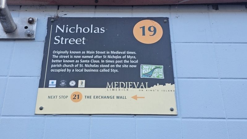
Photographed by Ian Lefkowitz, May 13, 2026
1. Nicholas Street Marker
Topics. This historical marker is listed in these topic lists: Religion & Religious Structures • Roads & Vehicles.
Location. 52° 40.154′ N, 8° 37.44′ W. Marker is in Limerick, Munster, in County Limerick. It is in Englishtown. It is on Nicholas Street north of Newgate Lane, on the right when traveling south. Touch for map. Marker is at or near this postal address: 13/14 Nicholas St, Limerick, Munster V94 D9V6, Ireland. Touch for directions.

Regionally, this marker is in the Ancient East. Globally, it is on the Atlantic Ocean, in the North Atlantic Region, in Europe, on the Island of Ireland, on the Celtic Fringe, in the European Union, in Atlantic Europe, on one of the British Isles, in the Western World, and in the Anglosphere.
Other nearby markers. At least 8 other markers are within
this page online
Also see . . . A stroll along Nicholas Street in the heart of mediaeval Limerick (Patrick Comerford).
According to the local historian and antiquarian, Thomas Johnson Westropp (1860-1922), Saint Nicholas’s Church ‘was in good repair in 1615.’ The church was apparently ‘destroyed’ during the sieges of Limerick, in either 1642 or 1651. No traces of this church exist, although local lore says it stood on the site of the former Thomond Cinema, now housing a business known as Stix – I wondered whether this was an abbreviation of Saint Nick’s or Saint Nicholas.

Photographed by Ian Lefkowitz, May 13, 2026
2. Nicholas Street Marker
The marker is located on the building known as Cinema Café, formerly known as Stix. An identical marker is located at the end of the street.
Credits. This page was last revised on May 26, 2026. It was originally submitted on May 25, 2026, by Ian Lefkowitz of New York, New York. This page has been viewed 16 times since then. Photos: 1, 2. submitted on May 25, 2026, by Ian Lefkowitz of New York, New York. • Andrew Ruppenstein was the editor who published this page.
