Forestville/Mystery Cave State Park near Preston in Fillmore County, Minnesota — The American Midwest (Upper Plains)
Forestville
Photographed by McGhiever, October 4, 2025
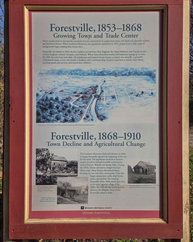
1. Forestville Marker, first panel
Growing Town and Trade Center
Native people lived in this area for hundreds of years, attracted by its ample fresh water, rich black soil, plentiful wildlife, and hardwood forests. When southeast Minnesota was opened for settlement in 1851, people from a wide range of backgrounds began making their homes here.
Forestville was settled in 1853. Its first residents arrived from New England, the Upper Midwest, and Canada as well as from England, Ireland, Germany, and Holland. Wheat farms flourished nearby and businesses sprang up in town. By 1860 the town had more than 150 inhabitants and boasted twenty houses, a school, two sawmills, a gristmill, a blacksmith shop, a store, two hotels, a distillery, and a cabinetry shop. Farmers came here to market their wheat, purchase goods and services, and school their children.
Bird's-eye view of Forestville, about 1899. David Geister rendering (2002), Minnesota Historical Society
Town Decline and Agricultural Change
The Southern Minnesota Railroad's decision in 1868 to bypass Forestville signaled the beginning of the end
this page online
Henry and Renslow Saw and Grist Mill, about 1900,
Minnesota Historical Society
Luedtke and Meighen Saw and Feed Mill, about 1905,
Minnesota Historical Society
Forestville schoolhouse (built 1856) as it appeared in 1899, Minnesota Historical Society
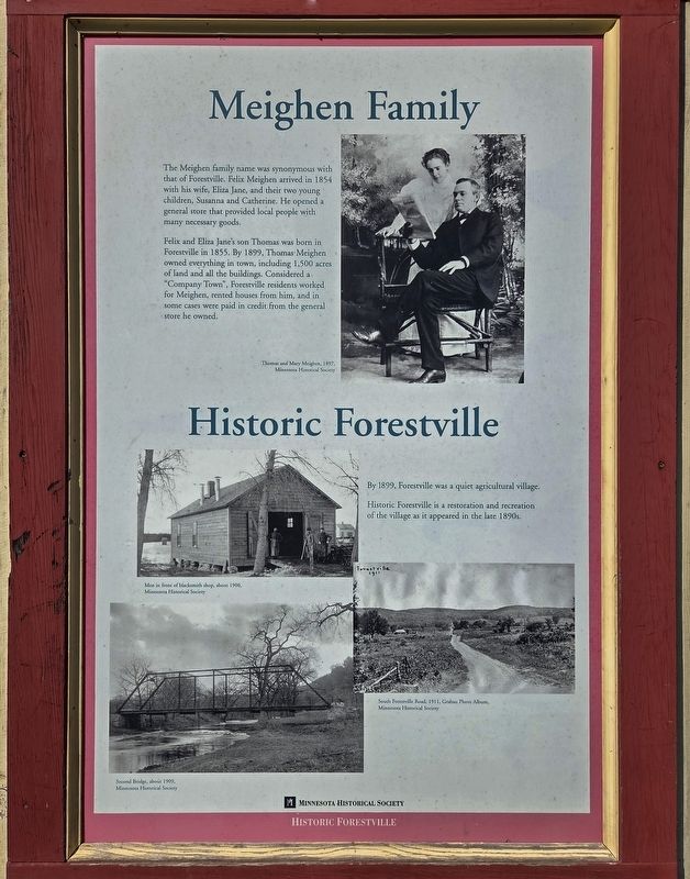
The Meighen family name was synonymous with that of Forestville. Felix Meighen arrived in 1854 with his wife, Eliza Jane, and their two young children, Susanna and Catherine. He opened a general store that provided local people with many necessary goods.
Felix and Eliza Jane's son Thomas was born in Forestville
Photographed by McGhiever, October 4, 2025
2. Forestville Marker, second panel
Thomas and Mary Meighen, 1907,
Minnesota Historical Society
By 1899, Forestville was a quiet agricultural village.
Historic Forestville is a restoration and recreation of the village as it appeared in the late 1890s.
Men in front of blacksmith shop, about 1900,
Minnesota Historical Society
South Forestville Road, 1911, Grabau Photo Album,
Minnesota Historical Society
Second Bridge, about 1909,
Minnesota Historical Society
Erected by the Minnesota Historical Society.
Topics. This historical marker is listed in these topic lists: Agriculture • Settlements & Settlers. A significant historical year for this entry is 1853.
Location. 43° 38.485′ N, 92° 12.896′ W. Marker is near Preston, Minnesota, in Fillmore County. It is in Forestville/Mystery Cave State Park. It is on County Road 118, on the left when traveling

Photographed by McGhiever, October 4, 2025
3. Forestville Marker, third panel (non-historical)

Regionally, this marker is in Southeast Minnesota and in Greater Rochester. It is also in the American Midwest, in the Corn Belt, and in the Driftless Area — Bluff Country. Globally, it is in North America, the Western Hemisphere, the Western World, and the Anglosphere. Historically, it finds itself in what was once Rupert’s Land, the territory of the Mississippian Culture, and the Louisiana Purchase.
Other nearby markers. At least 8 other markers are within walking distance of this marker: Bridges (within shouting distance of this marker); Forestville Sawmill (about 300 feet away, measured in a direct line); South Branch of the Root River (about 400 feet away); Bridges at Forestville (about 400 feet away); Historic Forestville (about 400 feet away); Meighen Icehouse (about 400 feet away); Meighen Store (about 500 feet away); Forestville Gristmill (approx. 0.2 miles away). Touch for a list and map of all markers
Photographed by McGhiever, October 4, 2025
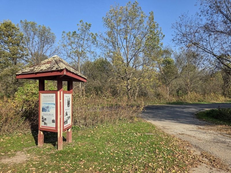
4. Forestville Marker at the parking lot for Historic Forestville
Credits. This page was last revised on May 25, 2026. It was originally submitted on May 25, 2026, by McGhiever of Minneapolis, Minnesota. This page has been viewed 10 times since then. Photos: 1, 2, 3, 4. submitted on May 25, 2026, by McGhiever of Minneapolis, Minnesota.
