Midtown - Downtown in Columbia in Richland County, South Carolina — The American South (South Atlantic)
Blossom Street School
⎯⎯⎯
Celia Dial Saxon School
Photographed by Mike Stroud, 2010
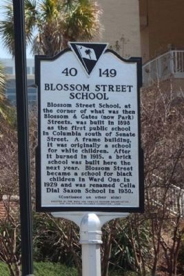
1. Blossom Street School Marker
Blossom Street School. Blossom Street School, at the corner of what was then Blossom & Gates (now Park) Streets, was built in 1898 as the first public school in Columbia south of Senate Street. A frame building, it was originally a school for white children. After it burned in 1915, a brick school was built here the next year. Blossom Street became a school for black children in Ward One in 1929 and was renamed Celia Dial Saxon School in 1930.
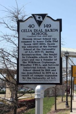
Celia Dial Saxon School. Blossom Street School was renamed to honor Celia Dial Saxon (1857-1935). Saxon was educated at the Normal School at the University of S.C. 1875-77, during Reconstruction. She taught in Columbia schools for 57 years and was a founder of the Wilkinson Orphanage, Wheatley YWCA, and Fairwold Industrial School. Saxon School closed in 1968 and was demolished in 1974 as a result of campus expansion by the University of S.C.
Erected 2008 by South Carolina Department of Archives and History, sponsored by The Ward One Families Reunion Organization and the Historic Columbia Foundation. (Marker Number 40-149.)
Topics and series. This historical marker is listed in these topic lists: African Americans • Education • Women. In addition, it is included in the South Carolina Historical Markers series list. A significant historical year for this entry is 1898.
Location. 33° 59.526′ N, 81° 1.966′ W. Marker is in Columbia, South Carolina, in Richland County. It is in Midtown - Downtown. It is on Blossom Street, on the right when traveling east. Located between Park Street and Assembly Street, at the Strom Thurmond Fitness and Wellness Center. Touch for map. Marker is in this post office area: Columbia SC 29201, United States of America. Touch for directions.

Regionally, this marker is in the Midlands. It is also in the American South and
this page online
Other nearby markers. At least 8 other markers are within walking distance of this marker: Blossom Street (approx. 0.2 miles away); "Commissioners' Oak" (approx. ¼ mile away); Mainigault's Funeral Home / Congaree Casket Company (approx. ¼ mile away); College Street (approx. 0.3 miles away); Richard Theodore Greener (1844-1922) (approx. 0.4 miles away); Site of Parade Ground (approx. 0.4 miles away); Booker T. Washington High School (approx. 0.4 miles away); U.S.C. During Reconstruction (approx. 0.4 miles away). Touch for a list and map of all markers in Columbia.
Also see . . . University Libraries. Celia Dial Saxon (Submitted on April 25, 2010, by Mike Stroud of Bluffton, South Carolina.)
Photographed by Mike Stroud, March 27, 2010
2. Celia Dial Saxon School Marker
Photographed by Mike Stroud, March 27, 2010
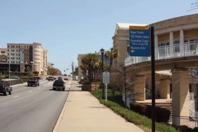
3. Blossom Street School Marker, as seen looking east along Blossom Street
Photographed by Mike Stroud, March 27, 2010
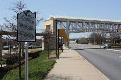
4. Celia Dial Saxon School Marker looking west along Blossom Street
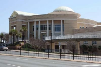
Photographed by Mike Stroud, March 27, 2010
5. Blossom Street School / Celia Dial Saxon School Marker
Located in front of the Strom Thurmond Fitness and Wellness Center, seen here
Credits. This page was last revised on January 23, 2026. It was originally submitted on April 25, 2010, by Mike Stroud of Bluffton, South Carolina. This page has been viewed 1,812 times since then and 75 times this year. Photos: 1, 2, 3, 4, 5. submitted on April 25, 2010, by Mike Stroud of Bluffton, South Carolina.
