Moncks Corner in Berkeley County, South Carolina — The American South (South Atlantic)
Old Santee Canal Park
Connecting the Upstate to Charleston
| — | Heritage Corridor | — |

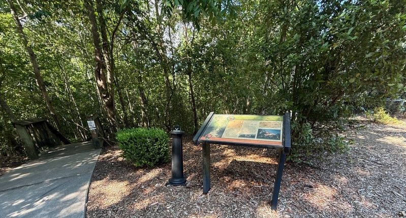
The Santee Canal opened to great fanfare in 1800. Prior to the opening of the canal, merchants and farmers had to travel down the Santee River, through the Santee Delta, out into the Atlantic Ocean and back into Charleston Harbor. Along this route they would encounter shifting sandbars in the delta and rough waters on the ocean.
The canal connected the Santee River, which drained two thirds of the state of South Carolina, to the Cooper River, providing merchants from as far as way as North Carolina, navigable inland waterway to the Charleston Harbor.
The Santee Canal was the first of its kind in the United States — a summit-level canal, connecting one river basin to another. It was also an important link in the chain of canals that operated in South Carolina from 1800 to 1830. It was the longest canal of the state system and the last canal leading to Charleston. The final boats poled through in the 1850s.
[Captions:]
On this 1825 Robert Mills Map of the Charleston District, the canal is highlighted in yellow. The canal started at White Oak Landing on the Santee River. Over the first 2½ miles, locks 1 through 3 raised vessels 34 feet to the summit of the canal. The summit portion of the canal carried vessels five miles to Lock 4. For the next 14½ miles, locks 4 through 10 lowered vessels 69 feet to Biggin Creek, a tidal creek that flowed into the Cooper River at Stony Landing.
The canal locks under the waters of Lake Moultrie were exposed during the drought of 2007.
The construction of the canal was under the direction of Colonel J. Christian Senf, an engineer who served with Hessian Troops, during the Revolutionary War. Originally thought to be of Swedish descent, further research has confirmed that Colonel Senf was of Saxon birth. Here you can see his General Plan for the canal.
The Stony Landing House, located up the path from here, was built in 1843 by Charleston merchang John Dawson.
Erected by SC
this page online
Topics. This historical marker is listed in these topic lists: Industry & Commerce • Waterways & Vessels. A significant historical year for this entry is 1800.
Location. 33° 11.62′ N, 79° 58.246′ W. Marker is in Moncks Corner, South Carolina, in Berkeley County. It is on Stony Landing Road 0.3 miles east of Red Mulberry Road, on the left when traveling east. Touch for map. Marker is at or near this postal address: 900 Stony Lndg Rd, Moncks Corner SC 29461, United States of America. Touch for directions.

Regionally, this marker is in the Lowcountry and in Santee Cooper Country. It is also in the American South, specifically in the Deep South, and on the Eastern Seaboard. Globally, it is in the North Atlantic Region, North America, the Western Hemisphere, the Western World, and the Anglosphere. Historically, it finds itself in what was once the territory of the Mississippian Culture, one of the original Thirteen Colonies, one of the Confederate States of America, and the Antebellum South.
Other nearby markers. At least 8 other markers are within walking distance of this marker: Too Formidable to Take
Another marker is no longer nearby. Stony Landing House (was about 400 feet away but has been replaced with another marker now near it).
Credits. This page was last revised on May 25, 2026. It was originally submitted on May 25, 2026, by Devry Becker Jones of Washington, District of Columbia. This page has been viewed 19 times since then. Photos: 1, 2. submitted on May 25, 2026, by Devry Becker Jones of Washington, District of Columbia.
