
Bunratty East in County Clare, Munster, Ireland — Irish South-West ((Éire) North Atlantic Ocean)
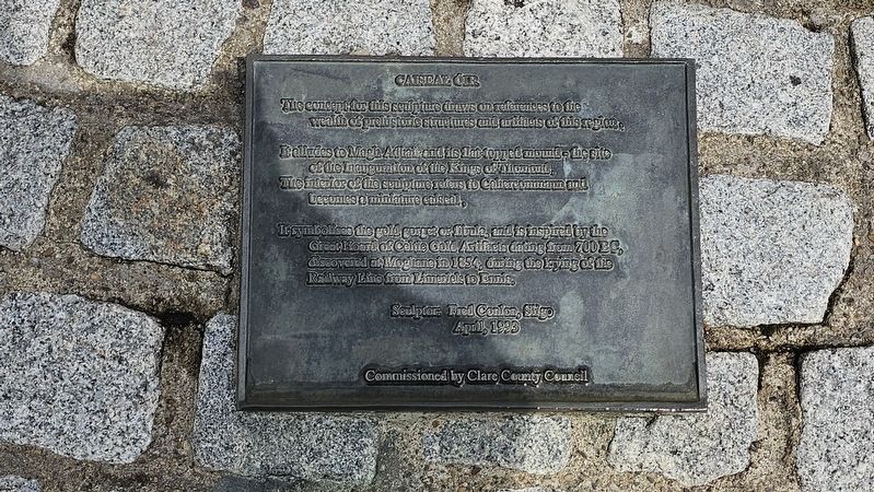
Caiseal Óir
Photographed by Ian Lefkowitz, May 14, 2026
1. Caiseal Óir Marker
The concept for this sculpture draws on references to the wealth of prehistoric structures and artifacts of this region.
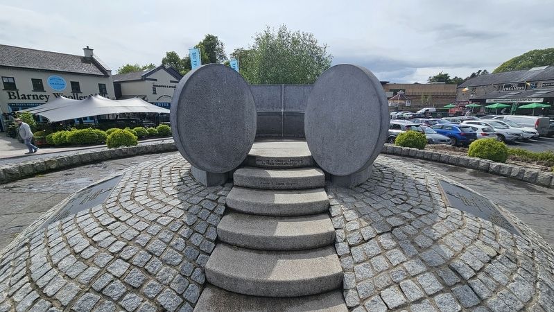
It alludes to Magh Adhair and its flat-topped mound — the site of the inauguration of the Kings of Thomond. The interior of the sculpture refers to Cahercommaun and becomes a miniature caiseal.
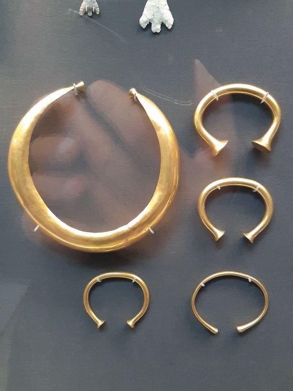
It symbolizes the gold gorget or fibula, and is inspired by the Great Hoard of Celtic Gold Artifacts dating from 700 B.C., discovered at Mooghaun in 1854, during the laying of the Railway Line from Limerick to Ennis.
Sculptor: Fred Conlon, Sligo
April, 1993
Commissioned by Clare County Council
Erected 1993.
Topics. This historical marker is listed in these topic lists: Anthropology & Archaeology • Arts, Letters, Music. A significant historical year for this entry is 1854.
Location. 52° 41.782′ N, 8° 48.768′ W. Marker is in Bunratty, Munster, in County Clare. It is in Bunratty East. It is at the intersection of Old Bunratty Road and Bunratty West, on the left when traveling north on Old Bunratty Road. Touch for map. Marker is at or near this postal address: 49 Old Bunratty Rd, Bunratty, Munster,
this page online

Regionally, this marker is in the Hidden Heartlands. Globally, it is on the Atlantic Ocean, in the North Atlantic Region, in Europe, on the Island of Ireland, on the Celtic Fringe, in the European Union, in Atlantic Europe, on one of the British Isles, in the Western World, and in the Anglosphere.
Other nearby markers. At least 8 other markers are within 13 kilometers of this marker, measured as the crow flies: Bunratty Castle (here, next to this marker); Bunratty House (within shouting distance of this marker); Bunratty Bridge (about 90 meters away, measured in a direct line); Military Events (about 120 meters away); Landscape and River (about 120 meters away); Sarsfield Bridge (approx. 12.8 kilometers away); Sóivéid Luimní / Limerick Soviet (approx. 12.8 kilometers away); Dockers Monument (approx. 12.8 kilometers away). Touch for a list and map of all markers in Bunratty.
Also see . . .
1. Mooghaun North Hoard.
The Mooghaun North Hoard or Great Clare Find is the name of an important Bronze Age hoard found at Mooghaun North, near Newmarket-on-Fergus in County Clare, Ireland. Considered(Submitted on May 27, 2026, by Ian Lefkowitz of New York, New York.)one of the greatest Bronze Age hoards of gold ever found north of the Alps, unfortunately most of the treasure was melted down soon after its discovery. What remains of the hoard is currently split between the National Museum of Ireland in Dublin and the British Museum in London.Photographed by Ian Lefkowitz, May 14, 20262. Caiseal ÓirThe sculpture is made from Kilkenny limestone.
2. Magh Adhair.
Magh Adhair is a former inauguration site and place of archaeological significance located near the village of Quin, County Clare, in Ireland. Traditionally known as the place in which the kings of Thomond were installed, most notably the O'Briens, the site itself consists of numerous monuments, including a mound, standing stone, fulacht fiadh and a bullaun stone.(Submitted on May 27, 2026, by Ian Lefkowitz of New York, New York.)
Photographed by Ian Lefkowitz, May 14, 2026
3. Caiseal Óir Marker
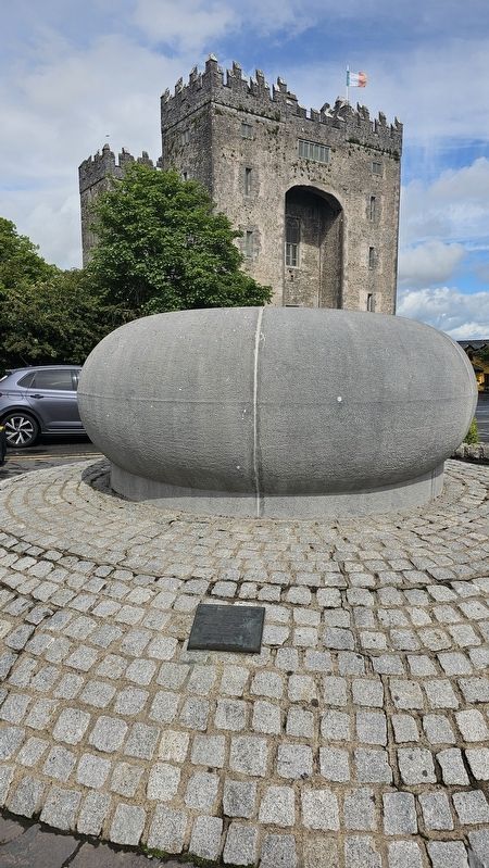
The marker, seen in line with the rear of the sculpture and Bunratty Castle.
By Jononmac46 - Own work, CC BY-SA 4.0, October 30, 2021
4. Part of the Mooghaun North Hoard in the British Museum
A photo of the hoard that inspired the Bunratty sculpture in form.
Photographed by Ian Lefkowitz, May 14, 2026
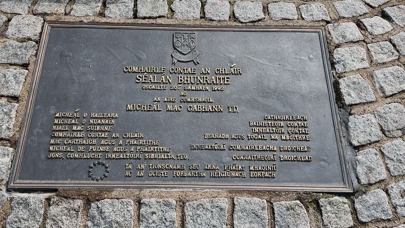
5. Séalán Bhunraite
This marker is located on the sculpture. It reads:
[Gaeilge:]
Comhairle Contae an Chláir
Séalán Bhunraite
Oscailte 20ú Samhain 1992
ag
An Aire Comhshaoil
Micheál Mac Gabhann T.D.
Micheál Ó hAileara — Cathaoirleach
Micheál Ó Nuanáin — Bainisteoir Contae
Niall Mac Suibhne — Innealtóir Contae
Comhairle Contae an Chláir — Dearadh agus Togáil na mBóithre
Mac Cárthaigh agus a Pháirtithe — Innealtóirí Comhairleacha Droichead
Micheál de Puinse agus a Pháirtithe — Conraitheoirí Droichead
Jons, Comhlucht Innealtóirí Sibhialta, Teo.
Tá an tionscnamh seo arna pháirt mhaoiniú
ag an gCiste Forbartha Réigiúnach Eorpach
Comhairle Contae an Chláir
Séalán Bhunraite
Oscailte 20ú Samhain 1992
ag
An Aire Comhshaoil
Micheál Mac Gabhann T.D.
Micheál Ó hAileara — Cathaoirleach
Micheál Ó Nuanáin — Bainisteoir Contae
Niall Mac Suibhne — Innealtóir Contae
Comhairle Contae an Chláir — Dearadh agus Togáil na mBóithre
Mac Cárthaigh agus a Pháirtithe — Innealtóirí Comhairleacha Droichead
Micheál de Puinse agus a Pháirtithe — Conraitheoirí Droichead
Jons, Comhlucht Innealtóirí Sibhialta, Teo.
Tá an tionscnamh seo arna pháirt mhaoiniú
ag an gCiste Forbartha Réigiúnach Eorpach
Photographed by Ian Lefkowitz, May 14, 2026
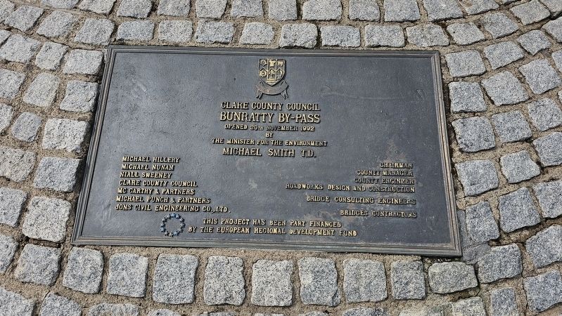
6. Bunratty Bypass Marker
This marker is located on the sculpture:
Clare County Council
Bunratty By-Pass
Opened 20th November 1992
by
the Minister for the Environment
Michael Smith T.D.
Michael Hillery — Chairman
Michael Nunan — County Manager
Niall Sweeney — County Engineer
Clare County Council — Roadworks Design and Construction
McCarthy & Partners — Bridge Consulting Engineers
Michael Punch & Partners
Jons Civil Engineering Co., Ltd. — Bridges Contractors
This project has been part financed by the European Regional Development Fund
Clare County Council
Bunratty By-Pass
Opened 20th November 1992
by
the Minister for the Environment
Michael Smith T.D.
Michael Hillery — Chairman
Michael Nunan — County Manager
Niall Sweeney — County Engineer
Clare County Council — Roadworks Design and Construction
McCarthy & Partners — Bridge Consulting Engineers
Michael Punch & Partners
Jons Civil Engineering Co., Ltd. — Bridges Contractors
This project has been part financed by the European Regional Development Fund
Credits. This page was last revised on May 28, 2026. It was originally submitted on May 27, 2026, by Ian Lefkowitz of New York, New York. This page has been viewed 11 times since then. Photos: 1, 2, 3, 4, 5. submitted on May 27, 2026, by Ian Lefkowitz of New York, New York. 6. submitted on May 28, 2026, by Ian Lefkowitz of New York, New York. • Andrew Ruppenstein was the editor who published this page.
