
Bunratty West in County Clare, Munster, Ireland — Irish South-West ((Éire) North Atlantic Ocean)
Bunratty House
| — | Bunratty Village Heritage Trail | — |
Photographed by Ian Lefkowitz, May 14, 2026
1. Bunratty House Marker

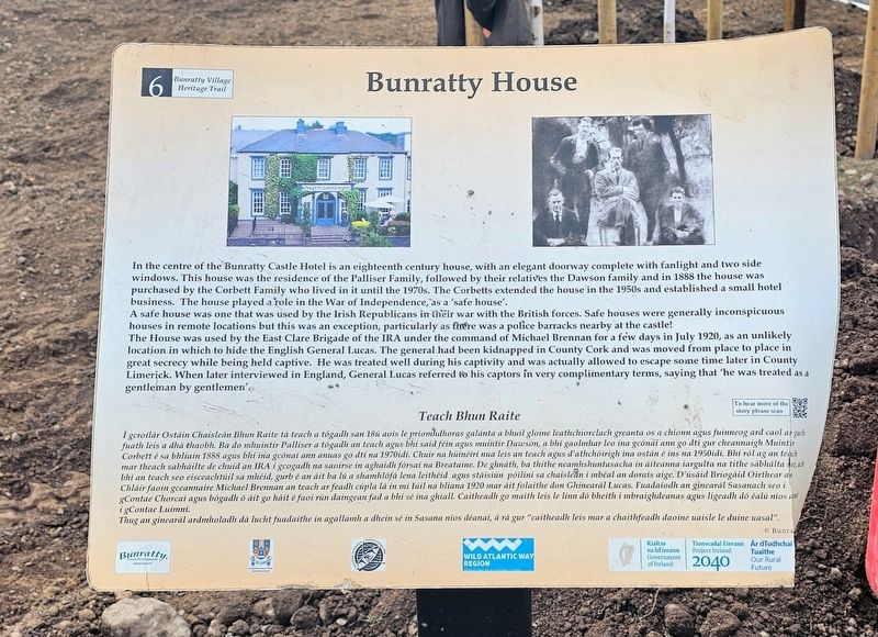
Bunratty House
In the centre of the Bunratty Castle Hotel is an eighteenth century house, with an elegant doorway complete with fanlight and two side windows. This house was the residence of the Palliser Family, followed by their relatives the Dawson family and in 1888 the house was purchased by the Corbett Family who lived in it until the 1970s. The Corbetts extended the house in the 1950s and established a small hotel business. The house played a role in the War of Independence, as a ‘safe house’.
A safe house was one that was used by the Irish Republicans in their war with the British forces. Safe houses were generally inconspicuous houses in remote locations but this was an exception, particularly as there was a police barracks nearby at the castle!
The House was used by the East Clare Brigade of the IRA under the command of Michael Brennan for a few days in July 1920, as an unlikely location in which to hide the English General Lucas. The general had been kidnapped in County Cork and was moved from place to place in great secrecy while being held captive. He was treated well during his captivity and was
this page online
Teach Bhun Raite
I gcroílár Ostáin Chaisleán Bhun Raite tá teach a tógadh san 18ú aois le príomhdhoras galánta a bhuil gloine leathchiorclach greanta os a chionn agus fuinneog ard caol ar gach fuath leis a dhá thaobh. Ba do mhuintir Palliser a tógadh an teach agus bhí said féin agus muintir Dawson, a bhí gaolmhar leo ina gcónaí ann go dtí gur cheannaigh Muintir Corbett é sa bhliain 1888 agus bhí ina gcónaí ann anuas go dtí na 1970idí. Chuir na húinéirí nua leis an teach agus d’athchóirigh ina ostán é ins na 1950idí. Bhí ról ag an teach mar theach sábháilte de chuid an IRA i gcogadh na saoirse in aghaidh fórsaí na Breataine. De ghnáth, ba thithe neamhshuntasacha in áiteanna iargúlta na tithe sábháilta seo, ach bhí an teach seo eisceachtúil sa mhéid, gurb é an áit ba lú a shamhlófá lena leithéid agus stáisiún póilíní sa chaisleán i mbéal an dorais aige. D’úsáid Briogáid Oirthear an Chláir faoin gceannaire Michael
Photographed by Ian Lefkowitz, May 14, 2026
2. Bunratty House Marker
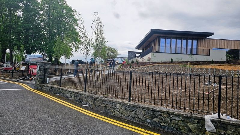
Construction taking place outside of the Bunratty Castle Hotel. The marker can be seen affixed to the wall.
Thug an ginearál ardmholadh dá lucht fuadaithe in agallamh a dhein sé in Sasana níos déanaí, á rá gur “caitheadh leis mar a chaithfeadh daoine uaisle le duine uasal”.
Erected by Bunratty Local Development Association. (Marker Number 6.)
Topics. This historical marker is listed in these topic lists: Industry & Commerce • Wars, Non-US.
Location. 52° 41.769′ N, 8° 48.827′ W. Marker is in Bunratty, Munster, in County Clare. It is in Bunratty West. It is at the intersection of Bunratty West and Old Bunratty Road, on the left when traveling north on Bunratty West. Touch for map. Marker is at or near this postal address: Bunratty West, Bunratty, Munster, Ireland. Touch for directions.

Regionally, this marker is in the Hidden Heartlands. Globally, it is on the Atlantic Ocean, in the North Atlantic Region, in Europe, on the Island of Ireland, on the Celtic Fringe, in the European Union, in Atlantic Europe, on one of the British Isles, in the Western World, and in the Anglosphere.
Other nearby markers. At least 8 other markers are within 13 kilometers of this marker, measured as the crow flies: Bunratty Castle (within shouting distance of this marker); Caiseal Óir (within shouting distance of this marker); Bunratty Bridge (about 150 meters away, measured in a direct line); Military Events (about 180 meters away); Landscape and River (about 180 meters away); Sarsfield Bridge (approx. 12.8 kilometers away); Sóivéid Luimní / Limerick Soviet (approx. 12.8 kilometers away); Dockers Monument (approx. 12.9 kilometers away). Touch for a list and map of all markers in Bunratty.
Credits. This page was last revised on May 28, 2026. It was originally submitted on May 28, 2026, by Ian Lefkowitz of New York, New York. This page has been viewed 18 times since then. Photos: 1, 2. submitted on May 28, 2026, by Ian Lefkowitz of New York, New York. • Andrew Ruppenstein was the editor who published this page.
