
Charleston in Charleston County, South Carolina — The American South (South Atlantic)
The Magnolia Houses
| — | Magnolia Plantation & Gardens | — |
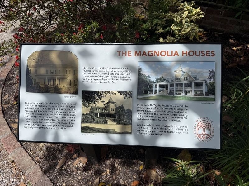
Sometime before 1714, the first plantation house was built at Magnolia. Governor John Drayton, writing in about 1820, describes it as "a Mansion house of brick, of one story high, with a dormant roof…the ceilings of the first floor were remarkably high, being about eighteen feet". Inside were "pilasters and other ornaments of Stucco work" with "kitchen and and offices underneath". No image of this house survives. It was destroyed by fire, possibly from a lightning strike to the roof, in 1810.
Shortly after the fire, the second house's foundation was built using bricks salvaged from the first home. An early photograph (c. 1860) shows some of the Drayton family posing in front of a cypress clapboard house. This house was deliberately burned in 1865.
In the early 1870s, the Reverend John Grimké Drayton built a four room cottage atop the second house's foundation. Later, his daughter Julia enlarged the house in stages, adding dining and sitting rooms, upstairs bedrooms, and a tower cistern to collect rainwater.
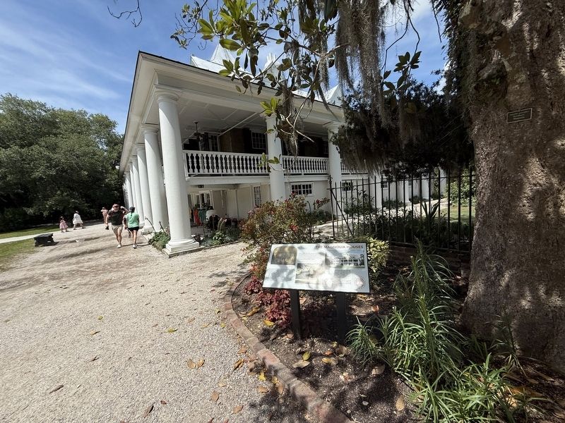
Julia's grandson, John Drayton Hastie, opened the house to the public in 1975. In 1995, he expanded the
this page online
Erected by Magnolia Plantation & Gardens.
Topics. This historical marker is listed in these topic lists: Architecture • Parks & Recreational Areas • Settlements & Settlers. A significant historical year for this entry is 1714.
Location. 32° 52.577′ N, 80° 5.008′ W. Marker is in Charleston, South Carolina, in Charleston County. It is on Magnolia Plantation Road half a mile east of Nursery Road, on the left when traveling south. Touch for map. Marker is at or near this postal address: 3550 Ashley River Rd, Charleston SC 29414, United States of America. Touch for directions.

Regionally, this marker is in the Lowcountry. It is also in the American South and specifically in the Deep South. Globally, it is in the North Atlantic Region, North America, the Western Hemisphere, the Western World, and the Anglosphere. Historically, it finds itself in what was once the territory of the Mississippian Culture, one of the original Thirteen Colonies, one of the Confederate States of America, and the Antebellum South.
Other nearby markers. At least 8 other markers are
Credits. This page was last revised on May 28, 2026. It was originally submitted on May 28, 2026, by Devry Becker Jones of Washington, District of Columbia. This page has been viewed 5 times since then. Photos: 1, 2. submitted on May 28, 2026, by Devry Becker Jones of Washington, District of Columbia.
