Magnolia Plantation and Gardens in North Charleston in Charleston County, South Carolina — The American South (South Atlantic)
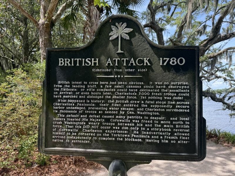
British Attack 1780
| — | 🌴 | — |

From this riverbank began the final assault on Charleston, as recorded below in the diary by Hessian, Capt. Johann Ewald, recently published at Yale University, beginning March 23, 1780:
"About eight o'clock - I received orders to try to get to Drayton's house. Towards noon we reached the gardens of Drayton's plantation (today's Magnolia) -- in the afternoon General Leslie arrived and took up quarters."
"The 28th. The entire army assembled at Drayton's plantation."
"The 29th. Before daybreak the army set out to Drayton's landing place, where armed ships and flatboats were lying along the right bank to transport troops to the left -- at daybreak the troops boarded (a large force of infantry and artillery under Lord Cornwallis). At about 8 o'clock, the light infantry climbed the left bank at Ben Fuller's plantation, opposite Drayton's house. Some distance away several groups of horsemen and a number of riflemen appeared, who honored us with a few rifle shots, without any damage."
British intent to cross here had been obvious. It was no surprise. From the landing bluff, a few small cannons could have destroyed
this page online
What happened is history: the British drew a fatal siege line across Charleston's Pensinsula; their fleet entered the supposedly secure harbor undamaged, preventing water escape; and Charleston surrendered its thousands of troops so needed by Gen. Washington.
This default and defeat caused many patriots to despair; and local leaders toasted His Majesty. Cornwallis was feed to move north to crush Washington's weary troops between his and the main British force. That this did not occur was due only to a storybook reversal of Cornwallis' Charleston experience: He inadvertently allowed himself to be cornered on the Yorktown Peninsula and a French fleet arrived unexpectedly to complete the blockade, leaving him to alternative to surrender.
Topics. This historical marker is listed in these topic lists: War, US Revolutionary • Waterways & Vessels. A significant historical date for this entry is March 23, 1780.
Location. 32° 52.607′ N, 80° 4.923′ W.

Regionally, this marker is in the Lowcountry. It is also in the American South, specifically in the Deep South, and on the Eastern Seaboard. Globally, it is in the North Atlantic Region, North America, the Western Hemisphere, the Western World, and the Anglosphere. Historically, it finds itself in what was once the territory of the Mississippian Culture, one of the original Thirteen Colonies, one of the Confederate States of America, and the Antebellum South.
Other nearby markers. At least 8 other markers are within walking distance of this marker: Magnolia at War (a few steps from this marker); The Ashley River (within shouting distance of this marker); Henry Woodward (within shouting distance of this marker); Excursion Up the Ashley (within shouting distance of this marker); The Earthquake of 1886

Credits. This page was last revised on August 26, 2026. It was originally submitted on May 28, 2026, by Devry Becker Jones of Washington, District of Columbia. This page has been viewed 18 times since then. Photos: 1, 2, 3. submitted on May 28, 2026, by Devry Becker Jones of Washington, District of Columbia.
