Magnolia Plantation and Gardens in North Charleston in Charleston County, South Carolina — The American South (South Atlantic)
Excursion Up the Ashley
| — | Magnolia Plantation & Gardens | — |
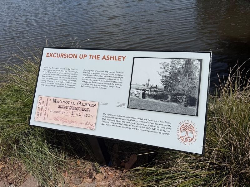
When the Reverend John Grimké Drayton returned to Magnolia after the Civil War, he found Charleston in ruins, his congregation scattered, and the Magnolia house burned. Desperate for income, the Reverend sold more than half of Magnolia's land to a phosphate mining company. In 1871, realizing the only way to save his garden was to share it, he opened Magnolia to the public during the spring bloom.
Roughly half of the men and women formerly enslaved at Magnolia remained on the plantation after Emancipation. They earned minimal wages as garden workers, greeters, and guides for the tourists who came up the Ashley by steamship and spent a few hours marveling at the azaleas, camellias, and cypress trees in the gardens before returning to Charleston.
The trip from Charleston harbor took about two hours each way. Many of these first visitors were Northerners, some of whom came to satisfy their curiosity about the defeated Confederacy. When automobiles became the preferred mode of transit in the early 20th century, the journey became faster and easier, and the steamships ceased to operate.
Erected by Magnolia Plantation
this page online
Topics. This historical marker is listed in these topic lists: African Americans • Horticulture & Forestry • Industry & Commerce • Waterways & Vessels. A significant historical year for this entry is 1871.
Location. 32° 52.567′ N, 80° 4.915′ W. Marker is in North Charleston, South Carolina, in Charleston County. It is in Magnolia Plantation and Gardens. It can be reached from Magnolia Plantation Road east of Nursery Road, on the left when traveling south. Touch for map. Marker is in this post office area: Charleston SC 29414, United States of America. Touch for directions.

Regionally, this marker is in the Lowcountry. It is also in the American South, specifically in the Deep South, and on the Eastern Seaboard. Globally, it is in the North Atlantic Region, North America, the Western Hemisphere, the Western World, and the Anglosphere. Historically, it finds itself in what was once the territory of the Mississippian Culture, one of the original Thirteen Colonies, one of the Confederate States of America, and the Antebellum South.
Other nearby markers. At least 8 other markers are within walking
Credits. This page was last revised on August 26, 2026. It was originally submitted on May 28, 2026, by Devry Becker Jones of Washington, District of Columbia. This page has been viewed 16 times since then. Photos: 1, 2. submitted on May 28, 2026, by Devry Becker Jones of Washington, District of Columbia.
