Port Royal in Beaufort County, South Carolina — The American South (South Atlantic)
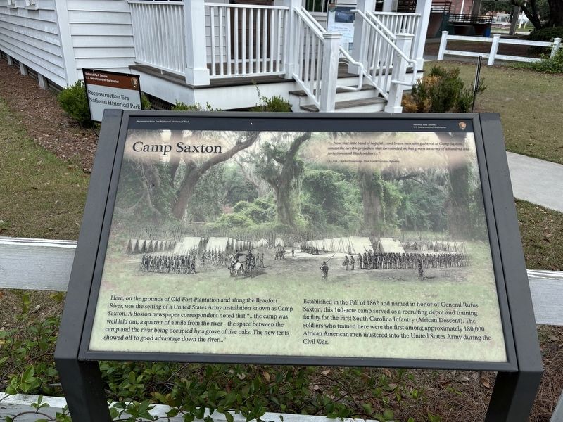
Camp Saxton
Reconstruction Era National Historical Park
| — | National Park Service, U.S. Department of the Interior | — |
Photographed by Benjamin Rubin, May 30, 2026
1. Camp Saxton Marker
"..from that little band of hopeful... and brave men who gathered at Camp Saxton... amidst the terrible prejudices that surrounded us, has grown an army of a hundred and forty thousand Black soldiers..."
-Lt. Col. Charles Trowbridge, First South Carolina Infantry
Here, on the grounds of Old Fort Plantation and along the Beaufort River, was the setting of a United States Army installation known as Camp Saxton. A Boston newspaper correspondent noted that "...the camp was well laid out, a quarter of a mile from the river - the space between the camp and the river being occupied by a grove of live oaks. The new tents showed off to good advantage down the river..."
Established in the Fall of 1862 and named in honor of General Rufus Saxton, this 160-acre camp served as a recruiting depot and training facility for the First South Carolina Infantry (African Descent). The soldiers who trained here were the first among approximately 180,000 African American men mustered into the United States Army during the Civil War.
Erected by National Park Service, U.S. Department of the Interior.
Topics. This historical
this page online
Location. 32° 23.292′ N, 80° 41.135′ W. Marker is in Port Royal, South Carolina, in Beaufort County. It is on Pinkney Blvd west of Shell Road, on the right when traveling west. Touch for map. Marker is at or near this postal address: 27 Pinckney Blvd, Port Royal SC 29935, United States of America. Touch for directions.

Regionally, this marker is in the Lowcountry and on the Sea Islands. It is also in the American South, specifically in the Deep South, and on the Eastern Seaboard. Globally, it is in the North Atlantic Region, North America, the Western Hemisphere, the Western World, and the Anglosphere. Historically, it finds itself in what was once New Spain, the territory of the Mississippian Culture, one of the original Thirteen Colonies, one of the Confederate States of America, and the Antebellum South.
Other nearby markers. At least 8 other markers are within one mile of this marker, measured as the crow flies: Emancipation Day (here, next to this marker); Old Fort Plantation (here, next to this marker); First South Carolina Infantry (a few steps from this marker); "The Year of Jubilee Has Come!" (a few steps from this marker); Emancipation Day / Camp Saxton Site (approx. 0.3 miles away); a different marker also named Camp Saxton (approx. 0.3 miles away); The Historic Union Church (approx. 0.9 miles away); Blue Channel Corporation (approx. one mile away). Touch for a list and map of all markers in Port Royal.
Credits. This page was last revised on June 11, 2026. It was originally submitted on May 31, 2026, by Benjamin Rubin of Columbia, South Carolina. This page has been viewed 24 times since then. Photo 1. submitted on May 31, 2026, by Benjamin Rubin of Columbia, South Carolina. • Devry Becker Jones was the editor who published this page.
