Near Thorp in Kittitas County, Washington — The American West (Northwest)
A prairie transformed
Thorp Mill
Photographed by Shirley A Stirling, May 20, 2026
1. A prairie transformed Marker
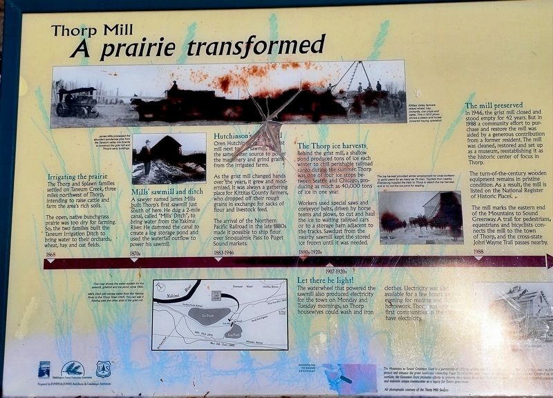
Irrigating the prairie
The Thorp and Splawn families settled on Taneum Creek, three miles northwest of Thorp, intending to raise cattle and farm the area’s rich soils.
The open, native bunchgrass prairie was too dry for farming. So, the two families built the Taneum Irrigation Ditch to bring water to their orchards, wheat, hay and oat fields.
1868
Mills’ sawmill and ditch
A sawyer named James Mills built Thorp’s first sawmill just south of here. He dug a 2-mile canal, called “Mills’ Ditch,” to bring water from the Yakima River. He dammed the canal to create a log storage pond and used the waterfall outflow to power his sawmill.
1870s
Hutchinson’s grist mill
Oren Hutchinson built his grist mill next to the sawmill, using the same water source to power the machinery and grind grain from the irrigated farms.
As the grist mill changed hands over the years, it grew and modernized. It was always a gathering place for Kittitas County farmers, who dropped off their rough grains in exchange for sacks of flour and livestock feed.
The arrival of the Northern Pacific Railroad in the late 1880s made it possible
this page online
1883–1946
The Thorp ice harvests
Behind the grist mill, a shallow pond produced tons of ice each winter to chill perishable railroad cargo during the summer. Thorp was one of four ice stops between Seattle and Chicago, producing as much as 40,000 tons of ice in one year.
Workers used special saws and conveyor belts, driven by horse teams and plows, to cut and haul the ice to waiting railroad cars or to a storage barn adjacent to the tracks. Sawdust from the nearby sawmill kept the stored ice frozen until it was needed.
1880s–1920s
The mill preserved
In 1946, the grist mill closed and stood empty for 42 years. But in 1988 a community effort to purchase and restore the mill was aided by a generous contribution from a former resident. The mill was cleaned, restored and set up as a museum, reestablishing it as the historic center of focus in Thorp.
The turn-of-the-century wooden equipment remains in pristine condition. As a result, the mill is listed on the National Register of Historic Places.
The mill marks the eastern end of the Mountains to Sound Greenway.
Photographed by Shirley A Stirling, May 20, 2026
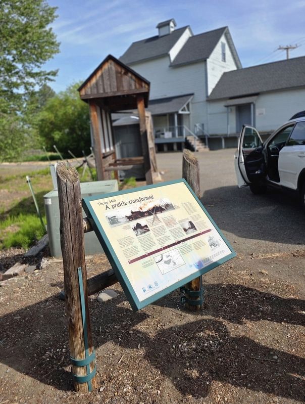
2. Marker in front of the mill
1988
Let there be light!
The waterwheel that powered the sawmill also produced electricity for the town on Monday and Tuesday mornings, so Thorp housewives could wash and iron clothes.
Electricity was also available for a few hours each evening for reading and homework. Thorp was one of the first communities in the state to have electricity.
1907–1920s
James Mills processed the abundant ponderosa pine from the Taneum Valley into boards to construct the grist mill and Thorp’s early buildings.
Kittitas Valley farmers raised wheat, hay, orchards, row crops and cattle. This c. 1915 photo shows a steam and horse-powered haying operation.
The ice harvest provided winter employment for local workers—in good years for as many as 75 men. Tourists from nearby Ellensburg hopped the train to Thorp to watch the ice harvest, and to try out the ice pond for skating.
This map shows the water system for the sawmill, gristmill and ice pond, circa 1900. Mills’ Ditch still carries water from the Yakima River to the Thorp Town Ditch. You can see it flowing past the other side of the grist mill.
All photographs courtesy of the Thorp Mill Society
Erected by Mountains to Sound Greenway, Washington Forest Protection Association, U.S. Forest Service, Jones & Jones Architects and Landscape Architects.
Topics. This historical marker is listed in these topic lists: Agriculture • Industry & Commerce • Railroads & Streetcars • Settlements & Settlers. A significant historical year for this entry is 1868.
Location. 47° 4.471′ N, 120° 41.026′ W. Marker is near Thorp, Washington, in Kittitas County. It is on Thorp Highway North 0.2 miles south of E Taneum Road, on the left when traveling south. Touch for map. Marker is at or near this postal address: 11640 N Thorpe Highway, Thorp WA 98946, United States of America. Touch for directions.

Regionally, this marker is in the Columbia Basin and in Yakima Valley. It is also in the American Mountain West and in the Lewis & Clark Corridor. Globally, it is in North America, in the Cascade Range, on the Pacific Rim, in the Western Hemisphere, in the Western World, and in the Anglosphere.
Other nearby markers. At least 3 other markers are within 14 miles of this marker, measured as the crow flies: The Thorp Grist Mill (a few steps from this marker); Robbers Roost (approx. 8.4 miles away); Inland Empire Highway (approx. 13.2 miles away).
Credits. This page was last revised on July 27, 2026. It was originally submitted on May 31, 2026, by Shirley A Stirling of Lacey, Washington. This page has been viewed 42 times since then. Photos: 1, 2. submitted on May 31, 2026, by Shirley A Stirling of Lacey, Washington. • James Hulse was the editor who published this page.
