Downtown in Hampton, Virginia — The American South (Mid-Atlantic)
Hampton Courthouse
"Roofless and Thoroughly Gutted"

"The courthouse, roofless and thoroughly gutted. … [Its] chimney served our cooks well in getting supper. The Telegraph tent was soon up and the operator at work on the newly strung wire to Fort Monroe." - Pvt. Robert Knox Sneden, March 24, 1862
Hampton's courthouse was one of more than 500 buildings that Capt. Jefferson C. Phillips's Confederate troops burned on August 7, 1861. The courthouse area was chosen as headquarters for Union Gen. Samuel Hentzelman's III Corps during the Peninsula Campaign. Heintzelman and his staff pitched their tents nearby.
The American Missionary Association soon erected a school and church here amid the ruins of the old courthouse to demonstrate that freedmen could live independently. This school was the most important one that A.M.A. established. Attended by 250 students, it contained a primary school on the first floor, while more advanced pupils on the second level were taught multiplication, division, penmanship, and elementary reading. The missionary teachers were ecstatic at the progress of their pupils, and they conducted their religious work in concert with their efforts in
this page online
The courthouse that stands today dates from 1876. Remodeled in 1910 by C. Taylor Hotsclaw, it has undergone several subsequent additions.
Erected by Virginia Civil War Trails.
Topics and series. This historical marker is listed in these topic lists: African Americans • Education • Religion & Religious Structures • War, US Civil. In addition, it is included in the Virginia Civil War Trails series list. A significant historical date for this entry is March 24, 1862.
Location. 37° 1.598′ N, 76° 20.675′ W. Marker is in Hampton, Virginia. It is in Downtown. It is on Kings Way north of West Queens Court, on the right when traveling south. Touch for map. Marker is at or near this postal address: 35 Kings Way, Hampton VA 23669, United States of America. Touch for directions.

Regionally, this marker is on Virginia’s Peninsula and in Coastal Virginia. It is also in the American South, specifically in the Upper

Other nearby markers. At least 8 other markers are within walking distance of this marker: Rochambeau (here, next to this marker); The Courthouse (a few steps from this marker); Hampton Baptist Church (a few steps from this marker); King and Queen Streets (about 300 feet away, measured in a direct line); F.W. Woolworth Co. Building (about 300 feet away); The Northeast Corner (about 300 feet away); The Sclater Building (about 300 feet away); The Southwest Corner (about 400 feet away). Touch for a list and map of all markers in Hampton.
Another marker is no longer nearby. Hampton Courthouse (has been replaced with this marker).
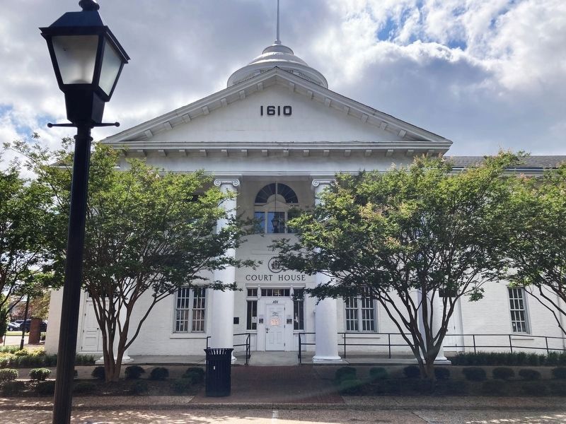
Photographed by Evan Dwyer, August 9, 2025
3. The 1876 Hampton Courthouse
This building replaced the building described in the marker, though its center section contains re-used bricks from the burned previous courthouse.
Credits. This page was last revised on July 10, 2026. It was originally submitted on June 4, 2026, by Devry Becker Jones of Washington, District of Columbia. This page has been viewed 16 times since then. Photos: 1, 2. submitted on June 4, 2026, by Devry Becker Jones of Washington, District of Columbia. 3. submitted on June 16, 2026, by Evan Dwyer of Richmond, Virginia.
