
Bonavista in CensusDiv 7 - Bonavista-Trinity-Clarenville, Newfoundland and Labrador — The Atlantic Provinces (North America)
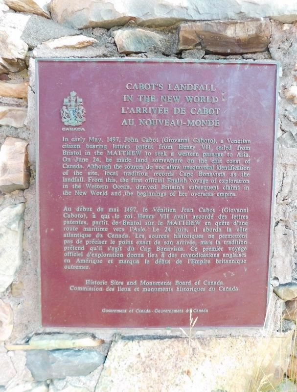
Cabot's Landfall in the New World
⎯⎯⎯
L'Arrivée de Cabot au Nouveau-Monde
Photographed by Jimmy Emerson, August 1, 2024
1. Cabot's Landfall in the New World / L'Arrivée de Cabot au Nouveau - Monde Marker

In early May, 1497, John Cabot (Giovanni Caboto), a Venetian citizen bearing letters patent from Henry VII, sailed from Bristol in the Matthew to seek a western passage to Asia. On June 24, he made land somewhere on the east coast of Canada. Although the sources do not allow unequivocal identification of the site, local tradition records Cape Bonavista as the landfall. From this, the first official English voyage of exploration in the Western Ocean, derived Britain's subsequent claims in the New World and the beginnings of her overseas empire.
Au début de mai 1497, le Vénitien Jean Cabot (Giovanni Caboto), à qui le roi Henry VII avait accordé des lettres patentes, partit de Bristol sur le Matthew en quête d'une route maritime vers l'Asie. Le 24 juin, il aborda la côte atlantique du Canada. Les sources historiques ne permettent pas de préciser le point exact de son arrivée, mais la tradition prétend qu'il s'agit du Cap Bonavista. Ce premier voyage officiel d'exploration donna lieu à des revendications anglaises en Amérique
this page online
Erected by Historic Sites and Monuments Board of Canada.
Topics and series. This historical marker is listed in these topic lists: Exploration • Waterways & Vessels. In addition, it is included in the Canada, Historic Sites and Monuments Board series list. A significant historical date for this entry is June 24, 1497.
Location. 48° 41.903′ N, 53° 5.36′ W. Marker is in Bonavista, Newfoundland and Labrador, in CensusDiv 7 - Bonavista-Trinity-Clarenville. It is on Cape Shore Road, on the left when traveling north. Touch for map. Marker is in this post office area: Bonavista NL A0C 1B0, Canada. Touch for directions.

Regionally, this marker is in Atlantic Canada. Globally, it is in the North Atlantic Region, North America, the Western Hemisphere, the Western World, and the Anglosphere. Historically, it finds itself in what was once a British colony and also the Viceroyalty of New France.
Other nearby markers. At least 3 other markers are within 8 kilometers of this marker, measured as the crow flies: Loyal Orange Lodge LOL #4 (approx. 5.5 kilometers away); St Joseph's Roman Catholic Church
via The Canadian Encyclopedia, unknown
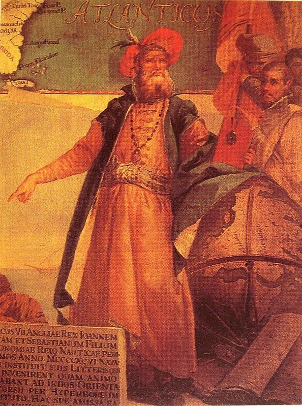
2. John Cabot
Also see . . . John Cabot. Wikipedia entry (Submitted on August 14, 2026, by Larry Gertner of New York, New York.)

Photographed by Jimmy Emerson, August 1, 2024
3. John Cabot Statue
Credits. This page was last revised on August 14, 2026. It was originally submitted on June 5, 2026, by Jimmy Emerson of Dalton, Georgia. This page has been viewed 19 times since then. Photos: 1. submitted on June 5, 2026, by Jimmy Emerson of Dalton, Georgia. 2. submitted on August 14, 2026, by Larry Gertner of New York, New York. 3. submitted on June 5, 2026, by Jimmy Emerson of Dalton, Georgia. • Andrew Ruppenstein was the editor who published this page.
