Near Pocomoke City in Worcester County, Maryland — The American Northeast (Mid-Atlantic)
Pocomoke Nation Tribal Homelands
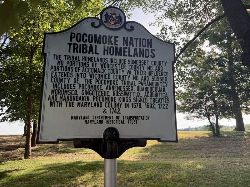
Erected by Maryland Department of Transportation; Maryland Historical Trust.
Topics and series. This historical marker is listed in these topic lists: Government & Politics • Indigenous Peoples and Communities • Settlements & Settlers. In addition, it is included in the Maryland Historical Trust series list. A significant historical year for this entry is 1678.
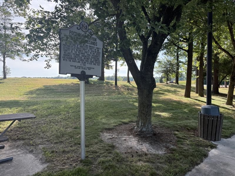
Location. 38° 0.296′ N, 75° 32.615′ W. Marker is near Pocomoke City, Maryland, in Worcester County. It can be reached from Ocean Highway (U.S. 13) north of Marva Road, on the right when traveling north. The marker stands on the grounds of the Maryland Welcome Center. Touch for map. Marker is at or near this postal address: 144 Ocean Hwy, Pocomoke City
this page online

Regionally, this marker is on the Eastern Shore. It is also in the American Mid-Atlantic, on the Delmarva Peninsula, in the Tidewater, and on the Eastern Seaboard. Globally, it is in the North Atlantic Region, North America, the Western Hemisphere, the Western World, and the Anglosphere. Historically, it finds itself in what was once one of the original Thirteen Colonies and also the Antebellum South.
Other nearby markers. At least 8 other markers are within 5 miles of this marker, measured as the crow flies: Pocomoke Tribal Homelands (here, next to this marker); Boundary Line (a few steps from this marker); From Wild Ponies to the Boardwalk (within shouting distance of this marker); War Along the Chesapeake (within shouting distance of this marker); Mark O. Pilchard (within shouting distance of this marker); Tireless Defender of Education (approx. 4.6 miles away); Pocomoke City Historic Railroad Station (approx. 4.6 miles away); Costen House (approx. 5 miles away). Touch for a list and map of all markers in Pocomoke City.
Other markers no longer nearby. Cultural Treasures
Credits. This page was last revised on June 6, 2026. It was originally submitted on June 6, 2026, by Devry Becker Jones of Washington, District of Columbia. This page has been viewed 12 times since then. Photos: 1, 2. submitted on June 6, 2026, by Devry Becker Jones of Washington, District of Columbia.
