Dominion Hills in Arlington in Arlington County, Virginia — The American South (Mid-Atlantic)
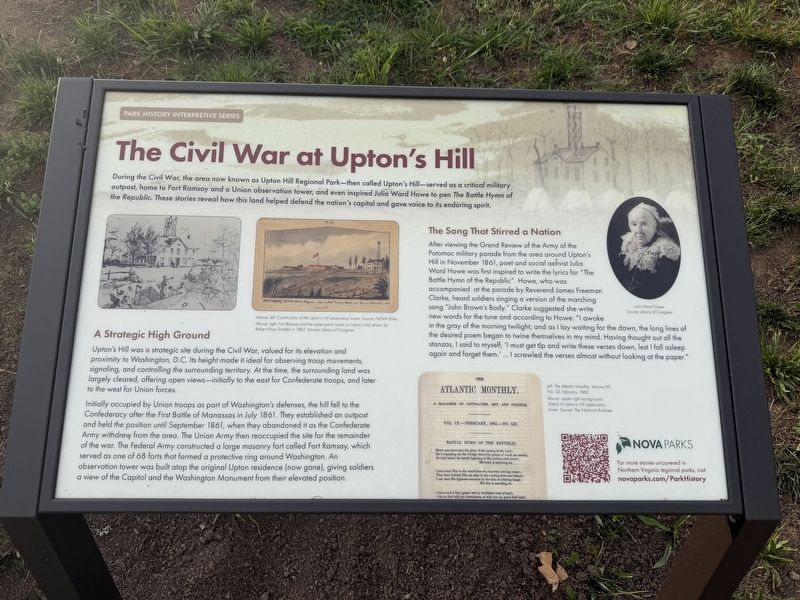
The Civil War at Upton’s Hill
Park History Interpretive Series
Photographed by T.L. Zagraniski, June 6, 2026
1. The Civil War at Upton’s Hill Marker
A Strategic High Ground
Upton's Hill was a strategic site during the Civil War, valued for its elevation and proximity to Washington, DC. Its height made it ideal for observing troop movements, signaling, and controlling the surrounding territory. At the time, the surrounding land was largely cleared, offering open views—initially to the east for Confederate troops, and later to the west for Union forces.
Initially occupied by Union troops as part of Washington's defenses, the hill fell to the Confederacy after the First Battle of Manassas in July 1861. They established an outpost and held the position until September 1861, when they abandoned it as the Confederate Army withdrew from the area. The Union Army then reoccupied the site for the remainder of
this page online
The Song That Stirred a Nation
After viewing the Grand Review of the Army of the Potomac military parade from the area around Upton's Hill in November 1861, poet and social activist Julia Word Howe was first inspired to write the lyrics for "The Battle Hymn of the Republic." Howe, who was accompanied at the parade by Reverend James Freeman Clarke, heard soldiers singing a version of the marching song "John Brown's Body.” Clarke suggested she write new words for the tune and according to Howe: "I awoke in the gray of the morning twilight; and as I lay waiting for the dawn, the long lines of the desired poem began to twine themselves in my mind. Having thought out all the stanzas, I said to myself, 'I must get up and write these verses down, lest I fall asleep again and forget them.' … I scrawled the verses
Photographed by T.L. Zagraniski, June 6, 2026
2. Area around Civil War at Upton’s Hill Marker
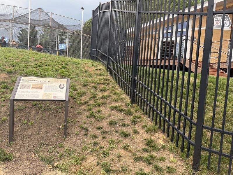
View of the marker looking northwest from the corner of the parking lot towards batting cages (uphill on the left) and Climb Upton building (through the fence on the right).
Erected by Northern Virginia regional parks.
Topics. This historical marker is listed in these topic lists: Arts, Letters, Music • Forts and Castles • War, US Civil. A significant historical month for this entry is July 1861.
Location. 38° 52.283′ N, 77° 8.611′ W. Marker is in Arlington, Virginia, in Arlington County. It is in Dominion Hills. It can be reached from Wilson Boulevard south of Patrick Henry Drive, on the right when traveling east. Located in the parking lot corner, between the batting cages and Climb Upton. Touch for map. Marker is at or near this postal address: 6060 Wilson Blvd, Arlington VA 22205, United States of America. Touch for directions.

Regionally, this marker is in the Washington Metropolitan Area and in Northern Virginia. It is also in the American South, specifically in the Upper South, in the Mid-Atlantic, and on the Eastern Seaboard. Globally, it is in the North Atlantic Region, North America, the Western Hemisphere, the Western World, and the Anglosphere. Historically, it finds itself in what was once the territory of the Mississippian Culture, one of the original Thirteen Colonies, one of the Confederate States of America, and the Antebellum South.
Other nearby markers. At least 8 other markers are within walking distance of this marker: This Is Upton Hill! (within shouting distance of this marker); Original Federal Boundary Stone, District of Columbia, Southwest 8 (approx. 0.2 miles away); Southwest No. 8 Boundary Marker (approx. 0.2 miles away); SW8 Boundary Stone Rededication (approx. 0.2 miles away); Upton's Hill and the Civil War (approx. 0.2 miles away); Febrey-Lothrop-Rouse Property (approx. 0.2 miles away); Dominion Hills, Past and Present (approx. 0.2 miles away); Civil War Outpost (approx. half a mile away). Touch for a list and map of all markers in Arlington.
Credits. This page was last revised on June 10, 2026. It was originally submitted on June 6, 2026, by T.L. Zagraniski of Reston, Va, Usa. This page has been viewed 19 times since then. Photos: 1, 2. submitted on June 6, 2026, by T.L. Zagraniski of Reston, Va, Usa. • Bernard Fisher was the editor who published this page.
