
Centre in Cork in County Cork, Munster, Ireland — Irish South-West ((Éire) North Atlantic Ocean)
Cuan Chorcaí
⎯⎯⎯
Cork Harbour
⎯⎯⎯
An Laoi
⎯⎯⎯
River Lee
Photographed by Ian Lefkowitz, May 15, 2026
1. Cuan Chorcaí / Cork Harbour Marker
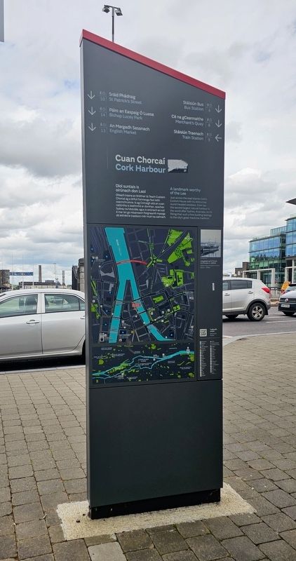
 Cuan Chorcaí
Cork Harbour
Díol suntais is oirúnach don Laoi
Díreach trasna an bhóthair tá Teach Custaim Chorcaí ag a bhfuil fuinneoga faoi leith ceannchuinne. Is ag Corcaigh atá an cuan nádúrtha is leathmhó ar domhan, seachas Sydney na hAstráile, agus is oiriúnach an rud é mar sin go mbaineann foirgneamh maorga dá leithéid le traidisiún mór muirí na cathrach.
A Landmark Worthy of the Lee
Just across the road stands Cork’s Custom House with its distinctive round-headed windows. Cork has the second largest natural harbour in the world after Sydney, Australia, so it’s fitting that such a fine building belongs to the city’s great maritime tradition.
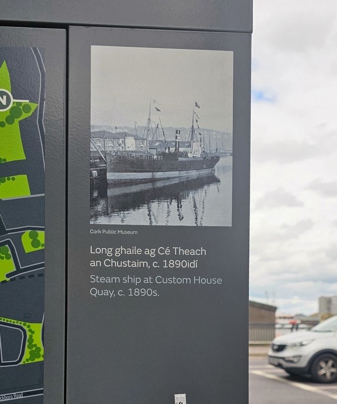
Cork Public Museum
Long ghaile ag Cé Theach an Chustaim, c. 1890idí
Steam ship at Custom House Quay, c. 1890s.
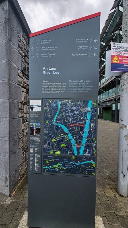
An Laoi / River Lee
Cumar
Agus an Laoi ag druidim le Cathair Chorcaí scoilteann sí ina dhá cainéal a shreabhann timpeall ar lár na cathrach. Gan ach tamall gairid de shiúl na gcos ón áit ina bhfuil tú i do sheasamh, tagann na cainéil thuaidh agus theas le chéile arís agus an Laoi ar a céim dheiridh chun na farraige.
The Meeting of the Waters
As the River Lee approaches Cork City it splits into two channels that embrace the core of the city. A short distance from where you’re standing, the north and south channels merge again on the final leg of the Lee’s journey to the sea.
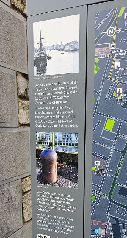
Courtesy of the National Library of Ireland
Longa trádála ar feadh chainéil na Laoi a shreabhann timpeall ar oileán lár chathair Chorcaí c. 1865–1914. Tá Calafort Chorcaí le feiceáil sa lár.
Trade ships lining the River Lee channels that surround the city-centre island of Cork c. 1865–1914. The Port of Cork can be seen in the centre.
Cork City Council
Bí ag faire amach do phostaí feistithe dá leithéid seo ar feadh ché Chorcaí. Baineann siad le c.1850, agus is iarsmaí iad ón uair a mbíodh longa feistithe ar feadh na habhann.
Look out for mooring posts like these along Cork’s quayside. Dating to around 1850, they are reminders of a time when ships were moored along the river.
Topics.
this page online
Location. 51° 53.917′ N, 8° 27.871′ W. Marker is in Cork, Munster, in County Cork. It is in Centre. It is on Lapp's Quay west of Eamon de Valera Bridge, on the left when traveling west. Touch for map. Marker is at or near this postal address: 10 Lapp's Quay, Cork, Munster, Ireland. Touch for directions.

Regionally, it is on the Atlantic Ocean, in the North Atlantic Region, on the Atlantic Arc, in Europe, on the Island of Ireland, on the Celtic Fringe, in the European Union, in Atlantic Europe, on one of the British Isles, in the Western World, and in the Anglosphere. Historically, it finds itself in what was once a British colony.
Other nearby markers. At least 8 other markers are within walking distance of this marker: Cé Andarsan / Anderson’s Quay (about 150 meters away, measured in a direct line); Tomás MacCurtain (about 150 meters away); Traolach MacSuibhne (about 180 meters away); S.S. Ardmore (about 180 meters away); An Meal Theas / South Mall (about 210 meters away); Cé na gCeannaithe / Merchant's Quay
Photographed by Ian Lefkowitz, May 15, 2026
2. An Laoi / River Lee Marker
Photographed by Ian Lefkowitz, May 15, 2026
3. Cuan Chorcaí / Cork Harbour Marker
A close-up of the image on the marker.
Photographed by Ian Lefkowitz, May 15, 2026
4. An Laoi / River Lee Marker
A close-up of the images on the marker.
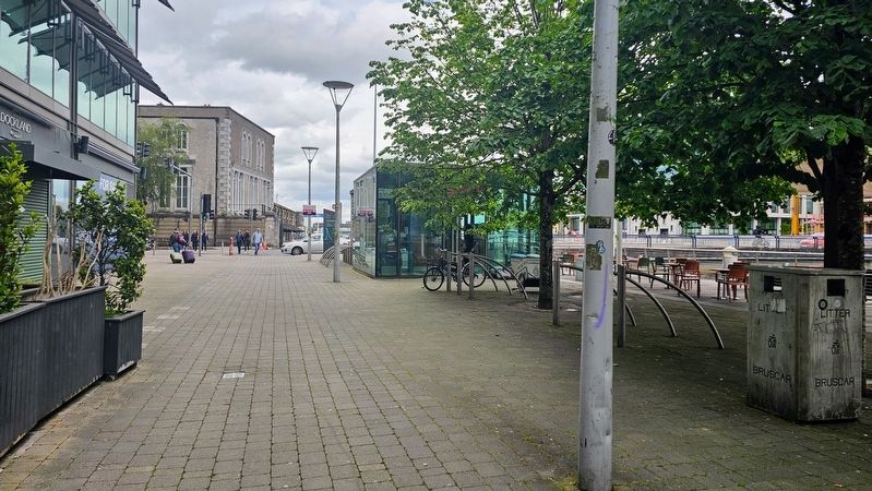
Photographed by Ian Lefkowitz, May 15, 2026
5. Cuan Chorcaí / Cork Harbour / An Laoi / River Lee Marker
The marker is located along the Lapp's Quay boardwalk.
Credits. This page was last revised on June 13, 2026. It was originally submitted on June 12, 2026, by Ian Lefkowitz of New York, New York. This page has been viewed 7 times since then. Photos: 1, 2. submitted on June 12, 2026, by Ian Lefkowitz of New York, New York. 3, 4, 5. submitted on June 13, 2026, by Ian Lefkowitz of New York, New York. • Andrew Ruppenstein was the editor who published this page.
