Great Bend in Barton County, Kansas — The American Midwest (Upper Plains)
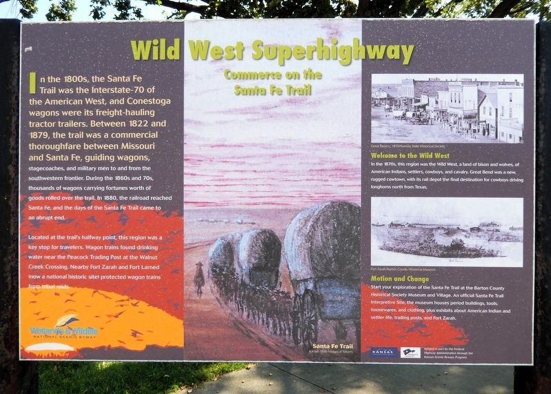
Wild West Superhighway
Commerce on the Santa Fe Trail
Photographed by Cosmos Mariner, September 7, 2024
1. Wild West Superhighway Marker
In the 1800s, the Santa Fe Trail was the Interstate-70 of the American West, and Conestoga wagons were its freight-hauling tractor trailers. Between 1822 and 1879, the trail was a commercial thoroughfare between Missouri and Santa Fe, guiding wagons, stagecoaches, and military men to and from the southwestern frontier. During the 1860s and 70s, thousands of wagons carrying fortunes worth of goods rolled over the trail. In 1880, the railroad reached Santa Fe, and the days of the Santa Fe Trail came to an abrupt end.
Located at the trail's halfway point, this region was a key stop for travelers. Wagon trains found drinking water near the Peacock Trading Post at the Walnut Creek Crossing. Nearby Fort Zarah and Fort Larned (now a national historic site) protected wagon trains from tribal raids.
Welcome to the Wild West
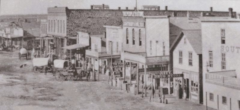
In the 1870s, this region was the Wild West, a land of bison and wolves, of American Indians, settlers, cowboys, and cavalry. Great Bend was a new, rugged cowtown, with its rail depot the final destination for cowboys driving longhorns north from Texas.
Motion and Change
Start your exploration of the Santa Fe Trail
this page online
[captions]
• Santa Fe Trail/Kansas State Historical Society
• Great Bend, c. 1870/Kansas State Historical Society
• Fort Zarah/Barton County Historical Museum
Erected by Wetlands & Wildlife National Scenic Byway, Kansas Dept of Transportation, and Federal Highway Administration.
Topics and series. This historical marker is listed in these topic lists: Forts and Castles • Industry & Commerce • Roads & Vehicles • Settlements & Settlers. In addition, it is included in the Santa Fe Trail series list.
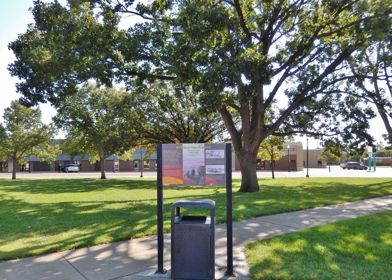
Location. 38° 21.893′ N, 98° 45.856′ W. Marker is in Great Bend, Kansas, in Barton County. It is on Kansas Avenue just north of Lakin Avenue, on the left when traveling north. The marker near the southeast corner of the Barton County Courthouse grounds. Touch for map. Marker is at or near this postal address: 1400
Kansas State Historical Society
2. Marker detail: Great Bend, c. 1870

Regionally, this marker is in Central Kansas. It is also in the American Midwest, in the Corn Belt, on the prairies, on the Southern Plains, and on the Santa Fe Trail Corridor. Globally, it is in North America, the Western Hemisphere, the Western World, and the Anglosphere. Historically, it finds itself in what was once the Louisiana Purchase.
Other nearby markers. At least 8 other markers are within walking distance of this marker: Veterans of Foreign Wars Memorial (within shouting distance of this marker); Jack Kilby (about 300 feet away, measured in a direct line); Streetscape (about 400 feet away); Santa Fe Trail (about 400 feet away); Civil War Memorial (about 500 feet away); Post Rock & Black Gold (approx. 0.3 miles away); Prey and Play (approx. 0.3 miles away); a different marker also named Santa Fe Trail (approx. half a mile away). Touch for a list and map of all markers in Great Bend.
Also see . . .
1. Great Bend, Kansas (Wikipedia).
Excerpt: Prior to American settlement of the area, the site of Great Bend was located(Submitted on June 13, 2026, by Cosmos Mariner of Cape Canaveral, Florida.)in the northern reaches of Kiowa territory. The first settlers of the area arrived in 1870. Living in sod houses and dugouts, they worked as buffalo hunters since trampling by bison herds precluded crop farming. In 1871, the Great Bend Town Company, anticipating the westward construction of the Atchison, Topeka and Santa Fe Railroad, founded Great Bend at a site roughly three miles west of Fort Zarah on the Santa Fe Trail. The railroad reached Great Bend in July 1872, and an election at about the same time declared the town the permanent county seat. In 1873, following the arrival of the railroad, Great Bend became a shipping point for cattle. This stimulated local business but also transformed the city into a rowdy, violent cowtown.Photographed by Cosmos Mariner, September 8, 20243. Wild West Superhighway MarkerLooking east through the south side of the Barton County Courthouse grounds. Kansas Avenue is in the background.
2. The Santa Fe National Historic Trail (National Park Service).
Excerpt: From 1821 until 1846, the Santa Fe Trail was a two-way international commercial highway used by both Mexican and American traders. Then, in 1846, the Mexican-American War began, and a few months later, America’s Army of the West followed the Santa Fe Trail westward to successfully invade Mexico. After the Treaty of Guadalupe Hidalgo ended the war in 1848, the Santa Fe Trail became a national road connecting the more settled parts of the United States to the new southwest territories. Commercial freighting along the trail boomed to unheard-of levels, including considerable military freight hauling to supply the southwestern forts. The trail was also used by stagecoach lines, thousands of gold seekers heading to the California and Colorado gold fields, adventurers, missionaries, wealthy New Mexican families and emigrants.(Submitted on June 13, 2026, by Cosmos Mariner of Cape Canaveral, Florida.)
Credits. This page was last revised on June 14, 2026. It was originally submitted on June 13, 2026, by Cosmos Mariner of Cape Canaveral, Florida. This page has been viewed 15 times since then. Photos: 1, 2, 3. submitted on June 13, 2026, by Cosmos Mariner of Cape Canaveral, Florida.
