Kilgarvan in Cobh in County Cork, Munster, Ireland — Irish South-West ((Éire) North Atlantic Ocean)
Radharc Inis Píc
⎯⎯⎯
Spike Island View
Photographed by Ian Lefkowitz, May 15, 2026
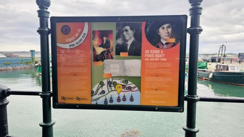
1. Radharc Inis Píc / Spike Island View Marker

Ag geata an Atlantaigh, léiríonn méid agus neart daingneán Inis Píc an tábhacht straitéiseach a bhain le Cóbh agus Cuan Chorcaí don mBreatain.
Sa bhliain 1775, bhí briseadh amach na Réabhlóide Meiriceánaí mar chúis le conbhuanna loingseoireachta trasatlantacha ollmhóra teacht le chéile i gCuan Chorcaí. Dá bhrí sin, bhí siad ina spriocanna do ruathairí Meiriceánacha ar nós John Paul Jones (1747–1792). Mar gheall ar an mbagairt seo, spreagadh daingneáin shealadacha a thógáil. Sa bhliain 1789, chuir an t-innealtóir míleata an Coirnéal Charles Vallancey (1731–1812) an céad fhoslár buan airtléire ar an oileán ina n-ionad.
Cé gur innealtóir oilte é, ní raibh meas chomh mór sin ar spéis Vallencey i stair agus i seaniarsmaí na hÉireann. In iris amháin, luaitear gur fhear foghlama é “an Ginearál Vallancey, ach gur scríobh sé níos mó raiméise ná aon fhear dá chuid ama”.
At the gateway to the Atlantic, the size and strength of Spike Island’s fortifications indicates how strategically important Cobh and Cork Harbour were to Britain.
In 1775, the outbreak of the American Revolution led to enormous transatlantic shipping convoys assembling in Cork Harbour. As such, they were sitting targets for American raiders such as John Paul Jones (1747–1792).
this page online
While a skilled engineer, Vallencey’s interest in Irish history and antiquities wasn’t so widely appreciated. One journal commented that “General Vallancey, though a man of learning, wrote more nonsense than any man of his time”.
An Raibh a Fhios Agat?
And Another Thing:
• Nuair a cailleadh Napoleon, rinneadh príosún den oileán, agus bhí os cionn 2,500 ciontóir ann sna 1850í. Mar sin, ba é an príosún is mó ar domhan é. Cé gur dhún an príosún in 1883, osclaíodh arís é os cionn céad bliain ina dhiaidh sin mar ionad coinneála óige.
With Napoleon’s defeat, the island became a prison which housed over 2,500 convicts in the 1850s. As such, it was then the world’s largest prison. While the jail closed in 1883, it reopened over a century later as a youth detention centre.
• Athraíodh ainm oifigiúil d’Inis Píc ó Dún Chlais an Rí go Dún an Mhistéalaigh sa bhliain 1951. Déanann sé seo comóradh ar Sheán Mistéal (1815–1875) réabhlóideach na hÉireann Óg a scríobh faoina thaithí príosúin féin in ‘Jail Journal’.
Spike Island’s official name was
Photographed by Ian Lefkowitz, May 15, 2026
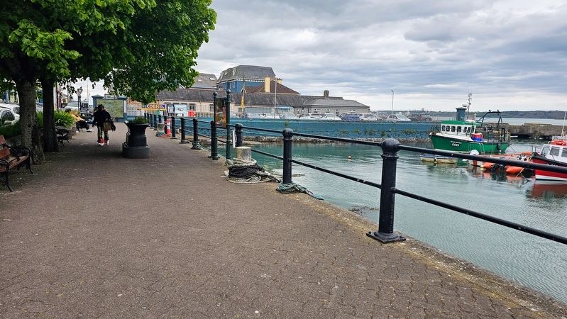
2. Radharc Inis Píc / Spike Island View Marker
The marker is located on West Beach, in front of the view of Spike Island itself.
• Díreach trí bliana tar éis dó a gheataí a oscailt do chuairteoirí den chéad uair, ainmníodh Inis Píc mar Phríomh-Cheann Scríbe Turasóireachta na hEorpa in 2017.
Just three years after first opening its gates to visitors, Spike Island was named Europe’s Leading Tourist Attraction in 2017.
Erected by Fáilte Ireland. (Marker Number 23.)
Topics. This historical marker is listed in these topic lists: Forts and Castles • Law Enforcement.
Location. 51° 51.014′ N, 8° 17.601′ W. Marker is in Cobh, Munster, in County Cork. It is in Kilgarvan. It is on West Beach east of Kennedy Pier, on the left when traveling west. Touch for map. Marker is at or near this postal address: 29D West Beach, Cobh, Munster, Ireland. Touch for directions.

Regionally, it is on the Atlantic Ocean, in the North Atlantic Region, on the Atlantic Arc, in Europe, on the Island of Ireland, on the Celtic Fringe, in the European Union, in Atlantic Europe, on one of the British Isles, in the Western World, and in the Anglosphere.
Photographed by J. Valentine and Sons, circa 1905
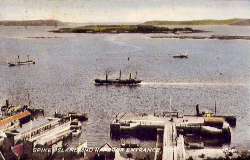
3. Spike Island and Harbour Entrance
Other nearby markers. At least 8 other markers are within walking distance of this marker: Charlotte Grace O'Brien, 1845 – 1909 (a few steps from this marker); Lusitania Centenary 2015 (within shouting distance of this marker); Father Theobald Mathew (within shouting distance of this marker); Cunard Line Offices (within shouting distance of this marker); R.M.S. Titanic Memorial (within shouting distance of this marker); Cuimneachán Titanic / Titanic Memorial (within shouting distance of this marker); Cóbh / Cobh (within shouting distance of this marker); Sonia O’Sullivan (about 90 meters away, measured in a direct line). Touch for a list and map of all markers in Cobh.
Also see . . . Spike Island, County Cork (Wikipedia).
Spike Island (Irish: Inis Píc) is an island of 103 acres (42 ha) in Cork Harbour, Ireland. Originally the site of a monastic settlement, the island is dominated by an 18th-century bastion fort now named Fort Mitchel. The island's strategic location within the harbour meant it was used at times for defence and as a prison. Since the early 21st century the island has been developed as a heritage tourist attraction, with €5.5 million investment in exhibition and visitor spaces and accompanying tourism marketing.(Submitted on June 14, 2026, by Ian Lefkowitz of New York, New York.)
Credits. This page was last revised on June 14, 2026. It was originally submitted on June 14, 2026, by Ian Lefkowitz of New York, New York. This page has been viewed 10 times since then. Photos: 1, 2. submitted on June 14, 2026, by Ian Lefkowitz of New York, New York. 3. submitted on June 14, 2026, by Andrew Ruppenstein of Lamorinda, California. • Andrew Ruppenstein was the editor who published this page.
