Marietta in Cobb County, Georgia — The American South (South Atlantic)
"Oakton"
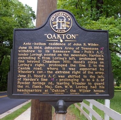
Ante-bellum residence of John R. Wilder.
Photographed by David Seibert, April 27, 2010
1. "Oakton" Marker
June 19, 1864. Johnston’s Army of Tennessee [CS] withdrew to its Kennesaw line -- Polk’s A. C. (under Loring), posted on the mountain; Hardee’s, extending S. from Loring’s left, prolonged the line beyond Cheatham Hill; Hood’s corps on Loring’s right, prolonged the line E. to the Canton road, where it was supported by Wheeler’s cav. -- the extreme right of the army.
June 21, Hood’s A. C. was shifted to the left, of Hardee’s line [CS] -- prolonging it to & S. of Powder Springs rd., leaving Wheeler to guard the rt. flank. Maj. Gen. W. W. Loring had his headquarters at "Oakton", the Wilder house.
Erected 1954 by Georgia Historical Commission. (Marker Number 033-50.)
Topics and series. This historical marker is listed in these topic lists: Notable Buildings • War, US Civil. In addition, it is included in the Georgia Historical Society series list. A significant historical date for this entry is June 19, 1742.
Location. 33° 57.997′ N, 84° 33.69′ W. Marker is in Marietta, Georgia, in Cobb County. It is on Kennesaw Avenue 0 miles north of St. Marys Lane, on the left when traveling north. Touch for map. Marker is in this post
this page online

Regionally, this marker is in the Piedmont and in Metro Atlanta. It is also in the American South and specifically in the Deep South. Globally, it is in North America, the Western Hemisphere, the Western World, and the Anglosphere. Historically, it finds itself in what was once the original Cherokee Nation, the territory of the Mississippian Culture, one of the original Thirteen Colonies, one of the Confederate States of America, and the Antebellum South.
Other nearby markers. At least 8 other markers are within walking distance of this marker: Cherokee Indian Trail Tree (about 700 feet away, measured in a direct line); Residence of Alice McLellan Birney (approx. 0.6 miles away); The Archibald Howell Home (approx. 0.7 miles away); Oil House Location (approx. 0.8 miles away); Forge Location (approx. 0.8 miles away); Civilian Conservation Corps Camp (approx. 0.8 miles away); Barracks Location (approx. 0.8 miles away); Education Building Location (approx. 0.8 miles away). Touch for a list and map of all markers in Marietta.
Photographed by David Seibert, April 27, 2010
2. "Oakton" Marker
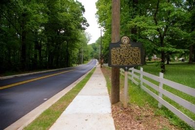
Looking south on Kennesaw Avenue, toward downtown Marietta
Photographed by David Seibert, April 27, 2010
3. "Oakton" Marker
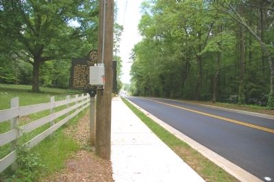
Looking north on Kennesaw Avenue, toward Kennesaw Mountain

Photographed by David Seibert, April 27, 2010
4. "Oakton" Marker
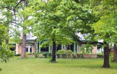
With Oakton, the Wilder house, in the background
Photographed by David Seibert, April 27, 2010
5. "Oakton"
The former John R. Wilder house is privately owned.
Credits. This page was last revised on February 22, 2026. It was originally submitted on May 1, 2010, by David Seibert of Sandy Springs, Georgia. This page has been viewed 1,980 times since then and 75 times this year. Photos: 1, 2, 3, 4, 5. submitted on May 1, 2010, by David Seibert of Sandy Springs, Georgia. • Craig Swain was the editor who published this page.
