Swope Parkway - Elmwood in Kansas City in Jackson County, Missouri — The American Midwest (Upper Plains)
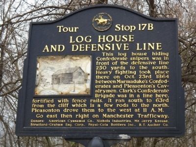
Log House and Defensive Line
This log house hiding Confederate snipers was in front of the defensive line 250 yards to the south. Heavy fighting took place there on Oct. 23, 1864 between Marmaduke's Confederates and Pleasonton's Cavalrymen. Clarke's Confederate Brigade was in line here, fortified with fence rails. It ran south to 63rd from the cliff which is a few rods to the north. Pleasonton drove them to the west at 11 A.M.
Erected by Various Companies. (Marker Number 17B.)
Topics and series. This historical marker is listed in this topic list: War, US Civil. In addition, it is included in the Missouri – Battle of Westport series list. A significant historical year for this entry is 1864.
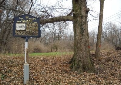
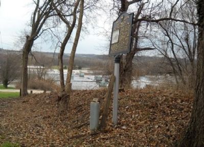
Location. 39° 1.107′ N, 94° 31.8′ W. Marker is in Kansas City, Missouri, in Jackson County. It is in Swope Parkway - Elmwood. Marker is on 59th Street, 0.1 miles east of Lister Avenue, on the right when traveling east. Touch for map. Marker is in this post office area: Kansas City MO 64132, United States of America. Touch for directions.
Other nearby markers. At least 8 other markers are within walking distance of this marker. Battle of the Big Blue, October 22, 1864 (approx. ¼ mile away); Byram's Ford Battlefield (approx. ¼ mile away); a different marker also named Battle of the Big Blue (approx. 0.3 miles away); Pratt's Artillery (approx. 0.3 miles away); Battle of Westport (approx. 0.4 miles away); Byram's Ford Historic District (approx. half a mile away); Byram's Ford and the Battle of Westport (approx. half a mile away); Storm of Lead (approx. half a mile away). Touch for a list and map of all markers in Kansas City.
More about this marker. 59th Street is narrow - park on Lister Avenue 1/2 block away.
Listing of companies that donated the marker:
American Cyanmid Co., Nichols Industries, Mr. Jerry Krouse, Stratford - Graham Engineering Corp., Pepsi-Cola Bottlers Inc., B. F. Ascher Co.
Also see . . .
1. Battle of Westport. Link from the Civil War Muse with further information on this tour stop. (Submitted on May 2, 2010, by Thomas Onions of Olathe, Kansas.)
2. John S Marmaduke. Wikipedia link on the life and career of Confederate division commander who fought here. (Submitted on May 2, 2010, by Thomas Onions of Olathe, Kansas.)
3. Alfred Pleasonton. Wikipedia Link to the life and career of the Commander of the Union Forces pursuing General Price across Missouri. (Submitted on May 2, 2010, by Thomas Onions of Olathe, Kansas.)
Credits. This page was last revised on February 10, 2023. It was originally submitted on May 2, 2010, by Thomas Onions of Olathe, Kansas. This page has been viewed 1,368 times since then and 24 times this year. Photos: 1, 2, 3. submitted on May 2, 2010, by Thomas Onions of Olathe, Kansas.


