
Centre in Cork in County Cork, Munster, Ireland — Irish South-West ((Éire) North Atlantic Ocean)
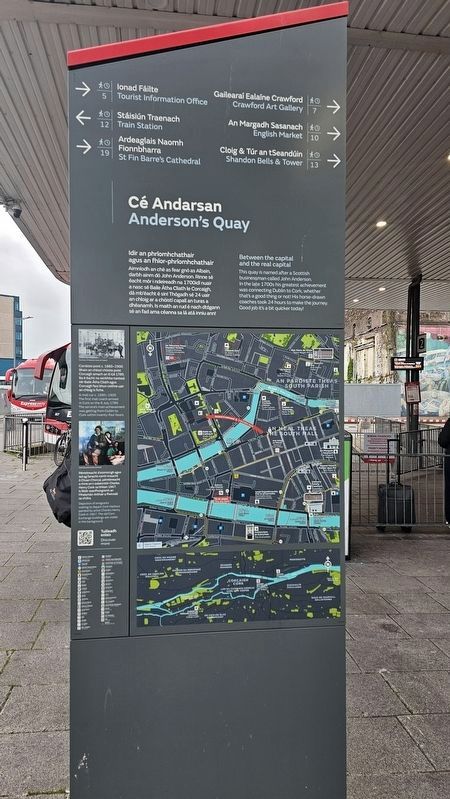
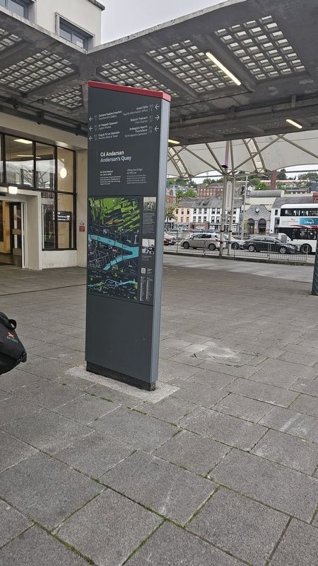
Cé Andarsan
⎯⎯⎯
Anderson’s Quay
Photographed by Ian Lefkowitz, May 15, 2026
1. Cé Andarsan / Anderson’s Quay Marker - Facing South

[Gaeilge:]
Idir an phríomhchathair agus an fhíor-phríomhchathair
Ainmníodh an ché as fear gnó as Albain, darbh ainm dó John Anderson. Rinne sé éacht mór i ndeireadh na 1700idí nuair a nasc sé Baile Átha Cliath le Corcaigh, dá mb’éacht é sin! Thógadh sé 24 uair an chloig ar a chóistí capall an turas a dhéanamh. Is maith an rud é nach dtógann sé an fad ama céanna sa lá atá inniu ann!
[English:]
Between the capital and the real capital
This quay is named after a Scottish businessman called John Anderson. In the late 1700s his greatest achievement was connecting Dublin to Cork, whether that’s a good thing or not! His horse-drawn coaches took 24 hours to make the journey. Good job it’s a bit quicker today!
[Gaeilge:]
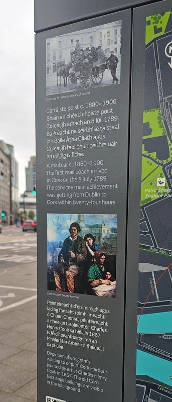
Carráiste poist c. 1880–1900. Bhain an chéad chóiste poist Corcaigh amach an 8 Iúil 1789. Ba é éacht na seirbhíse taisteal idir Baile Átha Cliath agus Corcaigh faoi bhun ceithre uair an chloig is fiche.
[English:]
A mail car c. 1880–1900. The first mail coach arrived in Cork on the 8 July 1789. The service’s main achievement was getting from Dublin to Cork within twenty-four hours.
[Gaeilge:]
Péintéireacht d’eisimircigh agus iad ag fanacht roimh imeacht ó Chuan Chorcaí, péintéireacht a rinne an t-ealaíontóir Charles Henry Cook sa bhliain 1867. Is féidir seanfhoirgnimh an Mhalartáin Arbhair a fheiceáil sa chúlra.
[English:]
Depiction of emigrants waiting to depart Cork Harbour painted by artist Charles Henry Cook in 1867. The old Corn Exchange buildings are visible in the background.
(Captions)
Courtesy of National Library of Ireland
Cork City and County Archives
(North Side)
[Gaeilge:]
An droichead ar an Laoi a ardú
Os do chomhair amach tá Droichead Bhriain Bhóramha. D’fhéadtaí lár an droichid seo a ardú tráth chun longa a ligean thar bráid.
Lifting the Bridge on the Lee
In front of you is the Brian Boru Bridge. At one time the middle section of this bridge could be raised to allow for passing ships.
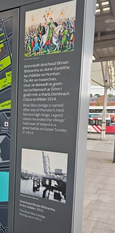
Ainmníodh droichead Bhriain Bhóramha as duine d’ardríthe ba cháiliúla na Mumhan. De réir an tseanchais, chuir sé deireadh le greim na Lochlannach ar Éirinn i gcath mór a tharla Domhnach Cásca sa bhliain 1014.
Brian Boru bridge is named after one of Munster’s most famous high-kings. Legend claims he ended the Vikings’ hold over of Ireland in a great battle on Easter Sunday in 1014.
(Captions)
Cork Public Museum
Michael Lenihan Collection
Droichead Bhriain Bhóramha le linn úsáide i 1911. / The Brian Boru bridge during use in 1911.
Topics.
this page online
Location. 51° 53.964′ N, 8° 27.965′ W. Marker is in Cork, Munster, in County Cork. It is in Centre. It is on Clontarf Street near Anderson's Quay, on the right when traveling south. Touch for map. Marker is at or near this postal address: 10A Clontarf St, Cork, Munster T12 W832, Ireland. Touch for directions.

Regionally, it is on the Atlantic Ocean, in the North Atlantic Region, on the Atlantic Arc, in Europe, on the Island of Ireland, on the Celtic Fringe, in the European Union, in Atlantic Europe, on one of the British Isles, in the Western World, and in the Anglosphere. Historically, it finds itself in what was once a British colony.
Other nearby markers. At least 8 other markers are within walking distance of this marker: Cé na gCeannaithe / Merchant's Quay (within shouting distance of this marker); Cuan Chorcaí / Cork Harbour / An Laoi / River Lee (about 150 meters away, measured in a direct line); S.S. Ardmore (about 180 meters away); An Meal Theas / South Mall (about
Photographed by Ian Lefkowitz, May 15, 2026
2. Cé Andarsan / Anderson’s Quay Marker - Facing North
Photographed by Ian Lefkowitz, May 15, 2026
3. Cé Andarsan / Anderson’s Quay Marker
A close-up of the images on the marker.
Photographed by Ian Lefkowitz, May 15, 2026
4. Cé Andarsan / Anderson’s Quay Marker
A close-up of the images on the marker.
Credits. This page was last revised on June 17, 2026. It was originally submitted on June 17, 2026, by Ian Lefkowitz of New York, New York. This page has been viewed 7 times since then. Photos: 1, 2, 3, 4. submitted on June 17, 2026, by Ian Lefkowitz of New York, New York. • Andrew Ruppenstein was the editor who published this page.
