
Centre in Cork in County Cork, Munster, Ireland — Irish South-West ((Éire) North Atlantic Ocean)
Cé na gCeannaithe
⎯⎯⎯
Merchant's Quay
Photographed by Ian Lefkowitz, May 15, 2026
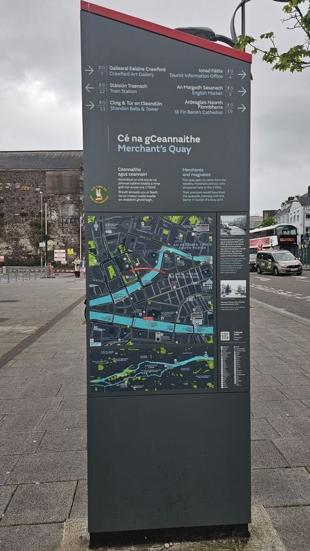
1. Cé na gCeannaithe / Merchant's Quay Marker, Side One
 (South Side)
Ceannaithe agus ceannairí
Ainmnítear an ché seo as na prionsaí saibhre trádála a rinne gnó mór anseo sna 1700idí. Bhíodh áitreabh acu ar feadh na cé i measc ruaille buaille an chalafoirt ghnóthaigh.
Merchants and magnates
This quay gets its name from the wealthy merchant princes who prospered here in the 1700s. Their premises would have lined the quayside, teeming with the barter ‘n’ bustle of a busy port.
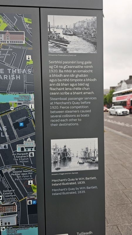
Seirbhísí paisinéirí long gaile ag Cé na gCeannaithe roimh 1920. Ba mhór an iomaíocht a bhíodh ann idir ghaltáin agus ba mhó timpiste a bhíodh ann dá bharr agus báid ag féachaint lena chéile chun ceann scríbe a bhaint amach.
Steamboat passenger services at Merchant’s Quay before 1920. Fierce competition between steamers caused several collisions as boats raced each other to their destinations.
Merchant’s Quay le W.H. Bartlett, Ireland Illustrated, 1839.
Merchant’s Quay by W.H. Bartlett, Ireland Illustrated, 1839.
(North Side)
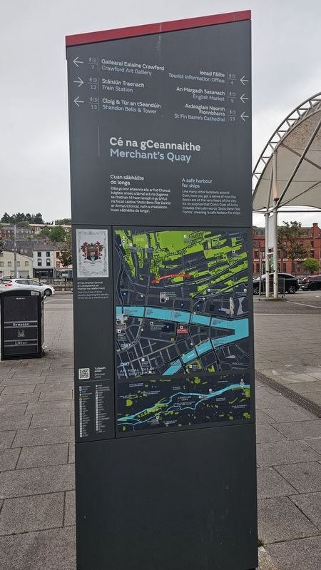
Cuan sábháilte do longa
Dála go leor áiteanna eile ar fud Chorcaí, tuigtear anseo a lárnaí atá na duganna sa chathair. Ní haon ionadh é go bhfuil na focail Laidine ‘Statio Bene Fide Carinis’ ar Armas Chorcaí, nath a chiallaíonn ‘cuan sábháilte do longa’.
A safe harbour for ships
Like many other locations around Cork, here you get a sense of how the docks are at the very heart of the city. It’s no surprise that Cork’s Coat of Arms includes the Latin words ‘Statio Bene Fide Carinis’, meaning ‘a safe harbour for ships’.
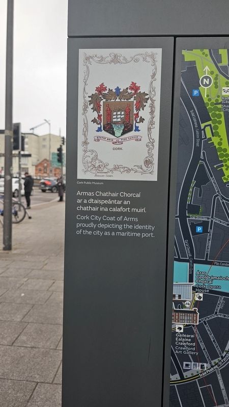
Armas Chathair Chorcaí ar a dtaispeántar an chathair ina calafort muirí.
Cork City Coat of Arms proudly depicting the identity of the city as a maritime port.
Topics. This historical marker is listed in these topic lists: Industry & Commerce • Roads & Vehicles.
Location. 51° 53.979′ N,
this page online

Regionally, it is on the Atlantic Ocean, in the North Atlantic Region, on the Atlantic Arc, in Europe, on the Island of Ireland, on the Celtic Fringe, in the European Union, in Atlantic Europe, on one of the British Isles, in the Western World, and in the Anglosphere. Historically, it finds itself in what was once a British colony.
Other nearby markers. At least 8 other markers are within walking distance of this marker: Cé Andarsan / Anderson’s Quay (within shouting distance of this marker); Metropole Hotel (about 180 meters away, measured in a direct line); Cuan Chorcaí / Cork Harbour / An Laoi / River Lee (about 210 meters away); An Meal Theas / South Mall (about 210 meters away); The Everyman (about 210 meters away); Mangan's Clock (about 240 meters away); S.S. Ardmore (about 240
Photographed by Ian Lefkowitz, May 15, 2026
2. Cé na gCeannaithe / Merchant''s Quay Marker, Side Two
Photographed by Ian Lefkowitz, May 15, 2026
3. Cé na gCeannaithe / Merchant's Quay Marker
A close-up of the images on the marker.
Photographed by Ian Lefkowitz, May 15, 2026
4. Cé na gCeannaithe / Merchant's Quay Marker
A close-up of the images on the marker.
Photographed by Ian Lefkowitz, May 15, 2026
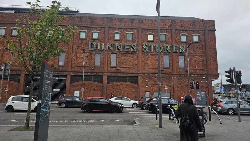
5. Cé na gCeannaithe / Merchant's Quay Marker
The marker is located across from Merchant's Quay Shopping Centre.
Credits. This page was last revised on June 17, 2026. It was originally submitted on June 17, 2026, by Ian Lefkowitz of New York, New York. This page has been viewed 7 times since then. Photos: 1, 2, 3, 4, 5. submitted on June 17, 2026, by Ian Lefkowitz of New York, New York. • Andrew Ruppenstein was the editor who published this page.
