Point Roberts in Whatcom County, Washington — The American West (Northwest)
Whatcom County Parks & Recreation Dept
Boundary Marker #1

Photographed by Jimmy Emerson, June 11, 2017
1. Whatcom County Parks & Recreation Dept Marker
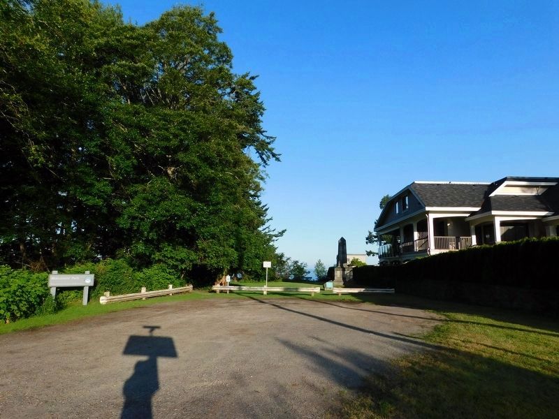
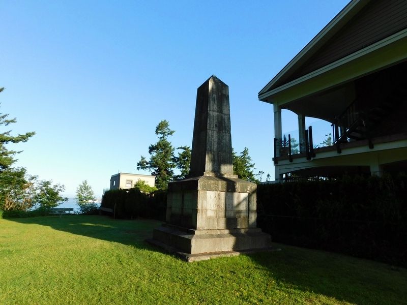
On June 15, 1846 Great Britain and the United States of America established the 49th parallel as the border between the United States and Canada. This obelisk was made in Scotland and placed on this western point of the boundary in 1865 marking the longest undefended border in the world. The Monument and Park was restored by the Tsawwassen Boundary Bay Lions Club, the Point Roberts Senior Center, and Whatcom County Parks and Recreation Department Staff. This sign was placed here on June 15, 1996 marking 150 years of peaceful coexistence between our two nations.
Erected 1996 by Whatcom County Parks & Recreation Dept.
Topics. This historical marker is listed in these topic lists: Parks & Recreational Areas • Peace. A significant historical date for this entry is June 15, 1846.
Location. 49° 0.123′ N, 123° 5.355′ W. Marker is in Point Roberts, Washington, in Whatcom County. It is at the intersection of Marine Drive and Roosevelt Wy, on the left when traveling north on Marine Drive. Touch for map. Marker is at or near this postal address: 50 Marine Dr, Point Roberts WA 98281, United States of America. Touch for directions.

Regionally,
this page online
Other nearby markers. At least 8 other markers are within 23 kilometers of this marker, measured as the crow flies: Point Roberts Boundary Marker (approx. 0.9 miles away); Japanese Fisherman Monument (approx. 9.1 miles away in Canada); West Coast Fishery / La Pêche Sur La Côte Ouest (approx. 15.4 kilometers away in Canada); Historic McMillan Expedition (approx. 16 kilometers away in Canada); Thanks and Remembrance (approx. 22.4 kilometers away in Canada); B.C. Hydro Helped The YVR Expansion Take Flight (approx. 22.4 kilometers away in Canada); Vancouver Control Tower / La tour de contrôle de Vancouver (approx. 22.4 kilometers away in Canada); New International Terminal and Third Runway (approx. 22.4 kilometers away in Canada).
Photographed by Jimmy Emerson, June 11, 2017
2. Whatcom County Parks & Recreation Dept Marker and International Boundary Marker #1
Photographed by Jimmy Emerson, June 11, 2017
3. International Boundary Monument #1
Credits. This page was last revised on June 23, 2026. It was originally submitted on June 17, 2026, by Jimmy Emerson of Dalton, Georgia. This page has been viewed 16 times since then. Photos: 1, 2, 3. submitted on June 17, 2026, by Jimmy Emerson of Dalton, Georgia. • James Hulse was the editor who published this page.
