
Jefferson Township near Jeffersonville in Fayette County, Ohio — The American Midwest (Great Lakes)
Ohio's Physiographic Regions
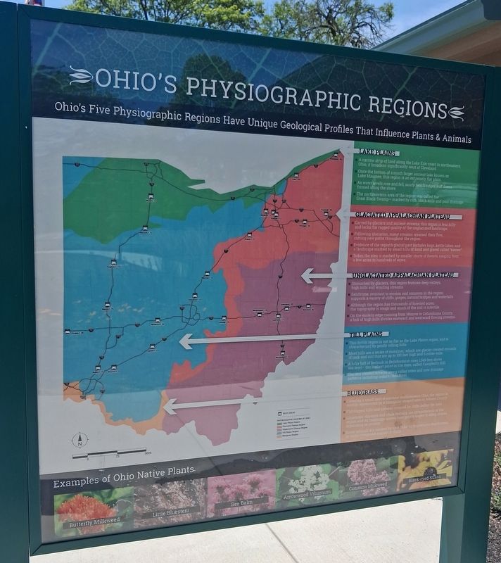
Ohio's Five Physiographic Regions Have Unique Geological Profiles
| — | That Influence Plants & Animals | — |
Photographed by William Fischer, Jr., June 13, 2026
1. Ohio's Physiographic Regions Marker
LAKE PLAINS
■ A narrow strip of land along the Lake Erie coast in northeastern Ohio, it broadens significantly west of Cleveland.
■ Once the bottom of a much larger ancient lake known as Lake Maumee, this region is an extremely flat plain.
■ As water levels rose and fell, sandy beach ridges and dunes formed along the shore.
■ The northwestern area of the region was called the Great Black Swamp-marked by rich, black soils and poor drainage.
GLACIATED APPALACHIAN PLATEAU
■ Carved by glaciers and ancient streams, this region is less hilly and lacks the rugged quality of the unglaciated landscape.
■ Following glaciation, many streams reversed their flow, cutting new paths throughout the region.
■ Evidence of the region's glacial past includes bogs, kettle lakes, and a landscape marked by small hills of sand and gravel called "kames".
■ Today, the area is marked by smaller tracts of forests, ranging from a few acres to hundreds of acres.
UNGLACIATED APPALACHIAN PLATEAU
■ Untouched by glaciers, this region features deep valleys, high hills and winding
this page online
■ Sandstone, resistant to erosion and common in the region, supports a variety of cliffs, gorges, natural bridges and waterfalls.
■ Although the region has thousands of forested acres, the topography is rough and much of the soil is infertile.
■ On the eastern edge running from Monroe to Columbiana County, a belt of high hills divides eastward and westward flowing streams.
TILL PLAINS
■ This fertile region is not as flat as the Lake Plains region, and is characterized by gently rolling hills.
■ Most hills are a series of moraines, which are glacier created mounds of rock and soil that are up to 100 feet high and 6 miles wide.
■ A hilly belt of bedrock in Bellefontaine rises 1,549 feet above sea level- the highest point in the state, called Campbell's Hill.
■ Glaciers created terraces along valley sides and new drainage patterns including today's Ohio River.
BLUEGRASS
■ Covering a small part of extreme southwestern Ohio, the region is mostly represented by a triangular shaped area in Adams County.
■ Flat-topped hills and uplands rimmed by cliffs define
Photographed by William Fischer, Jr., June 13, 2026
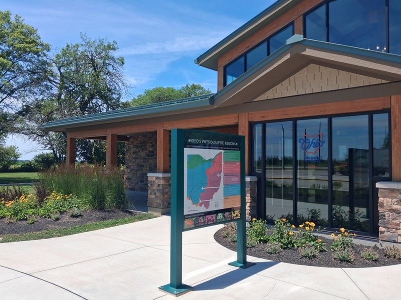
2. Ohio's Physiographic Regions Marker
■ Limestone, dolomite and shale bedrock are characteristic of the region and its landscape moves from gentle slopes to steep slopes, depending on erosion.
■ Some uplands are marked by sink holes or depressions that formed in rocks composed mainly of chalk.
Erected 2025 by Ohio Department of Transportation.
Topics. This historical marker is listed in this topic list: Natural Features.
Location. 39° 38.21′ N, 83° 34.449′ W. Marker is near Jeffersonville, Ohio, in Fayette County. It is in Jefferson Township. It is on Interstate 71 at milepost 68, on the right when traveling south. Marker is on the Fayette County (Garmhausen) Southbound Rest Area grounds. Touch for map. Marker is in this post office area: Jeffersonville OH 43128, United States of America. Touch for directions.

Regionally, this marker is in Southern Ohio Hill Country. It is also in the American Midwest and in the Corn Belt. Globally, it is in North America, the Western Hemisphere, the Western World, and the Anglosphere. Historically, it finds itself in what was once the Haudenosaunee (Iroquois) Confederacy, the territory of the Mississippian Culture, and the Northwest Territory.
Other nearby markers. At least 8 other markers are within 2 miles of this marker, measured as the crow flies: Ohio Native Plants (here, next to this marker); a different marker also named Ohio Native Plants (a few steps from this marker); a different marker also named Ohio Native Plants (a few steps from this marker); a different marker also named Ohio Native Plants (a few steps from this marker); Garmhausen Roadside Rest Area (a few steps from this marker); Ohio Buckeye Tree (within shouting distance of this marker); a different marker also named Ohio Native Plants (within shouting distance of this marker); Jeffersonville Veterans Memorial (approx. 1.3 miles away). Touch for a list and map of all markers in Jeffersonville.
Credits. This page was last revised on June 17, 2026. It was originally submitted on June 17, 2026, by William Fischer, Jr. of Reynoldsburg, Ohio. This page has been viewed 16 times since then. Photos: 1, 2. submitted on June 17, 2026, by William Fischer, Jr. of Reynoldsburg, Ohio.
