Madison in Jefferson County, Indiana — The American Midwest (Great Lakes)
History of Clifty Falls
Photographed by Tom Bosse, June 13, 2026
1. History of Clifty Falls Marker
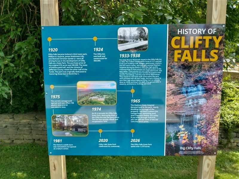
1920 Clifty Falls became Indiana's third state park. William A. Guthrie, James Watkinson Lilly, and Michael Christian Garber Jr. were all driving forces in the development of Clifty Falls as a State Park. The purchase price of the original 570 acres was $30,000. the state o Indiana paid half, and the citizens of Jefferson County raised the other half of the funds. the park was originally dedicated to honoring those lost in World War I.
1924 The Clifty Inn was built and constructed for $60,000.
1933-1938 First lady Eleanor Roosevelt stayed in the Clifty Falls Inn in 1934. The Civilian Conservation Corps (C.C.C.) worked in the park building trails, bridges, gatehouses, shelters, and the nature center, and they also assisted Madison residents during the flood of 1937. The high-wuality craftmanship of these young men is still evident in the park today. These young men were paid $30 / month. $25 of that was sent home to their families to support their parents and siblings, and they kept $5 for themselves. They stayed in a barracks style camp within the park, were provided with all their meals, and had a chance to earn
this page online
1965 The Madison State Hospital donated land to the park, nearly doubling the acreage of the property. This land is where the campground, swimming pool, and Cragmont Shelter are today. If you walk through Trail #10, you can still see some of the old concrete fence posts.
1974 An EF-4 tornado hit Clifty Falls State Park, destroying most of the Clifty Inn and the park office The Inn was quickly rebuilt and re-opened in 195.
1975 The current campground opened and now offers 106 electric sites and 63 non-electric sites.
1981 The historic saddle barn was remodeled and opened as a nature center.
2020 Clifty Falls State Park celebrated its centennial.
2026 The Clifty Falls State Park spans over 1,519 acres.
Erected 2026 by Clifty Falls State Park.
Topics and series. This historical marker is listed in these topic lists: Charity & Public Work • Parks & Recreational Areas. In addition, it is included in the Civilian Conservation Corps (CCC), and the Eleanor Roosevelt
Photographed by Tom Bosse, June 13, 2026
2. History of Clifty Falls Marker
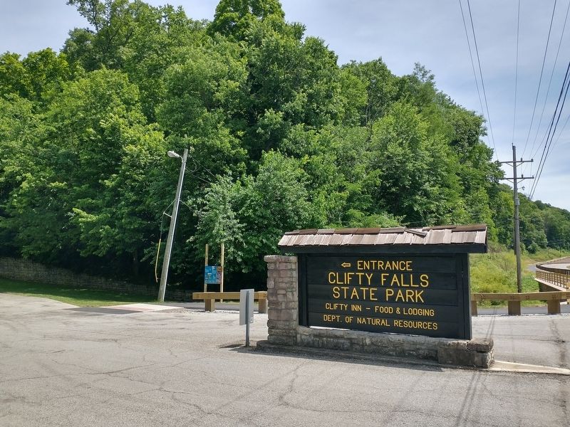
Location. 38° 44.539′ N, 85° 24.756′ W. Marker is in Madison, Indiana, in Jefferson County. It is at the intersection of Canyon Road and Clifty Hollow Road, on the right when traveling north on Canyon Road. The marker stands at the south entrance to Clifty Falls State Park. Touch for map. Marker is at or near this postal address: 1656 Ohio River Scenic Byway, Madison IN 47250, United States of America. Touch for directions.

Regionally, this marker is in Southern Indiana. It is also in the American Midwest, in the Ohio River Valley, and in the Corn Belt. Globally, it is in North America, the Western Hemisphere, the Western World, and the Anglosphere. Historically, it finds itself in what was once the territory of the Mississippian Culture and also the Northwest Territory.
Other nearby markers. At least 8 other markers are within 2 miles of this marker, measured as the crow flies: Clifty Inn (approx. ¼ mile away); IKE Clifty Creek Plant (approx. ¼ mile away); "Works of a Public Nature" (approx. 0.4 miles away); Where are the Deer? (approx. 0.7 miles away); Stacks of Power

Photographed by Tom Bosse, June 13, 2026
3. History of Clifty Falls Marker
Credits. This page was last revised on June 18, 2026. It was originally submitted on June 17, 2026, by Tom Bosse of Jefferson City, Tennessee. This page has been viewed 29 times since then. Photos: 1, 2, 3. submitted on June 17, 2026, by Tom Bosse of Jefferson City, Tennessee. • Devry Becker Jones was the editor who published this page.
