De Cocksdorp in Texel, North Holland, Netherlands — Northwestern Europe
De Strekdam
⎯⎯⎯
The Breakwater
Photographed by Andrew Ruppenstein, June 1, 2026
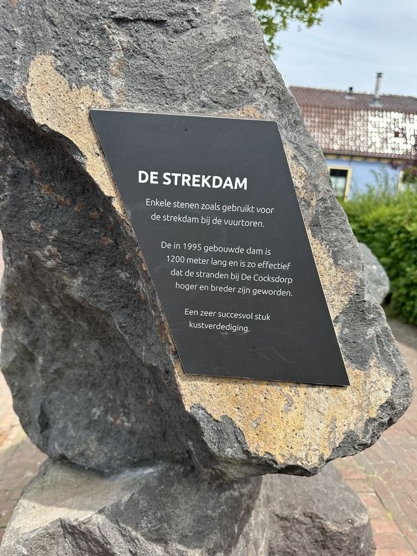
1. De Strekdam / The Breakwater Marker

Enkele stenen zoals gebruikt voor de strekdam bij de vuurtoren.
De in 1995 gebouwde dam is 1200 meter lang en is zo effectief dat de stranden bij De Cocksdorp hoger en breder zijn geworden.
Een zeer succesvol stuk kustverdediging.
The Breakwater
Some of the stones used for the breakwater near the lighthouse.
Built in 1995, the breakwater is 1,200 meters long and so effective that the beaches near De Cocksdorp have become higher and wider.
A highly successful coastal defense structure.
Topics. This historical marker is listed in this topic list: Man-Made Features. A significant historical year for this entry is 1995.
Location. 53° 9.417′ N, 4° 52.378′ E. Marker is in De Cocksdorp, Noord-Holland (North Holland), in Texel. It is on Kikkertstraat, on the right when traveling east. Touch for map. Marker is at or near this postal address: Kikkertstraat 40, De Cocksdorp, Noord-Holland 1795 AE, Netherlands. Touch for directions.

Regionally, this marker is on the German Wadden Sea. Globally, it is in Europe, the European Union, Atlantic Europe, the Benelux Low
this page online
Other nearby markers. At least 8 other markers are within walking distance of this marker: De Cocksdorp - Kikkerstraat 47 (a few steps from this marker); De Posthoorn / The Post Horn (within shouting distance of this marker); De Gele Buurt / The “Yellow Neighborhood” (within shouting distance of this marker); De Cocksdorp - Kikkertstraat 59, Polderhuis (within shouting distance of this marker); Stengweg (about 90 meters away, measured in a direct line); De Cocksdorp - Kikkertstraat 17, BnB De Moerbei (about 120 meters away); De Cocksdorp openbare lagere school / De Cocksdorp Public Primary School (about 150 meters away); De Waddenkerk / The Wadden Church (about 180 meters away). Touch for a list and map of all markers in De Cocksdorp.

Photographed by Andrew Ruppenstein, June 1, 2026
2. De Strekdam / The Breakwater Marker - wide view, looking east on Kikkert Street
Credits. This page was last revised on June 18, 2026. It was originally submitted on June 18, 2026, by Andrew Ruppenstein of Lamorinda, California. This page has been viewed 5 times since then. Photos: 1, 2. submitted on June 18, 2026, by Andrew Ruppenstein of Lamorinda, California.
