Marker Logo
THE HISTORICAL
MARKER DATABASE
“Bite-Size Bits of Local, National, and Global History”
Fort Steele in Windermere in East Kootenay, British Columbia — Canada’s West Coast (North America)
 

Fort Steele
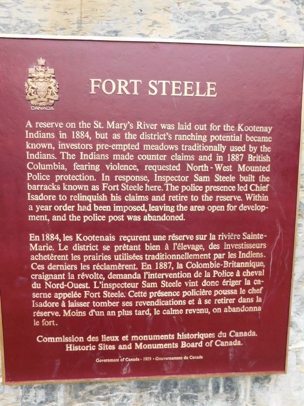
 
 
Fort Steele Marker image. Click for full size.
Photographed by Jimmy Emerson, June 14, 2017
1. Fort Steele Marker
Inscription.  
A reserve on the St. Mary's River was laid out for the Kootenay Indians in 1884, but as the district's ranching potential became known, investors pre-empted meadows traditionally used by the Indians. The Indians made counter claims and in 1887 British Columbia, fearing violence, requested North-West Mounted Police protection. In response, Inspector Sam Steele built the barracks known as Fort Steele here. The police presence led Chief Isadore to relinquish his claims and retire to the reserve. Within a year order had been imposed, leaving the area open for development, and the police post was abandoned.

En 1884, les Kootenais reçurent une réserve sur la rivière Sainte- Marie. Le district se prêtant bien à l'élevage, des investisseurs achetèrent les prairies utilisées traditionnellement par les Indiens. Ces derniers les réclamèrent. En 1887, la Colombie-Britannique, craignant la révolte, demanda l'intervention de la Police à cheval du Nord-Ouest. L'inspecteur Sam Steele vint donc ériger la ca- serne appelée Fort Steele. Cette présence policière poussa le chef Isadore à laisser tomber ses revendications
Paid Advertisement
Click or scan to see
this page online
et à se retirer dans la réserve. Moins d'un an plus tard, le calme revenu, on abandonna le fort.

 
Erected by Historic Sites and Monuments Board of Canada.
 
Topics and series. This historical marker is listed in these topic lists: Forts and CastlesIndigenous Peoples and Communities. In addition, it is included in the Canada, Historic Sites and Monuments Board series list. A significant historical year for this entry is 1884.
 
Location. 49° 37.042′ N, 115° 37.937′ W. Marker is in Windermere, British Columbia, in East Kootenay. It is in Fort Steele. It is on Main Street, on the left when traveling east. Touch for map. Marker is in this post office area: Windermere BC V0B 1N0, Canada. Touch for directions.

Regionally, this marker is in the BC Interior and in the Kootenay Rockies. Globally, it is in North America, in the Rocky Mountains, on the Ring of Fire, in the Pacific Rim, in the Western Hemisphere, in the Western World, and in the Anglosphere. Historically, it finds itself in what was once a British colony.

Other nearby markers. At least 6 other markers are within 19 kilometers of this marker, measured
Fort Steele Marker image. Click for full size.
Photographed by Jimmy Emerson, June 14, 2017
2. Fort Steele Marker
as the crow flies: A different marker also named Fort Steele (about 240 meters away, measured in a direct line); Chantecler Chicken (approx. 0.2 kilometers away); Wild Horse Creek (approx. 0.8 kilometers away); Fisherville- The Town that Sat on a Gold Mine (approx. 0.8 kilometers away); Railway Centennial (approx. 15.9 kilometers away); Kootenay Steamboats (approx. 18.3 kilometers away).
 
More about this marker. Located within the Fort Steele Heritage Town park
 
 
Credits. This page was last revised on June 24, 2026. It was originally submitted on June 18, 2026, by Jimmy Emerson of Dalton, Georgia. This page has been viewed 9 times since then. Photos:   1, 2. submitted on June 18, 2026, by Jimmy Emerson of Dalton, Georgia. • Andrew Ruppenstein was the editor who published this page.

m=303270

CeraNet Cloud Computing sponsors the Historical Marker Database.
This website earns income from purchases you make after using our links to Amazon.com. We appreciate your support.
Paid Advertisement
Sep. 3, 2026