Faversham in Kent, England, United Kingdom — Northwestern Europe (the British Isles)
Faversham Recreation Ground
The Story of the Recreation Ground from 1860
Photographed by Ray Gurganus, April 4, 2026
1. Faversham Recreation Ground Marker
Inscription.
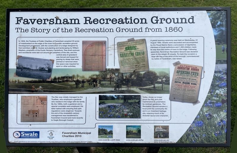
Faversham Recreation Ground. The Story of the Recreation Ground from 1860. In 1859, the Trustees of Public Charities of Faversham acquired 20 acres of meadowland on the edge of the town for public recreation ground. Development progressed, with the construction of a lodge designed by Kent architect Jo M. Hooker and planting and landscaping by William Masters, proprietor of the Exotic Nursery, Canterbury. Tree-lined avenues and woodlands were laid out around the periphery of the site, and the central area of grassland was fenced and leased for grazing by sheep that were penned or removed when this space was required for sport or other activities., A grand opening ceremony was held on Wednesday, 22 August 1860. Streets were decorated and accompanied by the Royal Marine Band, a procession of dignitaries, members of local institutions and 1,300 children made its way from the centre of town to the lodge. Following speeches, Faversham Recreation Ground was declared open to the delight of crowds. To mark the occasion a large silk flag of the arms of the borough, commissioned by ladies of Faversham, was raised., The Rec was initially managed by the Trustees, who employed a gardener who resided in the lodge with his family. By the 1880s, both a gardener and a special constable were employed, the latter tasked with ensuring that park regulations were observed. Towards the end of the nineteenth century management was transferred to Faversham Council and more recently to Swale Borough Council., Today, sheep no longer graze the Rec and park maintenance is undertaken by contract gardeners. The Recreation Ground remains a focal point for community and is an important heritage site, retaining much of its Victorian layout and character.
In 1859, the Trustees of Public Charities of Faversham acquired 20 acres of meadowland on the edge of the town for public recreation ground. Development progressed, with the construction of a lodge designed by Kent architect Jo M. Hooker and planting and landscaping by William Masters, proprietor of the Exotic Nursery, Canterbury. Tree-lined avenues and woodlands were laid out around the periphery of the site, and the central area of grassland was fenced and leased for grazing by sheep that were penned or removed when this space was required for sport or other activities.
A grand opening ceremony was held on Wednesday, 22 August 1860. Streets were decorated and accompanied by the Royal Marine Band, a procession of dignitaries, members of local institutions and 1,300 children made its way from the centre of town to the lodge. Following speeches, Faversham Recreation Ground was declared open to the delight of crowds. To mark the occasion a large silk flag of the arms of the borough, commissioned by ladies of Faversham, was raised.
The Rec was initially managed by the Trustees, who employed a gardener who resided in
Click or scan to see this page online
the lodge with his family. By the 1880s, both a gardener and a special constable were employed, the latter tasked with ensuring that park regulations were observed. Towards the end of the nineteenth century management was transferred to Faversham Council and more recently to Swale Borough Council.
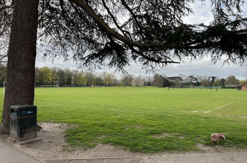
Today, sheep no longer graze the Rec and park maintenance is undertaken by contract gardeners. The Recreation Ground remains a focal point for community and is an important heritage site, retaining much of its Victorian layout and character.
Erected by Swale Borough Council.
Topics. This historical marker is listed in this topic list: Parks & Recreational Areas. A significant historical year for this entry is 1859.
Location. 51° 18.846′ N, 0° 53.788′ E. Marker is in Faversham, England, in Kent. It is at the intersection of East Street and Whitstable Road on East Street. The marker is located on the Faversham Recreation Area, just within the gate. Touch for map. Marker is in this post office area: Faversham, England ME13 8BE, United Kingdom. Touch for directions.
Regionally, this marker is in the Greater South East. Globally,
Photographed by Ray Gurganus, April 4, 2026
2. Faversham Recreation Ground
it is on the Atlantic Ocean, in the North Atlantic Region, in Europe, in Atlantic Europe, on one of the British Isles, in the Western World, and in the Anglosphere. Historically, it finds itself in what was once the Roman Empire.
Credits. This page was last revised on June 23, 2026. It was originally submitted on June 19, 2026, by Ray Gurganus of Washington, District of Columbia. This page has been viewed 9 times since then. Photos:1, 2. submitted on June 19, 2026, by Ray Gurganus of Washington, District of Columbia. • Andrew Ruppenstein was the editor who published this page.