Central Business District in Melbourne, Victoria, Australia — Oceania
Wesley Place Archaeological Excavations
| | Wesley Place Heritage Trail | |
Inscription.
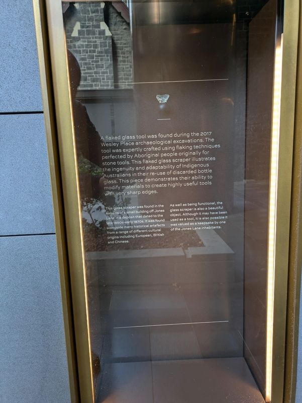
A flaked glass tool was found during the 2017 Wesley Place archaeological excavations. The tool was expertly crafted using flaking techniques perfected by Aboriginal people originally for stone tools. This flaked glass scraper illustrates the ingenuity and adaptability of Indigenous Australians in their re-use of discarded bottle glass. This piece demonstrates their ability to modify materials to create highly useful tools with very sharp edges.
This glass scraper was found in the remains of a small building off Jones Lane in a deposit that dated to the late 1850s-early 1870s. It was found alongside many historical artefacts from a range of different cultural origins including European, British and Chinese.
As well as being functional, the glass scraper is also a beautiful object. Although it may have been used as a tool, it is also possible it was valued as a keepsake by one of the Jones Lane inhabitants.
Erected by Wesley Place.
Topics. This historical marker is listed in this topic list: Anthropology & Archaeology. A significant historical year for this entry is 2017.
Location. 37° 48.58′ S, 144° 58.092′ E. Marker is in Melbourne, Victoria. It is in the Central Business District. It can be reached from Little Lonsdale Street 0.1 kilometers south of Bennetts Lane. Touch for map. Marker is at or near this postal address: 130 Lonsdale Street, Melbourne VIC 3000, Australia. Touch for directions.
Regionally, it is in Oceania, Australasia, the Pacific Ocean, South Pacific, the Pacific Rim, the Western World, and the Anglosphere. Historically, it finds itself in what was once a British colony.
Other nearby markers. At least 8 other markers are within walking distance of this marker: Archaeology and Artefacts (here, next to this marker); Caretaker's Cottage (a few steps from this marker); Former Leitrim Hotel (within shouting distance of this marker); Former Manse (within shouting distance of this marker); Former School House (within shouting distance of this marker); Nicholas Hall (within shouting distance of this marker); John Wesley Statue (within shouting distance of this marker); Wesley Church (within shouting distance of this marker). Touch for a list and map of all markers in Melbourne.
Also see . . . Beneath the Clay.
La Trobe Storage
122 Lonsdale Street (H7822-1198), and the Jones Lane Archaeological Precinct (H7822-2349) (Figure 1). The proposed development project comprised the renovation of the 1858 bluestone Wesley Church and associated historical buildings, the construction of a new multistory tower for office and administrative spaces, and the upgrade and creation of urban open spaces connecting Little Lonsdale and Lonsdale streets. The archaeological investigations focused on the area of land that would be impacted by the tower development and its new basement levels: a 18x95 m strip of land extending from Little Lonsdale Street in the north across the city block to Lonsdale Street, with a frontage along Jones Lane (formerly known as Foundry Lane; The Argus 13 January 1857:1).(Submitted on June 19, 2026, by Dean Barton-Ancliffe of Rowville, Victoria.)
Historical maps and aerial imagery suggested four phases of occupation within the investigation area: (I) stone and brick structures that pre-date 18541855 (Bibbs ca 18501855); (II) residential terrace houses that post-date 18541855 (De Gruchy and Leigh 1866; MMBW 1895); (III) 1900s factories (Mahlstedt 1910); and (IV) a surface carpark created by the Uniting Church in the 1990s. The ca 1850s Bibbs Map includes at least nine mediumlarge brick or stone buildings which front Jones Lane and Little Lonsdale Streets, namely the original Wesley Schoolhouse (shown as a large brick building facing, but set back from, Lonsdale Street); and two buildings fronting Lonsdale Street. However, the De Gruchy and Leigh 1866 drawing shows a different set of buildings, with a row of small, tightly packed terraced houses along Jones Lane, and the Wesley Church building. This evidence suggested a distinct change in the density of occupation of this block from the 1850s to the mid-1860s, initially assumed to be due to the growing population of Melbourne during the gold rush and to the subsequent redevelopment of many properties.
Credits. This page was last revised on June 20, 2026. It was originally submitted on June 19, 2026, by Dean Barton-Ancliffe of Rowville, Victoria. This page has been viewed 8 times since then. Photos: 1, 2. submitted on June 19, 2026, by Dean Barton-Ancliffe of Rowville, Victoria. • Andrew Ruppenstein was the editor who published this page.