Oudeschild in Texel, North Holland, Netherlands — Northwestern Europe
De Noorderhaven
⎯⎯⎯
The “North Harbor”
| — | Onze Thuishaven | — |
Photographed by Andrew Ruppenstein, June 1, 2026
1. De Noorderhaven / The “North Harbor” Marker

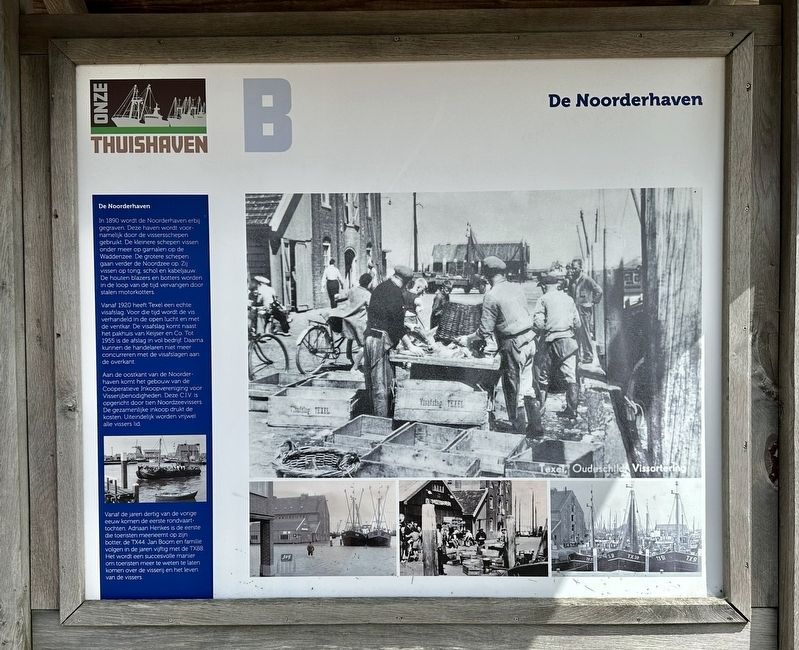
In 1890 wordt de Noorderhaven erbij gegraven. Deze haven wordt voornamelijk door de vissersschepen gebruikt. De kleinere schepen vissen onder meer op garnalen op de Waddenzee. De grotere schepen gaan verder de Noordzee op. Zij vissen op tong, schol en kabeljauw. De houten blazers en botters worden in de loop van de tijd vervangen door stalen motorkotters.
Vanaf 1920 heeft Texel een echte visafslag. Voor die tijd wordt de vis verhandeld in de open lucht en met de ventkar. De visafslag komt naast het pakhuis van Keijser en Co. Tot 1955 is de afslag in vol bedrijf. Daarna kunnen de handelaren niet meer concurreren met de visafslagen aan de overkant.
Aan de oostkant van de Noorderhaven komt het gebouw van de Coöperatieve Inkoopvereniging voor Visserijbenodigheden. Deze C.I.V. is opgericht door tien Noordzeevissers. De gezamenlijke inkoop drukt de kosten. Uiteindelijk worden vrijwel alle vissers lid.
Vanaf de jaren dertig van de vorige eeuw komen de eerste rondvaarttochten. Adriaan Henkes is de eerste die toeristen meeneemt op zijn botter, de TX44. Jan Boom en familie volgen in de
this page online
The North Harbor
The Noorderhaven (“North Harbor”) was excavated in 1890. This harbor was primarily used by fishing vessels. Smaller boats fished for species such as shrimp in the Wadden Sea, while larger vessels ventured further out into the North Sea to fish for sole, plaice, and cod. Over time, the traditional wooden blazers and botters were replaced by steel motor-powered trawlers.
Texel gained a dedicated fish auction facility in 1920; prior to that, fish were traded outdoors or sold from carts. The auction building was located next to the Keijser & Co. warehouse. It remained fully operational until 1955, after which local traders could no longer compete with the fish auctions on the mainland.
The building housing the Cooperative Purchasing Association for Fishing Supplies (C.I.V.) was constructed on the east side of the Noorderhaven. This cooperative was founded by ten North Sea fishermen; by pooling their purchasing power, they were able to reduce
Photographed by Andrew Ruppenstein, June 1, 2026
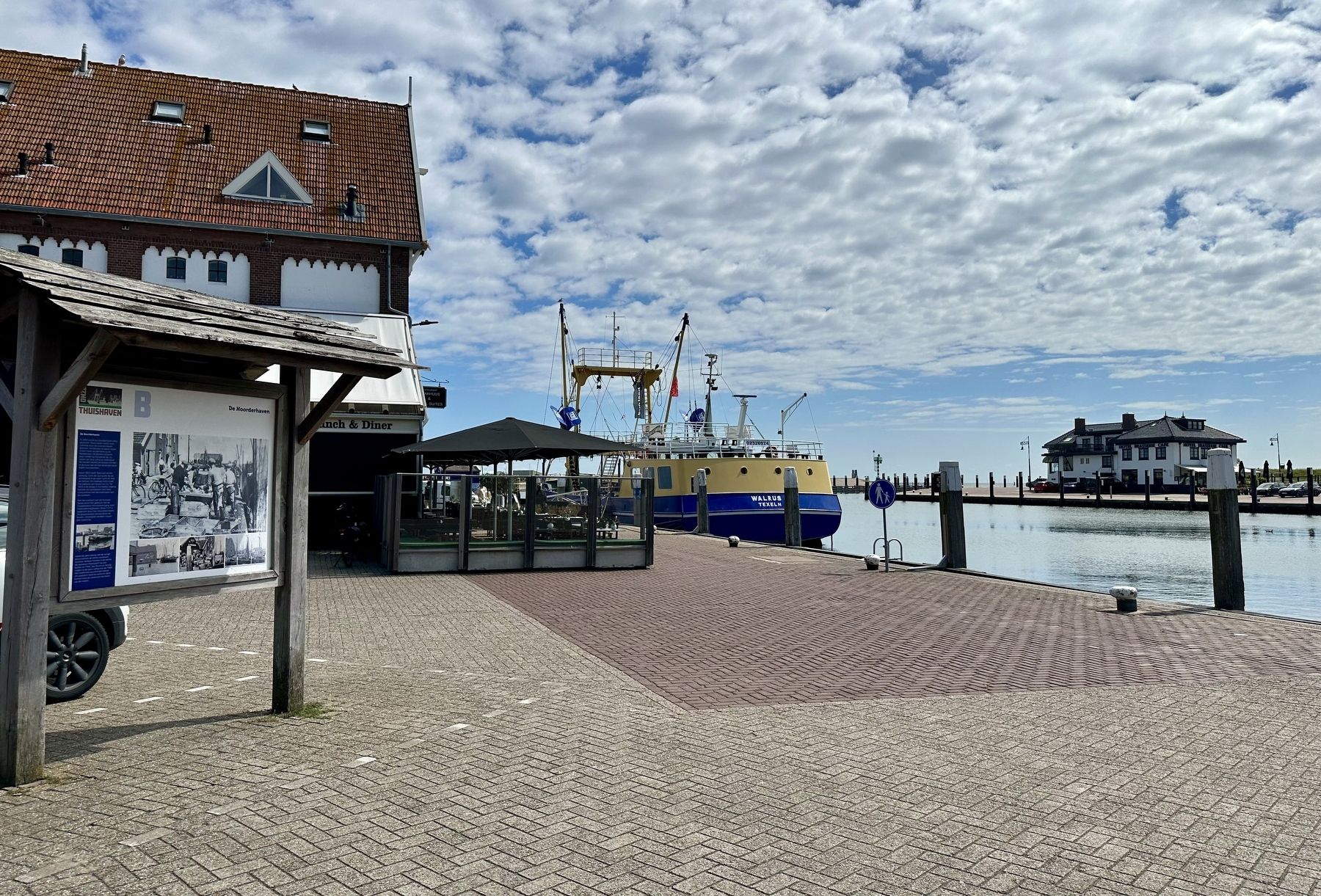
2. De Noorderhaven / The “North Harbor” Marker - wide view
The first sightseeing boat tours began in the 1930s. Adriaan Henkes was the first to take tourists out on his botter, the TX44. Jan Boom and his family followed suit in the 1950s with the TX88. These tours proved to be a successful way to introduce tourists to the fishing industry and the lives of the fishermen.
(Marker Number B.)
Topics. This historical marker is listed in these topic lists: Industry & Commerce • Waterways & Vessels. A significant historical year for this entry is 1890.
Location. 53° 2.356′ N, 4° 50.959′ E. Marker is in Oudeschild, Noord-Holland (North Holland), in Texel. It is on Haven, on the left when traveling south. Touch for map. Marker is at or near this postal address: Haven 8C, Oudeschild, Noord-Holland 1792 AC, Netherlands. Touch for directions.

Regionally, this marker is on the German Wadden Sea. Globally, it is in Europe, the European Union, Atlantic Europe, the Benelux Low Countries, the Schengen Area, Western Europe, and the Western World. Historically, it finds itself in what was once the Holy Roman Empire.
Other nearby markers. At least 8 other markers are within 5 kilometers of this marker, measured as the crow flies: Molen de Traanroeier / Windmill de Traanroeier / Mühle de Traanroeier (within shouting distance of this marker); De Zuiderhaven / The “South Harbor” (about 120 meters away, measured in a direct line); Siem de Waal Returns (about 120 meters away); Harold E. Kious Rescued (about 120 meters away); De haven… / Der Haven… / The Harbour… (about 180 meters away); Vliegtuigcrash Lancaster JA932 MG-M Gedenkteken / Lancaster JA932 MG-M Crash Memorial (approx. 0.6 kilometers away); Bakker Steegie / Bakker Alley (approx. 0.7 kilometers away); Nederlandse Hervormde Kerk van den Burg / Dutch Reformed Church of Den Burg (approx. 3.9 kilometers away). Touch for a list and map of all markers in Oudeschild.
Credits. This page was last revised on June 24, 2026. It was originally submitted on June 20, 2026, by Andrew Ruppenstein of Lamorinda, California. This page has been viewed 13 times since then. Photos: 1, 2. submitted on June 20, 2026, by Andrew Ruppenstein of Lamorinda, California.
