
Durango in San Miguel County, Colorado — The American Mountains (Southwest)
Winter on a Mountain Pass
Photographed by Kevin Vincent, June 1, 2026
1. Winter on a Mountain Pass Marker
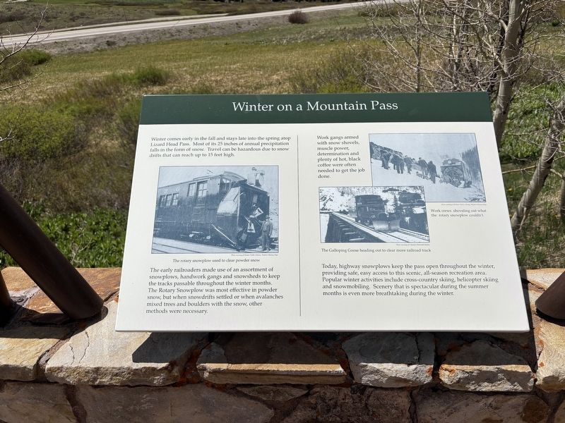
Winter comes early in the fall and stays late into the spring atop Lizard Head Pass. Most of its 25 inches of annual precipitation falls in the form of snow Travel can be hazardous due to snow drifts that can reach up to 15 feet high.
The early railroaders made use of an assortment of snowplows, handwork gangs and snowsheds to keep the tracks passable throughout the winter months. The Rotary Snowplow was most effective in powder snow, but when snowdrifts settled or when avalanches mixed trees and boulders with the snow, other methods were necessary.
Work gangs armed with snow shovels, muscle power, determination and plenty of hot, black coffee were often needed to get the job done.
Today, highway snowplows keep the pass open throughout the winter, providing safe, easy access to this scenic, all-season recreation area. Popular winter activities include cross-country skiing, helicopter skiing and snowmobiling. Scenery that is spectacular during the summer months is even more breathtaking during the winter.
Topics. This historical marker is listed in these topic lists: Railroads & Streetcars •
this page online
Location. 37° 48.771′ N, 107° 54.417′ W. Marker is in Durango, Colorado, in San Miguel County. It can be reached from TransAmerica Trail, on the right when traveling east. The marker is in the parking lot by Lizard Head Peak Vista Overlook. Touch for map. Marker is at or near this postal address: 59418 CO-145, Durango CO 81301, United States of America. Touch for directions.

Regionally, this marker is in the Western Slope. It is also in the American Mountain West, on the Colorado Plateau, and at the Four Corners. Globally, it is in North America, the Rocky Mountains, the Western Hemisphere, the Western World, and the Anglosphere. Historically, it finds itself in what was once Mexico’s Alta California.
Other nearby markers. At least 8 other markers are within 10 miles of this marker, measured as the crow flies: Sheep and Cattle Grazing in the High Country (here, next to this marker); Early History and Railroad Development (here, next to this marker); Keeping the Trains Running (approx. 0.2 miles away); Flushing Out the Gold (approx. 9½ miles away); Hear that Lonesome Whistle Blow (approx. 9½ miles away); San Miguel Valley Bank Robbery (approx. 9½ miles away); a different marker also named San Miguel Valley Bank Robbery (approx. 9½ miles away); Tomboy Mine Office (approx. 10 miles away). Touch for a list and map of all markers in Durango.
Credits. This page was last revised on June 23, 2026. It was originally submitted on June 20, 2026, by Kevin Vincent of Arlington, Virginia. This page has been viewed 13 times since then. Photo 1. submitted on June 20, 2026, by Kevin Vincent of Arlington, Virginia. • Andrew Ruppenstein was the editor who published this page.
