Waterford in County Waterford, Munster, Ireland — Irish South-West ((Éire) North Atlantic Ocean)
Mainistir Dhoiminiceach
⎯⎯⎯
Black Friars
Photographed by Ian Lefkowitz, May 16, 2026
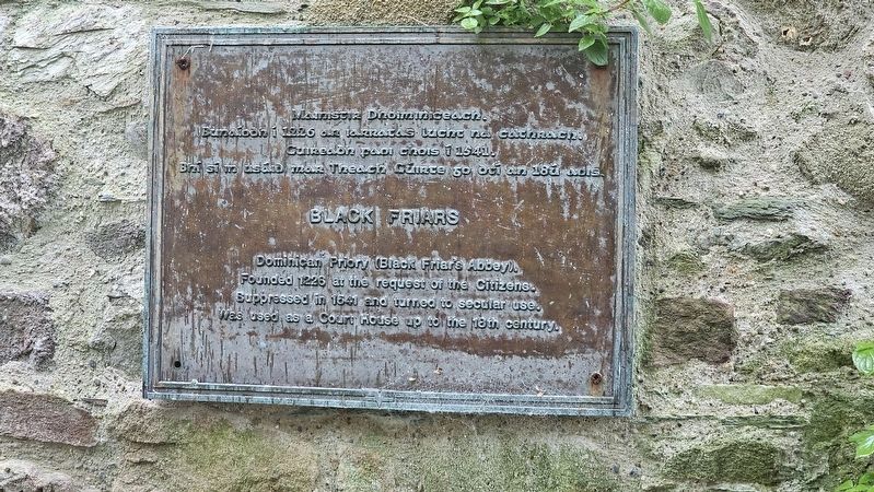
1. Mainistir Dhoiminiceach / Black Friars Marker

Mainistir Dhoiminiceach.
Bunaíodh í 1226 ar iarratas lucht na cathrach.
Cuireadh faoi chois í 1541.
Bhí sí in úsáid mar Theach Cúirte go dtí an 18ú aois.
Black Friars
Dominican Priory (Black Friar’s Abbey). Founded 1226 at the request of the Citizens. Suppressed in 1541 and turned to secular use. Was used as a Court House up to the 18th century.
Topics. This historical marker is listed in these topic lists: Law Enforcement • Religion & Religious Structures. A significant historical year for this entry is 1226.
Location. 52° 15.663′ N, 7° 6.64′ W. Marker is in Waterford, Munster, in County Waterford. It can be reached from Conduit Lane north of High Street, on the left when traveling north. Touch for map. Marker is at or near this postal address: 19 Conduit Ln, Waterford, Munster, Ireland. Touch for directions.

Regionally, this marker is in the Ancient East. Globally, it is on the Atlantic Ocean, in the North Atlantic Region, in Europe, on the Island of Ireland, on the Celtic Fringe, in the European Union, in Atlantic Europe, on one of the British Isles, in the Western World, and in the
this page online
Other nearby markers. At least 8 other markers are within walking distance of this marker: Dominican Priory, Waterford (a few steps from this marker); The Silversmith's Wife (a few steps from this marker); Edmund Rice / Éamann Ris (within shouting distance of this marker); Edmund Ignatius Rice (within shouting distance of this marker); Thomas Hussey (within shouting distance of this marker); Tadhg Gaelach Ó Súilleabháin (within shouting distance of this marker); Honest John's Last Work (within shouting distance of this marker); The Cockle Women (about 90 meters away, measured in a direct line). Touch for a list and map of all markers in Waterford.
Also see . . . Blackfriars (Waterford Civic Trust).
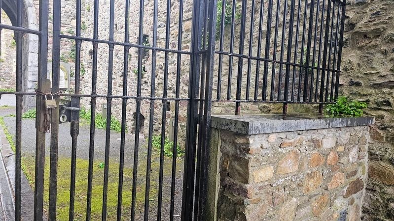
The Dominican order arrived in Waterford in 1226. The Priory of St. Saviour was founded in 1236 when the citizens of Waterford received permission from Henry III to build a friary for the Dominicans on a vacant spot below the walls, where there was a small tower. The extent of the site at its dissolution in April 1540 lists the presence of a church belfry, Lady Chapel, cemetery, cloister, dormitory, chapter-house,(Submitted on June 20, 2026, by Ian Lefkowitz of New York, New York.)library, hall over two cellars, kitchen, store, bake-house ‘Little Hall’ over two cellars, ‘Doctors Chamber’ with cellar, ‘Barron’s Hall’ over three cellars, three small gardens, two small chambers with cellars, four messages, 15 acres called the King’s Meadow and a water course.Photographed by Ian Lefkowitz, May 16, 20262. Mainistir Dhoiminiceach / Black Friars MarkerThe entrance to the building is closed, and the marker can be seen behind the gate.
Credits. This page was last revised on June 23, 2026. It was originally submitted on June 20, 2026, by Ian Lefkowitz of New York, New York. This page has been viewed 11 times since then. Photos: 1, 2. submitted on June 20, 2026, by Ian Lefkowitz of New York, New York. • Andrew Ruppenstein was the editor who published this page.
