Quay in Waterford in County Waterford, Munster, Ireland — Irish South-West ((Éire) North Atlantic Ocean)
SS Portláirge
Photographed by Ian Lefkowitz, May 16, 2026
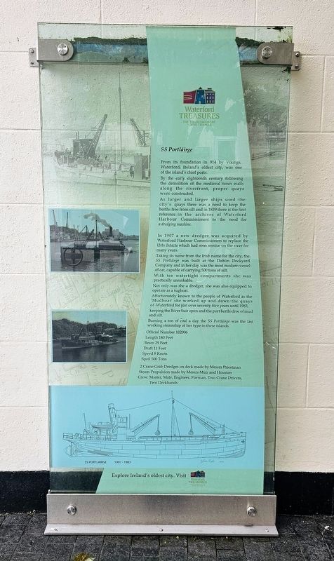
1. SS Portláirge Marker
In 1907 a new dredger was acquired by Waterford Harbour Commissioners to replace the Urbs Intacta which had seen service on the river for many years. Taking its name from the Irish name for the city, the SS Portláirge was built at the Dublin Dockyard Company and in her day was the most modern vessel afloat, capable of carrying 500 tons of silt. With ten watertight compartments she was practically unsinkable. Not only was she a dredger, she was also equipped to operate as a tugboat. Affectionately known to the people of Waterford as the ‘Mudboat’ she worked up and down the quays of Waterford for just over seventy-five years until 1983, keeping the River Suir open and the port berths free of mud and silt. Burning a ton of coal a day the SS Portláirge was the last working steamship of her type in these islands.
Official Number 102006
Length 140 Feet
Beam 29 Feet
Draft 11 Feet
Speed 8 Knots
Spoil 500 Tons
2 Crane Grab Dredges on deck made by Messrs Priestman
Steam Propulsion made by Messrs Muir and Houston
Crew: Master, Mate, Engineer, Fireman, Two Crane Drivers, Two Deckhands
Erected by Waterford Treasures.
Topics. This historical marker is listed in this topic list: Waterways & Vessels. A significant historical year for this entry is 1907.
Location. 52° 15.662′ N, 7° 6.461′ W. Marker is in Waterford, Munster, in County Waterford. It is in Quay. It is
this page online

Regionally, this marker is in the Ancient East. Globally, it is on the Atlantic Ocean, in the North Atlantic Region, in Europe, on the Island of Ireland, on the Celtic Fringe, in the European Union, in Atlantic Europe, on one of the British Isles, in the Western World, and in the Anglosphere.
Other nearby markers. At least 8 other markers are within walking distance of this marker: The Devils Drink (here, next to this marker); Clyde Shipping Company (within shouting distance of this marker); Brick Lane (within shouting distance of this marker); Franciscan Friary (within shouting distance of this marker); Remains of a 15th Century Town House (within shouting distance of this marker); Where St Patrick’s Day Began (about 90 meters away, measured in a direct line); King Richard II of England (about 90 meters away); Lewis Chess Set (about 90 meters away). Touch for a list and map
Photographed by Ian Lefkowitz, May 16, 2026
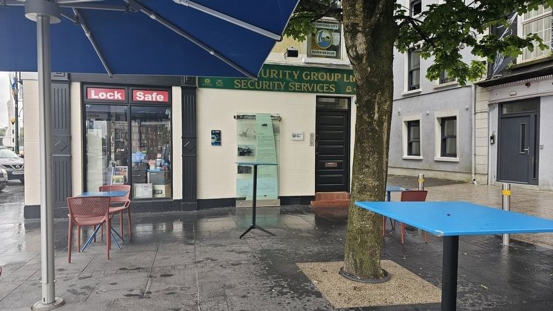
2. SS Portláirge Marker
The marker stands in a plaza along Coffee House Lane.
Also see . . . SS Port Láirge propeller unveiled as monument.
Affectionately known to the people of Waterford as the ‘Mudboat’ the SS Port Láirge worked up and down the quays of Waterford for just over seventy-five years until 1983, keeping the River Suir open and the port berths free of mud and silt. The SS Port Láirge was the last working steamship of her type in these islands.(Submitted on June 21, 2026, by Ian Lefkowitz of New York, New York.)
Photographed by Ian Lefkowitz, May 16, 2026
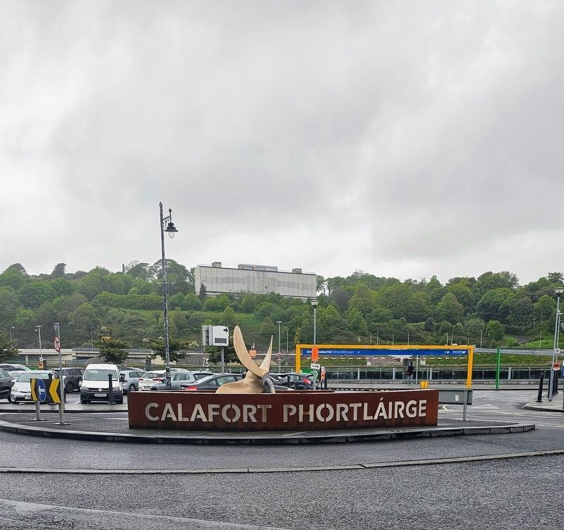
3. SS Portláirge
The propeller from the SS Portláirge has been added as a nearby town monument.
Credits. This page was last revised on June 21, 2026. It was originally submitted on June 21, 2026, by Ian Lefkowitz of New York, New York. This page has been viewed 14 times since then. Photos: 1, 2, 3. submitted on June 21, 2026, by Ian Lefkowitz of New York, New York. • Andrew Ruppenstein was the editor who published this page.
