Waterford in County Waterford, Munster, Ireland — Irish South-West ((Éire) North Atlantic Ocean)
Reginald's Tower
Photographed by Ian Lefkowitz, May 16, 2026
1. Reginald's Tower Marker

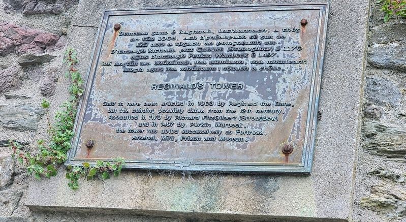
Deirtear gurb é Raghnall, Lochlannach, a thóg an túr 1003, ach b’fhéadfadh sé gur sa 12ú aois a tógadh an foirgneamh seo. D’ionsaigh Richard Fitz Gilbert (Strongbow) é 1170 agus d’ionsaigh Perkin Warbeck é 1497. Bhí an túr ina dhúnáras, ina armlann, ina mhuilleann airgid agus ina mhúsaem i ndiaidh a chéile.
Reginald’s Tower
Said to have been erected in 1003 by Reginald the Dane, but this building possibly dates from the 12th century. Assaulted in 1170 by Richard FitzGilbert (Strongbow) and in 1497 by Perkin Warbeck, the tower has acted successively as Fortress, Arsenal, Mint, Prison and Museum.
Topics. This historical marker is listed in these topic lists: Forts and Castles • Wars, Non-US. A significant historical year for this entry is 1003 CE.
Location. 52° 15.628′ N, 7° 6.319′ W. Marker is in Waterford, Munster, in County Waterford. It is at the intersection of The Mall and Adelphi Quay, on the left when traveling north on The Mall. Touch for map. Marker is at or near this postal address: 1 The Mall, Waterford, Munster, Ireland. Touch for directions.

Regionally, this marker is in the Ancient
this page online
Other nearby markers. At least 8 other markers are within walking distance of this marker: A different marker also named Reginald's Tower (here, next to this marker); Dundory / Reginald's Tower (here, next to this marker); a different marker also named Reginald's Tower (here, next to this marker); Thomas Francis Meagher (a few steps from this marker); Medieval City Walls (a few steps from this marker); Viking Ship (a few steps from this marker); S.S. Coningbeg (within shouting distance of this marker); S.S. Formby (within shouting distance of this marker). Touch for a list and map of all markers in Waterford.
Also see . . . Reginald’s Tower.
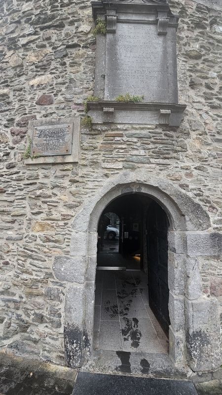
Reginald’s Tower is Waterford’s landmark monument and Ireland’s oldest civic building. It has been in continuous use for over 800 years. The first tower on the site was built by Vikings after 914 and formed the apex of the(Submitted on June 21, 2026, by Ian Lefkowitz of New York, New York.)triangular settlement, an area known to this day as the Viking Triangle. Re-built by the Anglo-Normans in the 12th century the top two floors were added in the 15th century. Until about 1700 the tower was the strongpoint of the medieval defensive walls that enclosed the city. The tower now houses an exhibition on Viking Waterford, curated by Waterford Treasures staff, and is managed by the Office of Public Works.Photographed by Ian Lefkowitz, May 16, 20262. Reginald's Tower MarkerThis marker is located above the entrance to Reginald's Tower.
Credits. This page was last revised on June 24, 2026. It was originally submitted on June 21, 2026, by Ian Lefkowitz of New York, New York. This page has been viewed 15 times since then. Photos: 1, 2. submitted on June 21, 2026, by Ian Lefkowitz of New York, New York. • Andrew Ruppenstein was the editor who published this page.
