Gloucester Point in Gloucester County, Virginia — The American South (Mid-Atlantic)
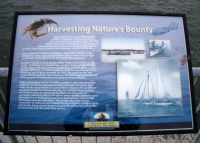
Harvesting Nature's Bounty
Besides a source of food, oysters (filter feeders) are critical to the health of the Bay. In Colonial times, oysters could completely filter all the water in the Bay in three to four days, today it takes a year. Around 1900, over 17 million bushels of oysters were harvested in Maryland and Virginia annually. By 1993, the total harvest was under 200,000 bushels. The decrease in filtration has increased the development of zooplankton and their predator, jellyfish.
With a population of over 15 million people in the watershed, the resilience of the Bay has been severely stressed. The states that make up the watershed have committed to improve the quality of the Bay through the Chesapeake Bay Act. Pollution from human and animal waste products and fertilizers are two areas of particular concern in efforts to restore water quality. Guidelines for the reduction of pollutants have been developed in conjunction with state and local authorities. The proper use of fertilizers, restoration of wetlands and establishment of riparian buffers (trees and shrubs along stream banks) can provide tremendous benefits to local areas and the entire Bay system.
Erected by Chesapeake Bay Gateways Network.
Topics. This historical marker is listed in these topic lists: Environment • Natural Features • Natural Resources. A significant historical year for this entry is 1900.
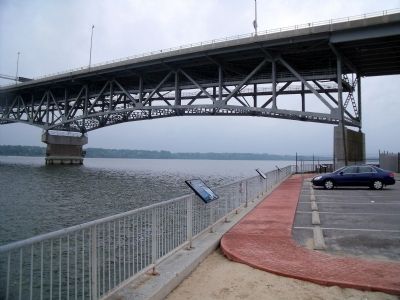
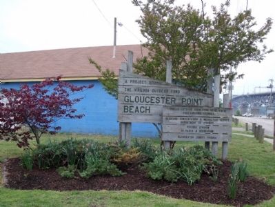
Location. 37° 14.721′ N, 76° 30.251′ W. Marker is in Gloucester Point, Virginia, in Gloucester County. Marker can be reached from the intersection of Greate Road (Route 1208) and Franklin Road. This marker is located in the Gloucester Point Beach parking area under the Coleman Bridge. Touch for map. Marker is in this post office area: Gloucester Point VA 23062, United States of America. Touch for directions.
Other nearby markers. At least 8 other markers are within walking distance of this marker. Virginia's First Shots in the Civil War (a few steps from this marker); Freedom is Won (within shouting distance of this marker); Port of Call (within shouting distance of this marker); To Get to the Other Side (within shouting distance of this marker); Mother Nature Comes Calling (within shouting distance of this marker); Virginia Institute of Marine Science (about 300 feet away, measured in a direct line); a different marker also named Port of Call (about 800 feet away); Gloucester Point (approx. 0.3 miles away). Touch for a list and map of all markers in Gloucester Point.
Also see . . . Chesapeake Bay Program - A Watershed Partnership. (Submitted on May 4, 2010, by Bernard Fisher of Richmond, Virginia.)
Credits. This page was last revised on June 16, 2016. It was originally submitted on May 4, 2010, by Bernard Fisher of Richmond, Virginia. This page has been viewed 642 times since then and 12 times this year. Photos: 1, 2, 3. submitted on May 4, 2010, by Bernard Fisher of Richmond, Virginia.


